1980s Maps of Minnesota
Explore 293 historic maps of Minnesota from the 1980s. These maps offer a rare glimpse into what life looked like during the 1980s — showing old roads, neighborhoods, homes, and landmarks that have changed or disappeared over time.
Whether you're researching your family's past, planning a metal detecting trip, or studying how Minnesota's landscape evolved across the 1980s, these high-resolution maps are a powerful tool for exploring the history of this region.
- Focus on a specific era: All maps on this page are from the 1980s, giving you a focused view of this time period.
- See what’s changed: Compare century-old streets, trails, and buildings to today's modern landscape using overlays and satellite layers.
- Research with precision: Use these maps for genealogy, historical research, land use analysis, or educational projects.
- View, download, or print: Maps are fully viewable online in high resolution, and can be downloaded or printed for your own records.
Start exploring Minnesota's history through authentic maps from the 1980s. This is your window into the past.
Minnesota maps
(293)- 1980 Map of Port Wing
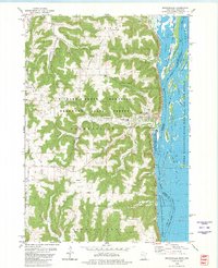
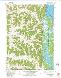
 1980 Port Wing1980 Print · USGSThe Lake Superior shoreline and the deep forests of Bayfield and Douglas counties are captured here in the early eighties. Genealogists and historians can trace the rail lines through Iron River or locate the lakeside landings at Cornucopia and Port Wing.
 - 1980 Map of Brownsville
 1980 Brownsville1980 Print · USGSThe Mississippi River valley near Brownsville comes alive in this 1980 survey, showing the intricate sloughs and ridges of the region. Trace local history at St Patricks Cem, Townhall, and along the Chicago Milwaukee St Paul and Pacific railroad.
 - 1980 Map of Caledonia
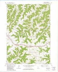
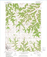 1980 Caledonia1980 Print · USGSHouston County’s coulee country is captured here during the late 1970s as agricultural ridges met protected hardwood forests. Genealogists can locate family landmarks like St Peters Ch, Calvary Cemetery, and the Townhall among the many family-named heights like Murphy Ridge.
 - 1980 Map of Rushford East
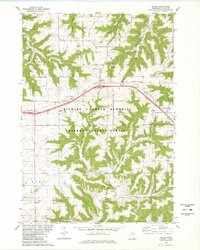
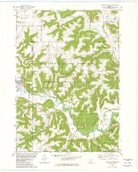 1980 Rushford East1980 Print · USGSSoutheastern Minnesota's river valleys and forested ridges are captured in detail here during the late 1970s. Researchers can trace the Milwaukee Road railroad and locate family-history sites like St Johns Cem and the settlement of Perkins.
 - 1980 Map of Sandstone
 1980 Sandstone1980 Print · USGSPine County and the Minnesota-Wisconsin borderlands are shown here in the early eighties as a region of dense state forests and river corridors. Genealogists and historians can trace rail-town development along the Burlington Northern including Sandstone, Askov, and Hinckley.
 - 1980 Map of Eitzen
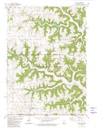 1980 Eitzen1980 Print · USGSThe Minnesota-Iowa border region near Eitzen comes alive in this 1980s record of the Driftless Area's ridges and valleys. Researchers can trace family sites like St Lukes Ch and Carsten Cem or explore the wooded draws of Winnebago Creek.
 - 1980 Map of Witoka
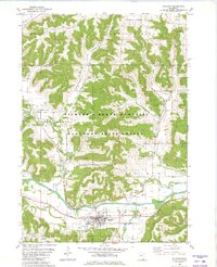
 1980 Witoka1980 Print · USGSWinona County in the late seventies and early eighties shows a landscape shaped by narrow ridges and the corridor of the then-modern interstate. Genealogists can locate family sites at St. Patricks Cemetery, Cedar Valley Church, and the settlement of Witoka.2 unique versions available
 - 1980 Map of Houston
 1980 Houston1980 Print · USGSSoutheastern Minnesota's river valleys and hardwood ridges are documented here during the late twentieth century. Genealogists and historians can trace family locations through sites like Johnstons Cem, Money Creek, and the Chicago Milwaukee St Paul and Pacific rail line.
 - 1980 Map of Wilson
 1980 Wilson1980 Print · USGSWinona County's wooded ridges and deep valleys are captured here in the late twentieth century, showing a landscape defined by state forestry and small rural communities. Researchers can trace family roots at Frank Hill Cem, St Johns Ch, and the settlement of Wilson.2 unique versions available
 - 1980 Map of Duluth
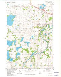
 1980 Duluth1980 Print · USGSThe Twin Ports of the early 1980s showcase a landscape defined by heavy rail lines and Lake Superior shipping. Trace the iron-ore routes through Proctor or locate family sites near Sunrise Memorial Cem and Floodwood.
 - 1980 Map of Reno
 1980 Reno1980 Print · USGSThe bluffs of Houston County met the Mississippi backwaters in the late seventies, creating a landscape of deep timber and intricate sloughs. Genealogists and hikers can locate Winnebago Cem, the Church of Peace, and rail history along the Chicago Milwaukee St Paul and Pacific.
 - 1981 Map of Barnesville
 1981 Barnesville1981 Print · USGSThe Clay and Wilkin county line near Barnesville was a hub of rail activity and prairie agriculture in the early 1980s. Researchers can locate family landmarks like Rosemound Cem, St Marys Ch, and the waters of Blue Eagle Lake.
 - 1981 Map of Lawndale
 1981 Lawndale1981 Print · USGSWilkin and Otter Tail Counties are shown in the early eighties as a landscape of prairie agriculture and managed wetlands. Researchers can trace the Burlington Northern rail line through Lawndale and locate the Little Bethany Ch and Prairie View Cem.
 - 1981 Map of Campbell
 1981 Campbell1981 Print · USGSWilkin and Traverse counties are captured here in the early eighties as a hub of rail-dependent agriculture and intricate water management. Researchers can trace the dual rail lines serving Campbell and Tenney or locate the Cem along the winding Rabbit River.
 - 1981 Map of Rothsay NW
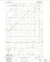
 1981 Rothsay NW1981 Print · USGSThe rural prairie of Wilkin County is captured here in the early eighties, showing a landscape defined by township grids and drainage engineering. Researchers can locate family farmsteads and local landmarks like Townhall, Manston Cem, and Meadows Cem.
 - 1981 Map of St Michael
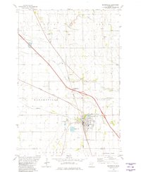
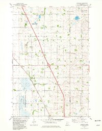
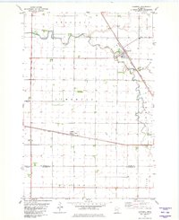
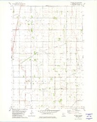
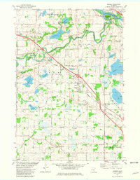
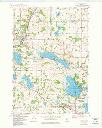
 1981 St Michael1981 Print · USGSIn the early 1980s, the growing communities of St Michael and Albertville were still defined by their local institutions and lakeside geography. Genealogists and historians can trace family locations through St Albert Cem, St Michael Cem, and the historic Berning Mill along the Crow River.
 - 1981 Map of Ensign Lake East
 1981 Ensign Lake East1981 Print · USGSThe Minnesota-Ontario borderlands remained a pristine wilderness in the early eighties, defined by the vast waterways of the Boundary Waters. Researchers can trace remote portage routes and island landmarks like Isles of Pine across Knife Lake and Carp Lake.2 unique versions available
 - 1981 Map of Mayer
 1981 Mayer1981 Print · USGSCarver and Wright counties are shown here in the early eighties as a landscape of established rail corridors and river-bound townships. Genealogists and local historians can locate St Mark Cem, trace the Burlington Northern line, and find the Ziermann Landing Strip near Mayer.
 - 1981 Map of Barnesville SW
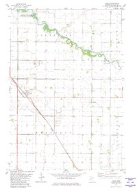
 1981 Barnesville SW1981 Print · USGSWilkin County in the early eighties shows a meticulously organized rural landscape defined by conservation and transport. Genealogists and historians can trace property lines through townships like Tanberg and Manston or locate local landmarks like the Townhall and Burlington Northern railroad.
 - 1981 Map of Everdell
 1981 Everdell1981 Print · USGSWilkin County agriculture and water management are on full display in this early 1980s survey. Genealogists and historians can trace the rail siding at Everdell, the township lines of Nilsen, and the remote Yaggie Landing Strip.
 - 1981 Map of Ensign Lake West
 1981 Ensign Lake West1981 Print · USGSThe international border wilderness of northern Minnesota is captured here in the early eighties. Outdoor historians can trace the critical water routes through Prairie Portage, identifying the Port of Entry and landmarks like Hobo Island.2 unique versions available
 - 1981 Map of Rogers
 1981 Rogers1981 Print · USGSNorth of Minneapolis in the early eighties, this area shows the transition from rural farming to industrial and suburban growth. Genealogists can trace family names at St Walburga Cem, St John the Baptist Cem, and the historic St John Ch.2 unique versions available
 - 1981 Map of Doran
 1981 Doran1981 Print · USGSWilkin County in the early eighties shows a meticulously drained prairie landscape centered on the village of Doran. Genealogists and historians can trace the rail corridor of the Burlington Northern and find local landmarks such as Sticklestad Ch and the winding Otter Tail River.
 - 1981 Map of Rockford
 1981 Rockford1981 Print · USGSCentral Minnesota lake country is captured here in the early eighties as the Crow River and the Burlington Northern railroad shaped local growth. Researchers can locate family sites near Burschville, Loretto, or the SS Peter & Paul Cem.2 unique versions available
 - 1981 Map of Snowbank Lake
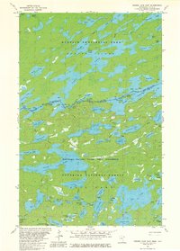
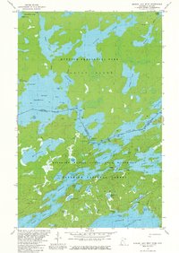
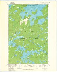 1981 Snowbank Lake1981 Print · USGSLake County and the Boundary Waters are captured here in the early eighties, showing a pristine wilderness of interconnected waterways and portages. Outdoor historians and researchers can trace the Old Pines Trail and locate landmarks like the Boy Scout Camp and the small settlement at Fernberg.3 unique versions available
Showing maps 1-25 of 293
Top cities of Minnesota
- Minneapolis historical maps
- Saint Paul historical maps
- Rochester historical maps
- Duluth historical maps
- Bloomington historical maps
- Brooklyn Park historical maps
See more
Top counties of Minnesota
- Hennepin County historical maps
- Ramsey County historical maps
- Dakota County historical maps
- Washington County historical maps
- Saint Louis County historical maps
- Stearns County historical maps
See more
Frequently asked questions
- What are the different types of historical maps available for Minnesota?
- What is the oldest map of Minnesota?
- Where can I purchase historical maps of Minnesota for my home or office?
- Where can I download high-res historical maps of Minnesota?
- Are there historical topographic maps available for Minnesota?
- Is there historical aerial imagery available for Minnesota?
- Where are historical maps of Minnesota sourced from?