1940s Maps of Minnesota
Explore 40 historic maps of Minnesota from the 1940s. These maps offer a rare glimpse into what life looked like during the 1940s — showing old roads, neighborhoods, homes, and landmarks that have changed or disappeared over time.
Whether you're researching your family's past, planning a metal detecting trip, or studying how Minnesota's landscape evolved across the 1940s, these high-resolution maps are a powerful tool for exploring the history of this region.
- Focus on a specific era: All maps on this page are from the 1940s, giving you a focused view of this time period.
- See what’s changed: Compare century-old streets, trails, and buildings to today's modern landscape using overlays and satellite layers.
- Research with precision: Use these maps for genealogy, historical research, land use analysis, or educational projects.
- View, download, or print: Maps are fully viewable online in high resolution, and can be downloaded or printed for your own records.
Start exploring Minnesota's history through authentic maps from the 1940s. This is your window into the past.
Minnesota maps
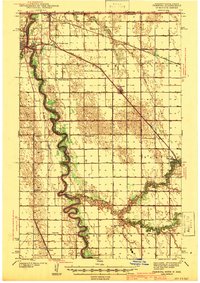
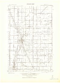
(40)- 1940 Map of Maiden Rock
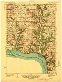 1940 Maiden Rock1940 Print · USGSPierce County’s bluff country meets the Mississippi River in this pre-war survey of the Wisconsin-Minnesota border. Genealogists can trace hundreds of family-named landmarks, from Clayfield Ch to vanished rural schoolhouses like Oakvale Sch and Drake Sch.2 unique versions available
 - 1941 Map of Kennedy
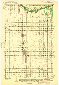 1941 Kennedy1941 Print · USGSNorthwest Minnesota farming life is centered on the rail corridor during the late 1930s. Genealogists and historians can trace the foundations of rural society through landmarks like West Emmaus Ch, Happy Corner, and the Whalen Sch.
 - 1941 Map of Drayton
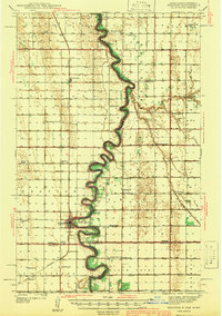 1941 Drayton1941 Print · USGSThe Red River of the North snakes across the border of North Dakota and Minnesota during the late 1930s. Genealogists and historians can trace rail-side towns like Bowesmont and Drayton, or locate rural landmarks such as Skjeberg Ch and the Airway Beacon.2 unique versions available
 - 1941 Map of Hallock
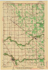 1941 Hallock1941 Print · USGSUpper Minnesota near the Canadian border thrived as a rail-and-river agricultural corridor in the early 1940s. Genealogists can trace early rural life through a dense grid of country schools like Grasshopper Sch and Webster Sch, alongside the Soo Line railroad.3 unique versions available
 - 1941 Map of Pembina
 1941 Pembina1941 Print · USGSThe Red River valley at the Canadian border comes alive in this pre-war survey of the North Dakota-Minnesota line. Genealogists can trace family roots through numerous rural landmarks like the Icelandic Cem, North Star Ch, and the Fleece Sch.2 unique versions available
 - 1943 Map of Solway
 1943 Solway1943 Print · USGSBeltrami County's timber and rail landscape is meticulously detailed here in the years following the first World War. Genealogists and researchers can trace family roots through rural stops like Solway, Aure, and Neving, or locate landmarks such as Bagley Dam and Pony Lake.
 - 1943 Map of Bagley
 1943 Bagley1943 Print · USGSClearwater County at the height of the Second World War is shown here as a landscape of timbered tracts and scattered rail towns. Genealogists can trace family roots through numerous unnamed schools and churches near Bagley, Shevlin, and Clearbrook.
 - 1943 Map of Lindford
 1943 Lindford1943 Print · USGSNorthern Minnesota's river-cut wilderness appears here as it was organized during the first half of the twentieth century. Genealogists and researchers can trace early rural life near the Big Fork River, locating the riverside community of Lindford and the Church at Bannock.
 - 1943 Map of Peppermint Creek
 1943 Peppermint Creek1943 Print · USGSIn the early 1940s, Beltrami County’s landscape was defined by an ambitious system of judicial ditches designed to reclaim timberland. Researchers can trace the Canadian Northern rail line through Graceton and explore the vast drainage network of Main Judicial Ditch No 23 and Peppermint Creek.
 - 1943 Map of Rollis
 1943 Rollis1943 Print · USGSMarshall County's rural townships are documented here during the first half of the twentieth century, showing a landscape defined by drainage engineering and early settlement. Researchers can trace family roots through numerous schools and churches or locate original township sites like Gatzke, Jonstad, and the Old Indian Reservation Boundary Line.
 - 1943 Map of Roosevelt
 1943 Roosevelt1943 Print · USGSNear the international boundary in the 1940s, this area shows the early development of Roseau and Beltrami Counties around the Canadian Northern line. Researchers can trace the layout of Roosevelt, Arnesen, and Swift alongside the timbered landscapes of Laona.
 - 1943 Map of Goos
 1943 Goos1943 Print · USGSNorthwestern Minnesota territory along the international border is mapped here during the Second World War based on earlier military surveys. Researchers can trace the Great Northern rail line and locate early rural landmarks like Salol, Mandus, and various School sites.
 - 1943 Map of Release
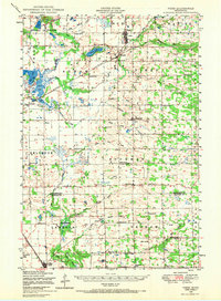
 1943 Release1943 Print · USGSItasca County’s lake country is documented here during the early 1940s, based on earlier surveys of this wetland-rich northern terrain. Researchers can locate the Release School and trace the paths around Balsam Lake, Long Lake, and Bear Lake.
 - 1943 Map of Thief River Falls
 1943 Thief River Falls1943 Print · USGSPennington County during the Second World War shows a landscape defined by the convergence of major rail lines and the drainage of the Red River Valley. Genealogists and historians can trace rail stops and rural landmarks like Steiner, St. Hilaire, and Church Cem.
 - 1943 Map of Warroad
 1943 Warroad1943 Print · USGSThe northern borderlands of Roseau County are captured here in the early 20th century, showing a landscape defined by rail junctions and ambitious drainage projects. Researchers can trace family sites near Warroad, find rural schools in America, or follow the old Great Northern RR line through the Red Lake Indian Reservation.
 - 1943 Map of Ponemah
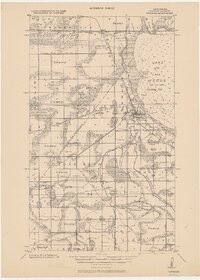
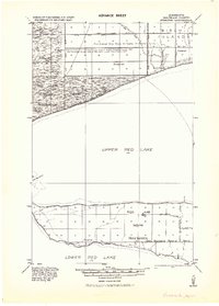 1943 Ponemah1943 Print · USGSThe Red Lake Indian Reservation is shown during the early 1940s, capturing the transition of the northern timberlands. Researchers can trace historic drainage networks like Jud. Ditch No. 82 and the lakefront settlements of Ponemah and Smithport.
 - 1943 Map of Port Wing, 1952 Print
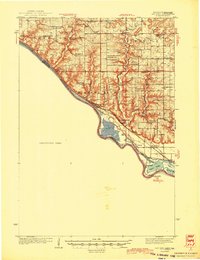
 1943 Port Wing1952 Print · USGSThe southern shore of Lake Superior comes into focus during the early 1940s, highlighting the coastal life and interior woodlands of Bayfield County. Researchers can trace the development of Port Wing and Herbster or locate family sites near Greenwood Cem and the Flag River.
 - 1944 Map of Red Wing
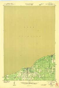
 1944 Red Wing1944 Print · USGSThe Wisconsin side of the Mississippi River valley is shown here just before the mid-century, where rail and river networks met. Genealogists can locate family-named landmarks and rural hubs like Moeville, Hager City, and St Marys Sch.2 unique versions available
 - 1946 Map of Port Wing
 1946 Port Wing1946 Print · USGSThe Bayfield County coast along Lake Superior is captured in the mid-1940s just as early highway and utility networks were expanding. Researchers can locate family sites near Port Wing and Herbster, or trace old forest trails like T Tr 181L and the Greenwood Cem.
 - 1946 Map of Hudson, 1954 Print
 1946 Hudson1954 Print · USGSThe riverfront communities of the St. Croix Valley are captured here just after the war, showing the distinct border towns of Wisconsin. Genealogists and local historians can trace the streets and benchmarks of Hudson, North Hudson, and Prescott.
 - 1947 Map of Flensburg, 1951 Print
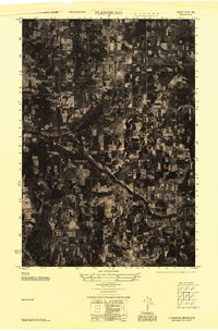 1947 Flensburg1951 Print · USGSMorrison County farming and timber lands are captured here in the late 1940s as rural life centered on local townships. Trace family roots at Mission Covenant Church and Cemetery, Culdrum Town Hall, or Flensburg.
 - 1948 Map of New Richmond, 1957 Print
 1948 New Richmond1957 Print · USGSSt. Croix County at the close of the 1940s shows a landscape of river-powered hamlets and rural school districts. Genealogists can trace family footprints through sites like Schroeder Cem, Emanuel Ch, and numerous schoolhouses from Lonesome Trail Sch to Elm Park Sch.3 unique versions available
 - 1948 Map of Belle Prairie, 1961 Print
 1948 Belle Prairie1961 Print · USGSMorrison and Crow Wing counties are captured here in the late 1940s, a landscape defined by military grounds and a dense network of country schools. Researchers can trace the legacy of early settlements through Old Darling Mission Cemetery, the Northern Pacific line at Darling Switch, and St Mathias Church.
 - 1948 Map of Stillwater, 1962 Print
 1948 Stillwater1962 Print · USGSThe St. Croix River valley comes to life in the late 1940s, capturing the river border between Minnesota and Wisconsin. Trace local genealogy and geography through the streets of Houlton, the Houlton Cem, and the historic Marine Ferry crossing.2 unique versions available
 - 1948 Map of Pierz, 1967 Print
 1948 Pierz1967 Print · USGSMorrison and Benton Counties in the late 1940s are characterized by a dense network of rail lines and rural school districts. Genealogists can trace family roots through numerous numbered schools, St Johns Church, and local landmarks like Rosemarks Store.
Showing maps 1-25 of 40
Top cities of Minnesota
- Minneapolis historical maps
- Saint Paul historical maps
- Rochester historical maps
- Duluth historical maps
- Bloomington historical maps
- Brooklyn Park historical maps
See more
Top counties of Minnesota
- Hennepin County historical maps
- Ramsey County historical maps
- Dakota County historical maps
- Washington County historical maps
- Saint Louis County historical maps
- Stearns County historical maps
See more
Frequently asked questions
- What are the different types of historical maps available for Minnesota?
- What is the oldest map of Minnesota?
- Where can I purchase historical maps of Minnesota for my home or office?
- Where can I download high-res historical maps of Minnesota?
- Are there historical topographic maps available for Minnesota?
- Is there historical aerial imagery available for Minnesota?
- Where are historical maps of Minnesota sourced from?