1960s Maps of Minnesota
Explore 823 historic maps of Minnesota from the 1960s. These maps offer a rare glimpse into what life looked like during the 1960s — showing old roads, neighborhoods, homes, and landmarks that have changed or disappeared over time.
Whether you're researching your family's past, planning a metal detecting trip, or studying how Minnesota's landscape evolved across the 1960s, these high-resolution maps are a powerful tool for exploring the history of this region.
- Focus on a specific era: All maps on this page are from the 1960s, giving you a focused view of this time period.
- See what’s changed: Compare century-old streets, trails, and buildings to today's modern landscape using overlays and satellite layers.
- Research with precision: Use these maps for genealogy, historical research, land use analysis, or educational projects.
- View, download, or print: Maps are fully viewable online in high resolution, and can be downloaded or printed for your own records.
Start exploring Minnesota's history through authentic maps from the 1960s. This is your window into the past.
Minnesota maps
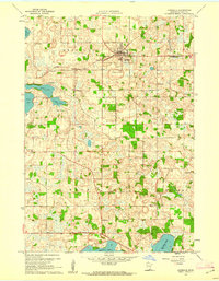
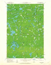
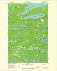
(823)- 1960 Map of Hancock
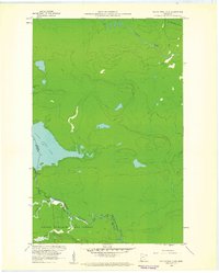
 1960 Hancock1960 Print · USGSThe Keweenaw Peninsula and Isle Royale are captured in detail during the late 1950s. Researchers can trace copper-mining era settlements like Calumet and Laurium, or locate remote maritime landmarks such as the Isle Royale Lighthouse.
 - 1960 Map of Brewster, 1961 Print
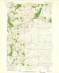
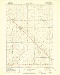
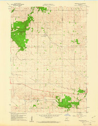
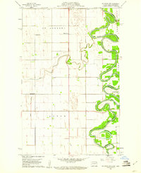
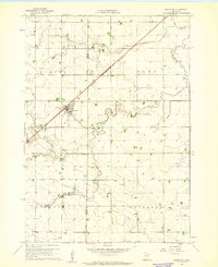 1960 Brewster1961 Print · USGSThe town of Brewster and its surrounding townships are shown here during the early 1960s as a thriving agricultural and rail corridor. Genealogists can locate Trinity Cem and Hersey Cem, or trace the path of the Chicago and North Western line.2 unique versions available
 - 1960 Map of The Cascades, 1961 Print
 1960 The Cascades1961 Print · USGSThe northern borderlands of Cook County come to life in the early 1960s, showing the intersection of international boundaries and historic trade routes. Local historians can trace the Site of Fort Charlotte and the river rapids at The Cascades along the Pigeon River.3 unique versions available
 - 1960 Map of Faribault, 1961 Print
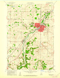
 1960 Faribault1961 Print · USGSFaribault at the start of the 1960s is a dense hub of institutional life and rail commerce at the edge of Minnesota's lake country. Genealogists and historians can locate specific school districts and landmarks like the Minnesota Sch for the Deaf, Shattuck Sch, and Calvary Cemetery.
 - 1960 Map of Northfield, 1961 Print
 1960 Northfield1961 Print · USGSNorthfield and its surrounding townships are shown at a peak of mid-century growth, serving as a vital rail junction between the Twin Cities and southern Minnesota. Researchers can trace institutional grounds at St Olaf College and Carleton College or find rural landmarks like Little Prairie Ch and Dundas.2 unique versions available
 - 1960 Map of Cannon City, 1961 Print
 1960 Cannon City1961 Print · USGSRice County farmland and small crossroads settlements are captured here in the early sixties. Researchers can trace the rail corridors of the Chicago and North Western or locate local landmarks like Crystal Lake and the Wide Awake Sch.2 unique versions available
 - 1960 Map of Dennison, 1961 Print
 1960 Dennison1961 Print · USGSSoutheast Minnesota's agricultural heartland is documented here at the start of the 1960s. Family historians and researchers can trace the rail-side growth of Dennison and Stanton, locate the Prairie Creek Cem, and find landmarks like Carleton Airport.
 - 1960 Map of Cross Lake, 1961 Print
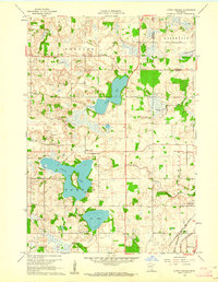
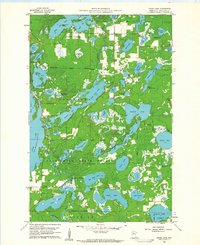 1960 Cross Lake1961 Print · USGSCrow Wing County's lake country in the early sixties was a burgeoning landscape of woodland recreation and small-town growth. You can locate family history at Pinewood Cemetery, trace the old roads around Manhattan Beach, or find mid-century landmarks like the Drive-in Theater.4 unique versions available
 - 1960 Map of Shieldsville, 1961 Print
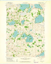 1960 Shieldsville1961 Print · USGSShieldsville and the surrounding lake country of Rice County are captured here in the early sixties. Researchers can trace rural school districts like Lake View Sch and Trinity Sch, or locate family landmarks near Caron Lake and Willing Lake.4 unique versions available
 - 1960 Map of Lonsdale, 1961 Print
 1960 Lonsdale1961 Print · USGSLonsdale and the surrounding Rice County townships are captured in the early sixties as a landscape of rural schoolhouses and rail-side villages. You can trace family footprints at Trondjem, Calvary Hill Cem, and numerous school sites like Meehl Sch.2 unique versions available
 - 1960 Map of Reading, 1961 Print
 1960 Reading1961 Print · USGSNobles County farming communities and rail lines are captured here in the early sixties. Researchers can trace family sites near Reading and locate landmarks like Summit Lake Cem or the Brethren Ch along the prairie roads.2 unique versions available
 - 1960 Map of Little Chicago, 1961 Print
 1960 Little Chicago1961 Print · USGSRice and Dakota Counties are shown in the early sixties, a time when three major railroads still converged in the southeastern corner. Genealogists can trace rural roots at Christdala Ch, Township Cem, and the old Millersburg townsite.2 unique versions available
 - 1960 Map of Farquhar Peak, 1961 Print
 1960 Farquhar Peak1961 Print · USGSThe northern wilderness of Cook County and the Canadian border are captured here in the early sixties. Researchers can trace the path of the Pigeon River along the international line and locate the Hovland Lookout Tower standing near Farquhar Peak.4 unique versions available
 - 1960 Map of South Fowl Lake, 1961 Print
 1960 South Fowl Lake1961 Print · USGSThe international boundary at the dawn of the 1960s reveals a remote landscape where the Pigeon River and South Fowl Lake meet. Trace the historic waterways of Grand Portage State Forest and the winding course of the Arrow River.4 unique versions available
 - 1960 Map of Nerstrand, 1961 Print
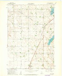
 1960 Nerstrand1961 Print · USGSSoutheastern Minnesota farmland at the start of the 1960s reveals a landscape of rural churches and competing rail lines. Local historians can trace family roots at Valley Grove Ch, explore the village of Nerstrand, or locate old sites near Falls Creek.2 unique versions available
 - 1960 Map of Hovland, 1961 Print
 1960 Hovland1961 Print · USGSNorth Shore life in the early sixties centers on the small coastal community of Hovland along the edge of the Grand Portage State Forest. Researchers can trace old family sites near the local Cem and the mouths of the Flute Reed River and Carlson Creek.4 unique versions available
 - 1960 Map of Grand Marais, 1961 Print
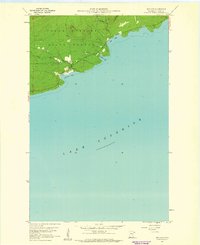
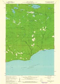
 1960 Grand Marais1961 Print · USGSGrand Marais and the Cook County shoreline are captured here in the early sixties as the harbor town anchored the gateway to the North Woods. Genealogists and local historians can trace the foundations of Chippewa City, the Maple Hill School, and the start of the historic Gunflint Trail.3 unique versions available
 - 1960 Map of Bigelow, 1961 Print
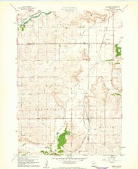
 1960 Bigelow1961 Print · USGSNobles County's southern border at the turn of the 1960s reveals a landscape of prairie farms and vital rail links. Genealogists can locate Ransom Cem and the settlement of Org near the Chicago and North Western railroad.2 unique versions available
 - 1960 Map of Big Woods NW, 1961 Print
 1960 Big Woods NW1961 Print · USGSThe Red River Valley at the turn of the 1960s reveals a sparse but structured landscape of township schools and river crossings. Researchers can trace the boundaries of St Andrews and Acton, locating rural landmarks like St Joseph Ch and Zion Cem.2 unique versions available
 - 1960 Map of Kadunce Creek, 1961 Print
 1960 Kadunce Creek1961 Print · USGSThe North Shore of Lake Superior comes into focus in the early sixties, showing the rugged intersection of the Superior National Forest and the lake. Researchers can trace the development of Kadunce Creek State Park and locate numerous inland waters like Mink Lake and Section Fifteen Lake.4 unique versions available
 - 1960 Map of Tait Lake, 1962 Print
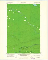
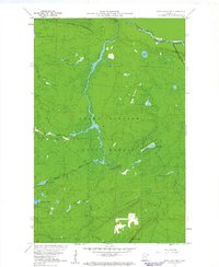
 1960 Tait Lake1962 Print · USGSThe wilderness of Cook County is captured here in the early sixties, showing the vast interconnected waters of the Minnesota State Forest. Trace the remote reaches of Tait Lake and find old landmarks like the Campground at Lichen Lake or the secluded Mistletoe Lake.5 unique versions available
 - 1960 Map of Devil Track Lake, 1962 Print
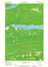 1960 Devil Track Lake1962 Print · USGSCook County's wilderness and aviation hubs are captured here in the early sixties, showing the region as it transitioned into a modern recreational destination. Researchers can locate the Sky Port Seaplane Base, trace the Little Devil Track River, and explore landmarks like Murphy Mountain and the Devil Lake Campground.3 unique versions available
 - 1960 Map of Lake Polly, 1962 Print
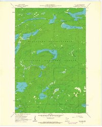
 1960 Lake Polly1962 Print · USGSThe northern wilderness of the Arrowhead region is captured here in the early 1960s, showing a complex network of glacial lakes and portage routes. Researchers can trace the courses of the Kawishiwi River and Louse River past landmarks like Adams Lake and Malberg Lake.4 unique versions available
 - 1960 Map of Mark Lake, 1962 Print
 1960 Mark Lake1962 Print · USGSCook County's deep woods and glacial lakes are captured here in the early sixties, showing a wilderness landscape shaped by forestry and water. Map collectors and historians can trace the path of the Old Railroad or locate sites near Pike Lake and the Cascade River Campground.3 unique versions available
 - 1960 Map of South Lake, 1962 Print
 1960 South Lake1962 Print · USGSThe Minnesota-Ontario borderlands at the dawn of the 1960s reveal a landscape of vast interconnected waterways and historical portages. Trace the path of the old Railroad Grade or locate remote sites like the Iron Lake Campground and Height of Land Portage.4 unique versions available
Showing maps 1-25 of 823
Top cities of Minnesota
- Minneapolis historical maps
- Saint Paul historical maps
- Rochester historical maps
- Duluth historical maps
- Bloomington historical maps
- Brooklyn Park historical maps
See more
Top counties of Minnesota
- Hennepin County historical maps
- Ramsey County historical maps
- Dakota County historical maps
- Washington County historical maps
- Saint Louis County historical maps
- Stearns County historical maps
See more
Frequently asked questions
- What are the different types of historical maps available for Minnesota?
- What is the oldest map of Minnesota?
- Where can I purchase historical maps of Minnesota for my home or office?
- Where can I download high-res historical maps of Minnesota?
- Are there historical topographic maps available for Minnesota?
- Is there historical aerial imagery available for Minnesota?
- Where are historical maps of Minnesota sourced from?