1970s Maps of Minnesota
Explore 571 historic maps of Minnesota from the 1970s. These maps offer a rare glimpse into what life looked like during the 1970s — showing old roads, neighborhoods, homes, and landmarks that have changed or disappeared over time.
Whether you're researching your family's past, planning a metal detecting trip, or studying how Minnesota's landscape evolved across the 1970s, these high-resolution maps are a powerful tool for exploring the history of this region.
- Focus on a specific era: All maps on this page are from the 1970s, giving you a focused view of this time period.
- See what’s changed: Compare century-old streets, trails, and buildings to today's modern landscape using overlays and satellite layers.
- Research with precision: Use these maps for genealogy, historical research, land use analysis, or educational projects.
- View, download, or print: Maps are fully viewable online in high resolution, and can be downloaded or printed for your own records.
Start exploring Minnesota's history through authentic maps from the 1970s. This is your window into the past.
Minnesota maps
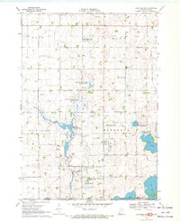
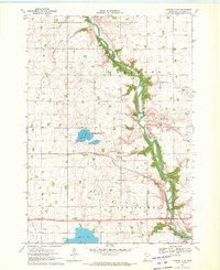
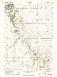
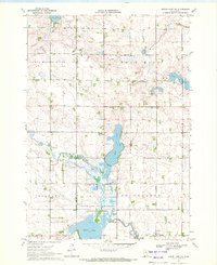
(571)- 1970 Map of Jackson NW, 1972 Print
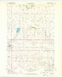
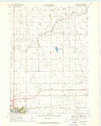 1970 Jackson NW1972 Print · USGSJackson and its surrounding townships are captured here during a period of agricultural and infrastructure expansion in the early seventies. Genealogists and local historians can trace family land in Enterprise, locate the Mennonite Ch, or survey the early grounds of the Jackson Municipal Airport.
 - 1970 Map of St James SE, 1972 Print
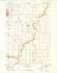
 1970 St James SE1972 Print · USGSMartin County agriculture and rural life take center stage in the early seventies, showing a landscape defined by prairie drainage and small townships. Researchers can locate the North Star Cem, the Waverly Ch, and various water bodies like Round Lake and Fox Lake.
 - 1970 Map of Kimberly, 1972 Print
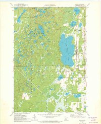
 1970 Kimberly1972 Print · USGSAitkin County’s river-fed lowlands are captured here during the 1970s, showing a landscape defined by conservation and rail transport. Researchers can trace the local community through the Lansford Cem, Saron Cem, and the settlement of Kimberly.2 unique versions available
 - 1970 Map of Butterfield, 1972 Print
 1970 Butterfield1972 Print · USGSButterfield and the surrounding farm country are captured here in the early 1970s as the rail-and-river economy persisted. Genealogists and local historians can locate the Mennonite Cem, trace the Chicago and North Western rail line, or explore the shores of Sulem Lake.
 - 1970 Map of Lakefield SW, 1972 Print
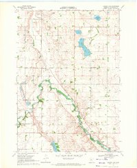
 1970 Lakefield SW1972 Print · USGSThe Minnesota-Iowa borderlands come to life in this early 1970s survey, showing a landscape of sprawling wildlife areas and prairie wetlands. Genealogists and local historians can locate Holy Trinity Cem and St Johns Ch or trace the winding Little Sioux River and Sangle Slough.
 - 1970 Map of St James West, 1972 Print
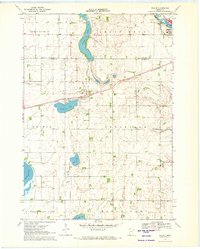
 1970 St James West1972 Print · USGSWatonwan County's agricultural and rail heartland is captured here in the early seventies, centered on the growing community of St James. Genealogists and local historians can trace rural roots through landmarks like Kansas Lake Ch, the settlement of Echols, and the prominent Chicago and North Western rail line.2 unique versions available
 - 1970 Map of Laura Lake, 1972 Print
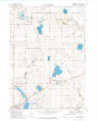
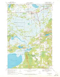
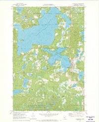
 1970 Laura Lake1972 Print · USGSCass County’s lake country is captured here during the 1970s, showing a landscape defined by state and national forest management. Researchers can trace the water levels and shorelines of Laura Lake, Inguadona Lake, and the complex wetlands surrounding Daggett Brook.2 unique versions available
 - 1970 Map of Ceylon, 1972 Print
 1970 Ceylon1972 Print · USGSSouthern Minnesota and the Iowa borderlands are captured here in the early 1970s, showing a prairie landscape shaped by drainage and rail. Researchers can trace family sites at Lone Cedar Cem or follow the path of the Chicago and North Western railroad through Ceylon.
 - 1970 Map of Lakefield NE, 1972 Print
 1970 Lakefield NE1972 Print · USGSJackson County's rural landscape is captured here in the early seventies, dominated by the winding Des Moines River valley. Genealogists can locate family landmarks like Belmont Ch and the East Belmont Cem near the Chicago Milwaukee St Paul and Pacific rail line.2 unique versions available
 - 1970 Map of Bingham Lake, 1972 Print
 1970 Bingham Lake1972 Print · USGSBingham Lake and the surrounding Cottonwood County prairie are shown here in the early 1970s, as the region's rail-and-lake economy thrived. Researchers can locate several family burial sites like Voth Cem or trace the Chicago and North Western line through Delft.
 - 1970 Map of Warba, 1972 Print
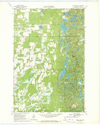
 1970 Warba1972 Print · USGSItasca County's marshlands and glacial lakes are captured here in the early seventies as the railroad and pipeline corridors dominated the landscape. Genealogists can locate family landmarks like Feeley Cem, Trout Lake Ch, and the rural community of Philbin.2 unique versions available
 - 1970 Map of Jackson, 1972 Print
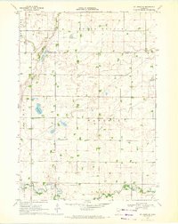
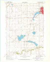
 1970 Jackson1972 Print · USGSJackson and the Des Moines River valley appear here in the early seventies as the region balanced its role as a county seat with a river-based economy. Researchers can locate several family burial sites including Riverside and Petersburg Cem, alongside local landmarks like the Powerplant and Getty Park.
 - 1970 Map of Heron Lake NW, 1972 Print
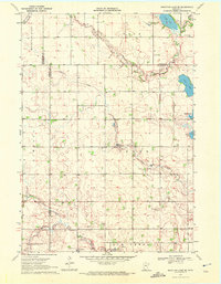
 1970 Heron Lake NW1972 Print · USGSCottonwood and Murray Counties in the early 1970s are defined by the winding Des Moines River and a series of glacial lakes. Genealogists and local historians can trace burial sites like Rosehill Cem and Emanuel Cem or locate the Townhall near Oaks Lake.
 - 1970 Map of Spider Lake, 1972 Print
 1970 Spider Lake1972 Print · USGSCass County’s lake-country landscape is documented here in the early seventies, showing a transitional area of state forests and glacial topography. Researchers can locate family landmarks like Bethlehem Ch, the Spider Lake Lookout Tower, and the local Townhall.
 - 1970 Map of Trimont, 1972 Print
 1970 Trimont1972 Print · USGSThe rail-and-water landscape of Martin and Watonwan Counties is captured here in the early seventies. Genealogists and local historians can trace family roots through the grain-and-rail economy of Trimont, the small-town streets of Odin, and the Cedar Lake Cem.
 - 1970 Map of Harder Lake, 1972 Print
 1970 Harder Lake1972 Print · USGSCottonwood County's agricultural and river landscape is preserved here during the early 1970s. Researchers can trace rural life through landmarks like the Greenhill Chapel, the Townhall, and the glacial waters of Harder Lake.
 - 1970 Map of Mc Gregor, 1972 Print
 1970 Mc Gregor1972 Print · USGSAitkin County in the early 1970s is a landscape of conservation and rail-side settlements centered on Mc Gregor. Researchers can locate family heritage sites like Union Cem or trace the Old Railroad Grade through the Rice Lake National Wildlife Refuge.
 - 1970 Map of Tamarack, 1972 Print
 1970 Tamarack1972 Print · USGSThe Northwoods of Aitkin County are seen here in the early 1970s, defined by the Burlington Northern line and sprawling wetlands. Genealogists and local historians can locate Fairview Cem and the early footprints of Tamarack and Grayling.
 - 1970 Map of Dundee, 1972 Print
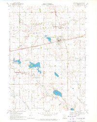
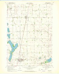
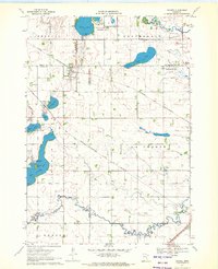 1970 Dundee1972 Print · USGSDundee and Kinbrae thrive at the junction of two major rail lines in this early 1970s landscape of the Minnesota prairie. Genealogists and local historians can trace family ties at St Marys Cemetery or Kinbrae Cemetery and explore the early wildlife management areas surrounding Talcot Lake and Graham Lake.2 unique versions available
 - 1970 Map of Mountain Lake SE, 1972 Print
 1970 Mountain Lake SE1972 Print · USGSSouthern Minnesota farm country is captured here in the early seventies as a network of creek-fed townships across four county lines. Genealogists and local historians can trace legacy landmarks like St Olaf Ch Cem, Cedar Hill Cem, and the waters of Fish Lake.
 - 1970 Map of Backus, 1972 Print
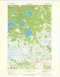
 1970 Backus1972 Print · USGSBackus and the lake country of Cass County are captured here in the early seventies, just as the regional rail and forest infrastructure reached its modern peak. Local historians can trace the Burlington Northern line through town, locate the Evergreen Cem, and explore the wooded expanse of the Deerfield State Forest.2 unique versions available
 - 1970 Map of St James East, 1972 Print
 1970 St James East1972 Print · USGSWatonwan County in the early seventies shows a landscape of steady agricultural management and growing civic infrastructure. Genealogists and local historians can trace the Chicago and North Western rail corridor and find family landmarks like Mt Hope Cem or the village of South Branch.
 - 1970 Map of Hackensack, 1972 Print
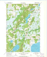
 1970 Hackensack1972 Print · USGSHackensack was a thriving Cass County hub in the early 1970s, where the railroad and forest service roads met the shoreline. Genealogists and historians can trace family-named sites like Paquet Lake and Hiram Lake or locate Hillcrest Cem.2 unique versions available
 - 1970 Map of Wilder, 1972 Print
 1970 Wilder1972 Print · USGSSouthern Minnesota's agricultural prairie and rail-connected towns are captured here in the early 1970s. Researchers can trace the path of the Chicago and North Western railroad or locate rural landmarks like St Peter Ch and Delafield Cem.
 - 1970 Map of Welcome, 1972 Print
 1970 Welcome1972 Print · USGSWelcome is captured in the early 1970s as a bustling rail crossroads in Martin County during a period of agricultural expansion. Genealogists and local historians can trace the paths of the Milwaukee Road, locate the Emmanuel Cem, or find early civic sites like the Townhall.
Showing maps 1-25 of 571
Top cities of Minnesota
- Minneapolis historical maps
- Saint Paul historical maps
- Rochester historical maps
- Duluth historical maps
- Bloomington historical maps
- Brooklyn Park historical maps
See more
Top counties of Minnesota
- Hennepin County historical maps
- Ramsey County historical maps
- Dakota County historical maps
- Washington County historical maps
- Saint Louis County historical maps
- Stearns County historical maps
See more
Frequently asked questions
- What are the different types of historical maps available for Minnesota?
- What is the oldest map of Minnesota?
- Where can I purchase historical maps of Minnesota for my home or office?
- Where can I download high-res historical maps of Minnesota?
- Are there historical topographic maps available for Minnesota?
- Is there historical aerial imagery available for Minnesota?
- Where are historical maps of Minnesota sourced from?