
Historical Maps of Cleveland County, Oklahoma
What stories do these 108 old maps tell about Cleveland County's past? From 1892 to present day, these maps reveal the evolution of streets, neighborhoods, iconic landmarks, and natural features in stunning high-res detail. Whether you're a history enthusiast, genealogist, or professional in education, environmental work, or architecture, these maps are perfect for exploration, research, and discovery.
Discover Cleveland County's history through maps:
- Trace Cleveland County's growth: Explore earlier and latest maps and editions to uncover how the region changed over time.
- Examine technical details: Each map includes its creators, publishers, scale, dimensions, and full source information.
- Layer maps with modern tools & imagery: Compare historical maps to modern-day with high-resolution satellite imagery and detailed LiDAR layers.
- Sourced from trusted archives: Carefully preserved and digitized by institutions like the United Stated Geological Survey and the US Library of Congress.
- Access in any format: View and explore in high resolution, download for offline use, or order a museum-quality print for yourself or a loved one.
Begin your journey into Cleveland County's history with these remarkable must-see maps.
Cleveland County, OK maps
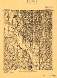
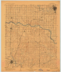
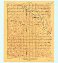
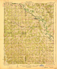
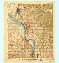
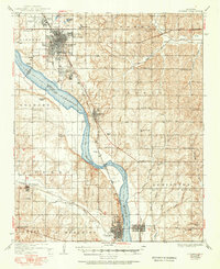
(108)- 1892 Map of Moore
 1892 Moore1892 Print · USGSCovers Cleveland County, including Oklahoma City, Norman, and other nearby areas
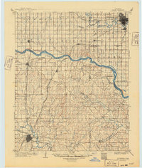
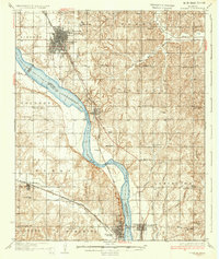
 - 1893 Map of Norman
 1893 Norman1893 Print · USGSCovers Cleveland County, including Norman, Newcastle, and other nearby areas
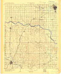
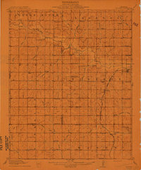
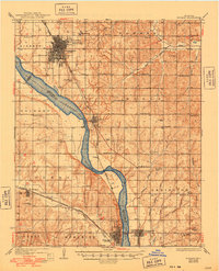
 - 1893 Map of Oklahoma City
 1893 Oklahoma City1893 Print · USGSCovers Cleveland County, including Oklahoma City, Norman, and other nearby areas
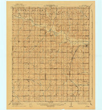
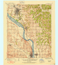
 - 1893 Map of Norman
 1893 Norman1893 Print · USGSCovers Cleveland County, including Norman, Newcastle, and other nearby areas
 - 1898 Map of Purcell
 1898 Purcell1898 Print · USGSCovers Cleveland County, including Oklahoma City, Norman, and other nearby areas
 - 1898 Map of Pauls Valley, 1954 Print
 1898 Pauls Valley1954 Print · USGSCovers Cleveland County, including Purcell, Pauls Valley, and other nearby areas
 - 1902 Map of Pauls Valley
 1902 Pauls Valley1902 Print · USGSCovers Cleveland County, including Purcell, Pauls Valley, and other nearby areas
 - 1902 Map of Pauls Valley, 1916 Print
 1902 Pauls Valley1916 Print · USGSCovers Cleveland County, including Purcell, Pauls Valley, and other nearby areas
 - 1902 Map of Pauls Valley, 1939 Print
 1902 Pauls Valley1939 Print · USGSCovers Cleveland County, including Purcell, Pauls Valley, and other nearby areas
 - 1904 Map of Chickasha
 1904 Chickasha1904 Print · USGSCovers Cleveland County, including Oklahoma City, Norman, and other nearby areas
 - 1904 Map of Chickasha
 1904 Chickasha1904 Print · USGSCovers Cleveland County, including Oklahoma City, Norman, and other nearby areas
 - 1904 Map of Chickasha, 1923 Print
 1904 Chickasha1923 Print · USGSCovers Cleveland County, including Oklahoma City, Norman, and other nearby areas
 - 1904 Map of Chickasha, 1949 Print
 1904 Chickasha1949 Print · USGSCovers Cleveland County, including Oklahoma City, Norman, and other nearby areas
 - 1910 Map of McComb
 1910 McComb1910 Print · USGSCovers Cleveland County, including Norman, Slaughterville, and other nearby areas
 - 1910 Map of McComb, 1941 Print
 1910 McComb1941 Print · USGSCovers Cleveland County, including Norman, Slaughterville, and other nearby areas
 - 1925 Map of Norman NO 2
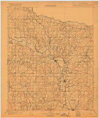
 1925 Norman NO 21925 Print · USGSCovers Cleveland County, including Norman, Newcastle, and other nearby areas
 - 1930 Map of McLoud
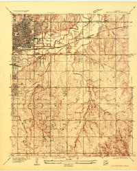
 1930 McLoud1930 Print · USGSCovers Cleveland County, including Oklahoma City, Norman, and other nearby areas
 - 1930 Map of McLoud
 1930 McLoud1930 Print · USGSCovers Cleveland County, including Oklahoma City, Norman, and other nearby areas
 - 1934 Map of Crutcho Creek
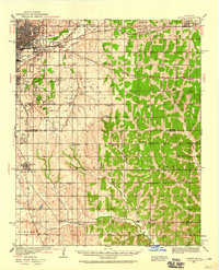
 1934 Crutcho Creek1934 Print · USGSCovers Cleveland County, including Oklahoma City, Midwest City, and other nearby areas
 - 1934 Map of Moore, 1959 Print
 1934 Moore1959 Print · USGSCovers Cleveland County, including Oklahoma City, Norman, and other nearby areas
 - 1936 Map of Norman
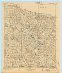
 1936 Norman1936 Print · USGSCovers Cleveland County, including Norman, Newcastle, and other nearby areas
 - 1936 Map of Norman
 1936 Norman1936 Print · USGSCovers Cleveland County, including Norman, Newcastle, and other nearby areas
 - 1936 Map of Norman, 1948 Print
 1936 Norman1948 Print · USGSCovers Cleveland County, including Norman, Newcastle, and other nearby areas
 - 1936 Map of Norman, 1951 Print
 1936 Norman1951 Print · USGSCovers Cleveland County, including Norman, Newcastle, and other nearby areas
 - 1936 Map of Norman, 1951 Print
 1936 Norman1951 Print · USGSCovers Cleveland County, including Norman, Newcastle, and other nearby areas
Showing maps 1-25 of 108
Top cities in Cleveland County
- Norman historical maps
- Moore historical maps
- Noble historical maps
- Slaughterville historical maps
- Lexington historical maps
- Etowah historical maps
Frequently asked questions
- What are the different types of historical maps available for Cleveland County?
- What is the oldest map of Cleveland County?
- Where can I purchase historical maps of Cleveland County for my home or office?
- Where can I download high-res historical maps of Cleveland County?
- Are there historical topographic maps available for Cleveland County?
- Is there historical aerial imagery available for Cleveland County?
- Where are historical maps of Cleveland County sourced from?