
Historical Maps of Edmond, Oklahoma
What stories do these 41 old maps tell about Edmond's past? From 1892 to present day, these maps reveal the evolution of streets, neighborhoods, iconic landmarks, and natural features in stunning high-res detail. Whether you're a history enthusiast, genealogist, or professional in education, environmental work, or architecture, these maps are perfect for exploration, research, and discovery.
Discover Edmond's history through maps:
- Trace Edmond's growth: Explore earlier and latest maps and editions to uncover how the region changed over time.
- Examine technical details: Each map includes its creators, publishers, scale, dimensions, and full source information.
- Layer maps with modern tools & imagery: Compare historical maps to modern-day with high-resolution satellite imagery and detailed LiDAR layers.
- Sourced from trusted archives: Carefully preserved and digitized by institutions like the United Stated Geological Survey and the US Library of Congress.
- Access in any format: View and explore in high resolution, download for offline use, or order a museum-quality print for yourself or a loved one.
Begin your journey into Edmond's history with these remarkable must-see maps.
Edmond, OK maps
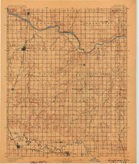
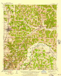
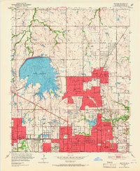
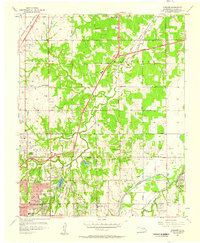
(41)- 1892 Map of Edmond
 1892 Edmond1892 Print · USGSCovers Edmond, including Oklahoma City, Midwest City, and other nearby areas
 - 1892 Map of Kingfisher, 1957 Print
 1892 Kingfisher1957 Print · USGSCovers Edmond, including Oklahoma City, Yukon, and other nearby areas
 - 1895 Map of Kingfisher
 1895 Kingfisher1895 Print · USGSCovers Edmond, including Oklahoma City, Yukon, and other nearby areas
 - 1895 Map of Kingfisher, 1904 Print
 1895 Kingfisher1904 Print · USGSCovers Edmond, including Oklahoma City, Yukon, and other nearby areas
 - 1895 Map of Kingfisher, 1915 Print
 1895 Kingfisher1915 Print · USGSCovers Edmond, including Oklahoma City, Yukon, and other nearby areas
 - 1895 Map of Kingfisher, 1922 Print
 1895 Kingfisher1922 Print · USGSCovers Edmond, including Oklahoma City, Yukon, and other nearby areas
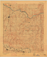
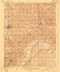
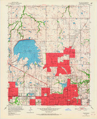
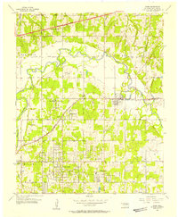
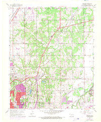
 - 1935 Map of Edmond
 1935 Edmond1935 Print · USGSCovers Edmond, including Oklahoma City, Midwest City, and other nearby areas
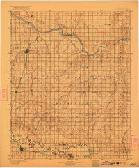
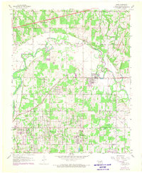
 - 1935 Map of Edmond, 1958 Print
 1935 Edmond1958 Print · USGSCovers Edmond, including Oklahoma City, Midwest City, and other nearby areas
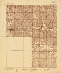
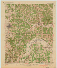
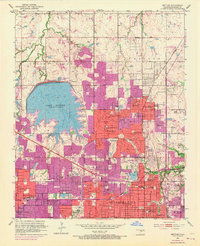
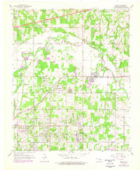
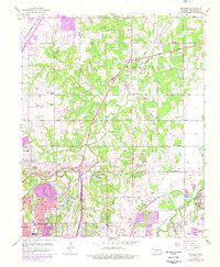
 - 1940 Map of Edmond
 1940 Edmond1940 Print · USGSCovers Edmond, including Oklahoma City, Midwest City, and other nearby areas
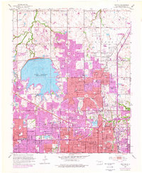
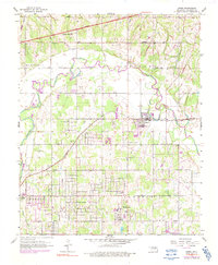
 - 1940 Map of Edmond
 1940 Edmond1940 Print · USGSCovers Edmond, including Oklahoma City, Midwest City, and other nearby areas
 - 1951 Map of Britton, 1952 Print
 1951 Britton1952 Print · USGSCovers Edmond, including Oklahoma City, Bethany, and other nearby areas
 - 1951 Map of Britton, 1966 Print
 1951 Britton1966 Print · USGSCovers Edmond, including Oklahoma City, Bethany, and other nearby areas
 - 1951 Map of Britton, 1967 Print
 1951 Britton1967 Print · USGSCovers Edmond, including Oklahoma City, Bethany, and other nearby areas
 - 1951 Map of Britton, 1970 Print
 1951 Britton1970 Print · USGSCovers Edmond, including Oklahoma City, Bethany, and other nearby areas
 - 1951 Map of Britton, 1976 Print
 1951 Britton1976 Print · USGSCovers Edmond, including Oklahoma City, Bethany, and other nearby areas
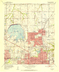
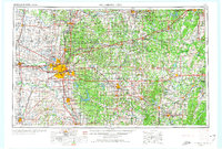
 - 1954 Map of Oklahoma City
 1954 Oklahoma City1954 Print · USGSCovers Edmond, including Oklahoma City, Norman, and other nearby areas
 - 1955 Map of Jones, 1957 Print
 1955 Jones1957 Print · USGSCovers Edmond, including Oklahoma City, Midwest City, and other nearby areas
 - 1955 Map of Jones, 1970 Print
 1955 Jones1970 Print · USGSCovers Edmond, including Oklahoma City, Midwest City, and other nearby areas
 - 1955 Map of Jones, 1976 Print
 1955 Jones1976 Print · USGSCovers Edmond, including Oklahoma City, Midwest City, and other nearby areas
 - 1955 Map of Jones, 1991 Print
 1955 Jones1991 Print · USGSCovers Edmond, including Oklahoma City, Midwest City, and other nearby areas
 - 1956 Map of Spencer, 1957 Print
 1956 Spencer1957 Print · USGSCovers Edmond, including Oklahoma City, Midwest City, and other nearby areas
 - 1956 Map of Spencer, 1970 Print
 1956 Spencer1970 Print · USGSCovers Edmond, including Oklahoma City, Midwest City, and other nearby areas
 - 1956 Map of Spencer, 1976 Print
 1956 Spencer1976 Print · USGSCovers Edmond, including Oklahoma City, Midwest City, and other nearby areas
 - 1957 Map of Oklahoma City, 1969 Print
 1957 Oklahoma City1969 Print · USGSCovers Edmond, including Oklahoma City, Norman, and other nearby areas
 - 1957 Map of Oklahoma City, 1974 Print
 1957 Oklahoma City1974 Print · USGSCovers Edmond, including Oklahoma City, Norman, and other nearby areas
Showing maps 1-25 of 41
Top neighborhoods in Edmond
- Waterloo historical maps
- Bridgewater historical maps
- Main Street Addition historical maps
- Heritage Village historical maps
- Persimmon Creek Place historical maps
- Trails South historical maps
See more
Frequently asked questions
- What are the different types of historical maps available for Edmond?
- What is the oldest map of Edmond?
- Where can I purchase historical maps of Edmond for my home or office?
- Where can I download high-res historical maps of Edmond?
- Are there historical topographic maps available for Edmond?
- Is there historical aerial imagery available for Edmond?
- Where are historical maps of Edmond sourced from?