1980s Maps of Pecos County, Texas
Explore 28 historic maps of Pecos County from the 1980s. These maps offer a rare glimpse into what life looked like during the 1980s — showing old roads, neighborhoods, homes, and landmarks that have changed or disappeared over time.
Whether you're researching your family's past, planning a metal detecting trip, or studying how Pecos County's landscape evolved across the 1980s, these high-resolution maps are a powerful tool for exploring the history of this region.
- Focus on a specific era: All maps on this page are from the 1980s, giving you a focused view of this time period.
- See what’s changed: Compare century-old streets, trails, and buildings to today's modern landscape using overlays and satellite layers.
- Research with precision: Use these maps for genealogy, historical research, land use analysis, or educational projects.
- View, download, or print: Maps are fully viewable online in high resolution, and can be downloaded or printed for your own records.
Start exploring Pecos County's history through authentic maps from the 1980s. This is your window into the past.
Pecos County, TX maps
(28)- 1980 Map of Chancellor
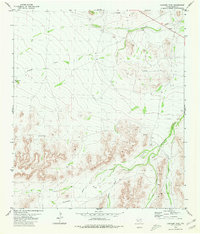
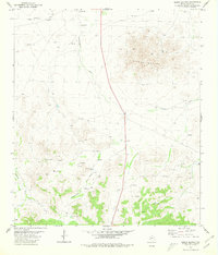
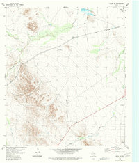
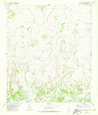
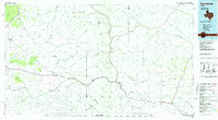
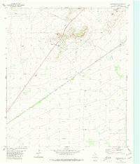 1980 Chancellor1980 Print · USGSPecos County's arid landscape is captured in the late seventies as a hub of rail transport and resource extraction. Trace the path of the Atchison Topeka and Santa Fe through Chancellor and locate landmarks like Triple Butte and Acebuche Draw.
 - 1980 Map of Cave Mesa NE
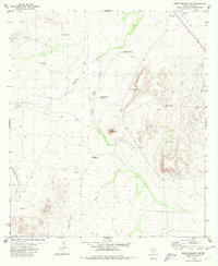
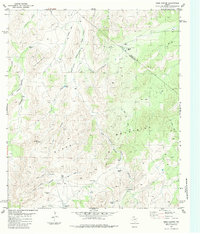
 1980 Cave Mesa NE1980 Print · USGSPecos County was a hub of energy and rail transit in the early eighties. You can trace the path of the Atchison Topeka and Santa Fe railroad and locate infrastructure like the Oates Pumping Sta and the high point of Pikes Peak.
 - 1980 Map of Sierra Madera SE
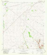
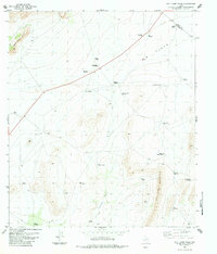
 1980 Sierra Madera SE1980 Print · USGSPecos County ranch lands are captured here during the 1980s, showcasing the isolated water infrastructure of West Texas. Researchers can locate family-named landmarks and remote facilities like Talley Taylor Tank, Mitchell Tank, and the local Landing Strip.
 - 1980 Map of Rock House Draw
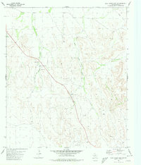
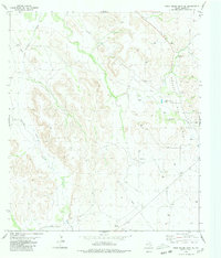
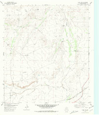
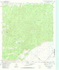
 1980 Rock House Draw1980 Print · USGSPecos County in the early eighties was a landscape of deep draws and industrial expansion. Genealogists and historians can trace the intersection of water and industry through Independence Creek, the Landing Strip, and scattered Gas Wells.
 - 1980 Map of Panther Tank
 1980 Panther Tank1980 Print · USGSPecos County’s arid landscape was a world of water-rights and remote aviation in the late twentieth century. Genealogists and historians can trace the essential desert infrastructure through landmarks like Ellis Windmill, the Landing Strips, and Panther Tank.
 - 1980 Map of Sierra Madera NW
 1980 Sierra Madera NW1980 Print · USGSPecos County industrial and desert landscapes are captured here during the 1970s energy expansion. Researchers can trace the development of the Pikes Peak Gas Plant and find remote water sources like Puckett Windmill and Red Bed Well.
 - 1980 Map of Cave Mesa
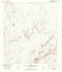
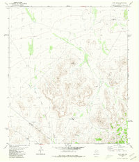 1980 Cave Mesa1980 Print · USGSThe West Texas high desert at the start of the 1980s was a landscape defined by isolated ranching infrastructure and striking topography. Researchers can trace the rugged county line and find essential water features like Rooney Tank, Burnt House Creek, and Cave Mesa.
 - 1980 Map of Rock House Draw NW
 1980 Rock House Draw NW1980 Print · USGSPecos County’s arid landscape and resource economy are captured here during the mid-1970s. Researchers can trace water management and transportation via Stockton Tank, several Gravel Pits, and a remote southern Landing Strip.
 - 1980 Map of Sierra Madera
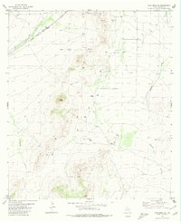
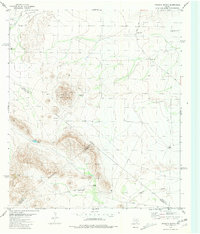
 1980 Sierra Madera1980 Print · USGSPecos County's ranching and energy landscape is captured here in the early eighties, centered on the prominent Sierra Madera rise. Researchers can locate remote outposts like Elsinore Ranch and trace vital water sources such as Sixshooter Draw and Huelem Tank.
 - 1980 Map of Sierra Madera NE
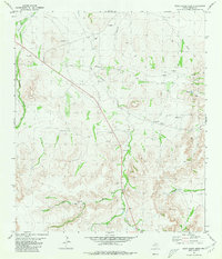
 1980 Sierra Madera NE1980 Print · USGSPecos County ranching and resource extraction are captured here during the 1970s, showing a landscape shaped by water scarcity and wide-open spaces. Researchers can trace remote infrastructure like the Landing Strip, Round Mountain, and various stock wells including Weak Windmill.
 - 1980 Map of Hovey
 1980 Hovey1980 Print · USGSThe Trans-Pecos ranching country of the early 1980s is defined here by the transit corridor of the Atchison Topeka and Santa Fe. Local historians can locate remote outposts like Burnt House Creek Ranch, the high ground of Robbers Roost, and the tracks at Hovey.
 - 1980 Map of Rock House Draw NE
 1980 Rock House Draw NE1980 Print · USGSPecos County's energy landscape is captured here in the early eighties as the industrial footprint expanded across the high desert. Map collectors can trace the complex network of the Puckett Gas Field, locating specific Gas Wells, Pipelines, and water sources like Little Bull Tank.
 - 1980 Map of Barrilla Mountains East
 1980 Barrilla Mountains East1980 Print · USGSThe high-desert terrain of the Trans-Pecos comes into focus during the late seventies, where the Barrilla Mountains meet at a three-county boundary. Researchers can trace ranching footprints through remote landmarks like South Camp and isolated water sources like Wagon Windmill.
 - 1980 Map of Hovey SW, 1981 Print
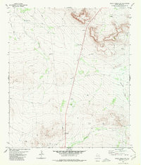
 1980 Hovey SW1981 Print · USGSBrewster and Pecos counties in the early 1980s reveal a landscape of vast ranchlands and vital rail lines. Genealogists and historians can trace the Atchison Topeka and Santa Fe tracks and find remote landmarks like Humble Well and U-Bar Tank.
 - 1980 Map of Hovey NE, 1981 Print
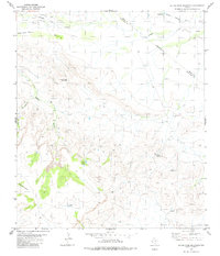
 1980 Hovey NE1981 Print · USGSPecos County ranching and rail infrastructure are captured here during the 1980s. Researchers can trace the path of the Atchison Topeka and Santa Fe and locate historic water sources like Headquarters Windmill and Coyanosa Draw.
 - 1980 Map of Little Star Mountain, 1981 Print
 1980 Little Star Mountain1981 Print · USGSJeff Davis County ranching life is preserved here in the late seventies, showing the remote canyonlands and peaks of West Texas. Researchers can locate family-named sites like Jeff Ranch and Cavett Tank, alongside natural landmarks like Indian Springs.
 - 1980 Map of Leoncita Ranch, 1981 Print
 1980 Leoncita Ranch1981 Print · USGSRanching life in the Trans-Pecos during the late seventies is centered on the water-scarce terrain where Pecos, Brewster, and Jeff Davis counties meet. Researchers can trace land use at Leoncita Ranch or locate landmarks like Benson Mountain and Waldo Windmill.
 - 1980 Map of Cave Mesa SE, 1981 Print
 1980 Cave Mesa SE1981 Print · USGSPecos County ranching and desert terrain are captured in this early 1980s survey. Researchers can trace the remote Landing Strip and critical water catchments like Wade Tank and Granger Tank along the Acebuche Draw.
 - 1983 Map of Glass Mountain Ranch, 1984 Print
 1983 Glass Mountain Ranch1984 Print · USGSThe Glass Mountains meet the West Texas plains in the early 1980s, revealing a landscape defined by remote ranching and resource management. Trace the boundaries of Glass Mountain Ranch and find evidence of desert life at the Oil Well Windmill and Little House Well.
 - 1983 Map of Hess Canyon, 1984 Print
 1983 Hess Canyon1984 Print · USGSThe Glass Mountains of West Texas are captured here in the early eighties, showing a landscape defined by ranching and high-desert water management. Researchers can trace remote infrastructure like the Double Jug Windmill, Landing Strips, and family-named landmarks like Gilliland Canyon.
 - 1983 Map of Wolf Camp Hills, 1984 Print
 1983 Wolf Camp Hills1984 Print · USGSThe ranching country of Brewster County is captured here in the early eighties, showcasing a complex system of water infrastructure. Researchers can trace land use through features like Kincaid Ranch, Stillwell Mountain, and Black Muley Windmill.
 - 1985 Map of Sanderson
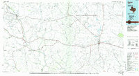
 1985 Sanderson1985 Print · USGSWest Texas ranching and railroading are captured here in the mid-eighties as the Southern Pacific traverses the Trans-Pecos. Researchers can trace the layout of Sanderson and find isolated sites like Dryden, Tesnus, and the Glass Mountains.2 unique versions available
 - 1985 Map of Ozona
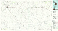
 1985 Ozona1985 Print · USGSCrockett County in the mid-eighties was a land of sprawling oil fields and high desert plateaus. Genealogists and local historians can trace the foundations of Fort Lancaster (Ruins) and follow the vital watercourse of the Pecos River near Sheffield.2 unique versions available
 - 1985 Map of Alpine
 1985 Alpine1985 Print · USGSWest Texas ranching and rail life are documented here in the mid-1980s as the region centers on Alpine. Trace the iron paths of the Southern Pacific and Atchison Topeka and Santa Fe through settlements like Marathon and Altuda.2 unique versions available
 - 1985 Map of Fort Stockton, 1986 Print
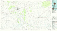
 1985 Fort Stockton1986 Print · USGSFort Stockton and the surrounding West Texas mesas are captured here in the mid-1980s, revealing a landscape of ranching, rail, and energy. Genealogists and historians can trace local landmarks like the Cem, the City-County Airport, and the settlement of Bakersfield.2 unique versions available
Showing maps 1-25 of 28
Top cities of Pecos County
- Fort Stockton historical maps
- Iraan historical maps
- Imperial historical maps
- Sheffield historical maps
- Coyanosa historical maps
Frequently asked questions
- What are the different types of historical maps available for Pecos County?
- What is the oldest map of Pecos County?
- Where can I purchase historical maps of Pecos County for my home or office?
- Where can I download high-res historical maps of Pecos County?
- Are there historical topographic maps available for Pecos County?
- Is there historical aerial imagery available for Pecos County?
- Where are historical maps of Pecos County sourced from?