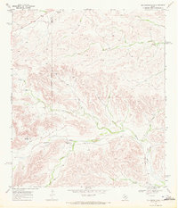
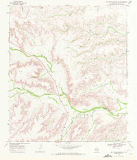
1960s Maps of Pecos County, Texas
Explore 41 historic maps of Pecos County from the 1960s. These maps offer a rare glimpse into what life looked like during the 1960s — showing old roads, neighborhoods, homes, and landmarks that have changed or disappeared over time.
Whether you're researching your family's past, planning a metal detecting trip, or studying how Pecos County's landscape evolved across the 1960s, these high-resolution maps are a powerful tool for exploring the history of this region.
- Focus on a specific era: All maps on this page are from the 1960s, giving you a focused view of this time period.
- See what’s changed: Compare century-old streets, trails, and buildings to today's modern landscape using overlays and satellite layers.
- Research with precision: Use these maps for genealogy, historical research, land use analysis, or educational projects.
- View, download, or print: Maps are fully viewable online in high resolution, and can be downloaded or printed for your own records.
Start exploring Pecos County's history through authentic maps from the 1960s. This is your window into the past.
Pecos County, TX maps
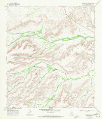
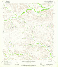
(41)- 1963 Map of Ligon Ranch, 1965 Print
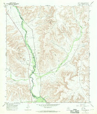
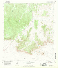
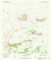
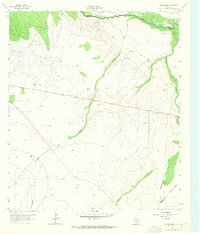 1963 Ligon Ranch1965 Print · USGSThe Pecos River valley and the expanding West Texas oil fields define this mid-century landscape. Researchers can trace the layout of the Automotive Proving Ground and remote outposts like Ligon Ranch and Alberts Well.2 unique versions available
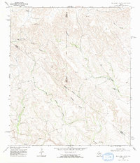
 - 1963 Map of Rio Pecos Ranch, 1965 Print
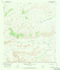
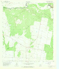 1963 Rio Pecos Ranch1965 Print · USGSWest Texas ranching and petroleum production meet along the river in the early sixties. Researchers can trace the layout of the Waha Oil Field, the remote Rio Pecos Ranch, and irrigation works like the Grand Canal.3 unique versions available
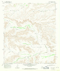
 - 1967 Map of Twelvemile Camp, 1970 Print
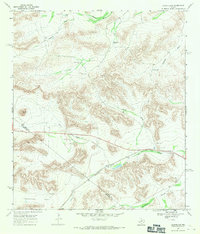
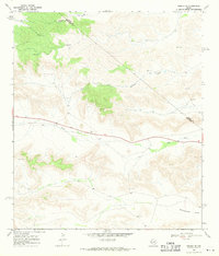
 1967 Twelvemile Camp1970 Print · USGSCrockett and Pecos counties in the late sixties were defined by the expansion of the energy sector into the high-desert canyons. Researchers can trace the mid-century petroleum footprint through numerous Oil Wells and the Pipeline near Twelvemile Camp.
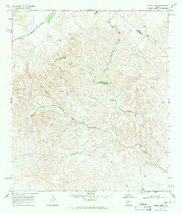
 - 1967 Map of Divide Country, 1970 Print
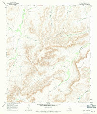
 1967 Divide Country1970 Print · USGSPecos County was a hub of petroleum exploration in the late sixties, as shown by this survey of the high plateau. Researchers can trace the industrial footprint of numerous Oil Wells and Drill Holes scattered across Upper Fourmile Draw and Riffle Canyon.2 unique versions available
 - 1967 Map of Sheffield NW, 1970 Print
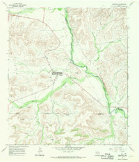
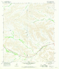
 1967 Sheffield NW1970 Print · USGSThe Pecos and Terrell county border country comes to life in this late 1960s study of the West Texas landscape. Genealogists and historians can trace the established Cannon Ranch, Slaughter Ranch, and the Perkins Windmill across the draws.2 unique versions available
 - 1967 Map of Deer Canyon, 1970 Print
 1967 Deer Canyon1970 Print · USGSThe Pecos River serves as the winding border between Crockett and Pecos counties in the late 1960s. Researchers can trace the mid-century energy boom through active Oil Wells and a Pumping Sta located within the Millard Oil Field and Noel Oil Field.
 - 1967 Map of Iraan, 1970 Print
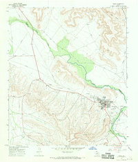 1967 Iraan1970 Print · USGSThe West Texas petroleum landscape comes to life in this mid-century survey of the Yates Oil Field and the town of Iraan. Genealogists and industrial historians can trace the development of local infrastructure including Restland Cemetery, the Municipal Airport, and the Gas Plant.
 - 1967 Map of Sheffield, 1970 Print
 1967 Sheffield1970 Print · USGSSheffield and the Pecos River valley are captured in the late sixties, showing a landscape defined by ranching and oil. Researchers can trace family sites at Sheffield Cem and locate remote landmarks like Greer Airfield or Squaw Peak.
 - 1968 Map of Cap Rock Butte, 1971 Print
 1968 Cap Rock Butte1971 Print · USGSRanching life in the late sixties comes into focus in this corner of the Trans-Pecos, where remote outposts like Skevington Ranch relied on the Red Windmill. Trace property lines across W B Flats and follow the natural draws that define the county line.
 - 1968 Map of Busher Canyon, 1971 Print
 1968 Busher Canyon1971 Print · USGSPecos County ranchlands in the late sixties reveal a landscape shaped by water and wind. Researchers can trace the essential infrastructure of remote Texas life through landmarks like Busher Windmill, Rebecca Draw, and Cedar Tank.2 unique versions available
 - 1968 Map of Big Brindle Canyon, 1971 Print
 1968 Big Brindle Canyon1971 Print · USGSWest Texas ranching life in the late sixties centers on isolated homesteads and vital water sources among the deep draws of the Trans-Pecos. Researchers can trace the boundaries of the Brown Ranch, Murrah Ranch, and the southern Ranchito near Maxon Creek.
 - 1968 Map of Toms Canyon, 1971 Print
 1968 Toms Canyon1971 Print · USGSThe arid ranchlands of the Trans-Pecos come into focus in the late 1960s, showing the vital water systems of the Wildcat Mountains. Researchers can locate historic family holdings and landmarks like Downie Ranch, Standifer Gap, and Cliett Windmills.2 unique versions available
 - 1968 Map of F C Ranch, 1971 Print
 1968 F C Ranch1971 Print · USGSPecos County ranching life is frozen in time during the late sixties, showing a landscape shaped by water and high-desert terrain. Researchers can locate remote infrastructure like the F C Ranch, the Landing Strip, and many named wells and tanks such as Lewis Well.
 - 1968 Map of Fresno Creek, 1971 Print
 1968 Fresno Creek1971 Print · USGSThe Southern Pacific railroad passes through the Brewster and Pecos county line in the late 1960s. Researchers can trace remote ranching outposts like Rosenfeld and water features such as Fresno Well and High Windmill.
 - 1968 Map of Marathon Gap, 1971 Print
 1968 Marathon Gap1971 Print · USGSPecos County in the late sixties reveals a landscape of high desert ridges and open ranch land. Researchers can trace the drainage of Sixshooter Draw and locate specific Water Tank sites near Marathon Gap.
 - 1968 Map of Longfellow, 1971 Print
 1968 Longfellow1971 Print · USGSThe high desert of Pecos and Brewster County is captured in the late sixties as the railroad era meets modern ranching. Trace the Southern Pacific line past Longfellow and locate family-named landmarks like Steer Wells and Panther Peak.
 - 1968 Map of Ebers Camp, 1971 Print
 1968 Ebers Camp1971 Print · USGSPecos County ranching life in the late sixties centers on isolated outposts and vital water sources among the Goat Hills. Researchers can trace old property improvements and livestock camps like Ebers Camp, North Camp, and the Cinco de Mayo Windmill.
 - 1968 Map of Ninemile Ranch, 1971 Print
 1968 Ninemile Ranch1971 Print · USGSRanching life and rail transport define this Terrell County landscape in the late sixties. Researchers can trace the Southern Pacific line through Sanderson Canyon and locate remote landmarks like Ninemile Ranch, Emerson, and Jackson Tank.2 unique versions available
 - 1968 Map of Dimple Hills, 1971 Print
 1968 Dimple Hills1971 Print · USGSThe Trans-Pecos ranchlands are captured in the late 1960s, showing a remote landscape defined by high summits and critical water points. Genealogists and historians can trace the bounds of League Ranch or locate family landmarks like Gurley Windmill and Sugar Loaf Mountain.
 - 1968 Map of Reininger Draw, 1971 Print
 1968 Reininger Draw1971 Print · USGSPecos County ranching life is preserved in this late 1960s survey of the West Texas landscape. Researchers can trace family-named infrastructure and water sources like the Reininger Tank Windmill, Nevins Windmills, and Morales Tank.
 - 1968 Map of Tesnus NE, 1971 Print
 1968 Tesnus NE1971 Print · USGSBrewster and Pecos counties meet in this arid West Texas landscape during the late sixties, where ranching and topography dictate the way of life. Genealogists and historians can trace the paths of Downie Draw and Dry Creek or locate landmarks like Rattlesnake Flats and the Gravel Pit.
 - 1969 Map of Grandfalls, 1971 Print
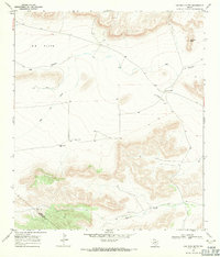
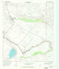 1969 Grandfalls1971 Print · USGSIn the arid Permian Basin of the late sixties, the landscape of Ward and Pecos Counties was a network of irrigation and oil production. Trace the early layout of Grandfalls and Imperial, or locate family sites near Tamarisk Cem and the Imperial Reservoir.2 unique versions available
 - 1969 Map of Smoky Mountain Ranch, 1972 Print
 1969 Smoky Mountain Ranch1972 Print · USGSThe Pecos and Terrell County line runs through this West Texas ranching country as it appeared in the late sixties. Researchers can trace the isolated outposts of Smoky Mountain Ranch, an active Oil Field, and the steep winding path of Surveyor Canyon.
 - 1969 Map of Big Canyon Ranch, 1972 Print
 1969 Big Canyon Ranch1972 Print · USGSThe arid canyons of West Texas are captured here in the late sixties, showing a landscape defined by the Pecos Co Terrell Co line. Researchers can trace the isolated outposts of the ranching frontier at Big Canyon Ranch, Hagelslein Ranch, and Russell.
 - 1969 Map of Big Canyon Ranch NW, 1972 Print
 1969 Big Canyon Ranch NW1972 Print · USGSPecos County ranching life in the late sixties is defined by the deep incisions of Big Canyon and the Middle Fork Big Canyon. Researchers can locate family landmarks like Thorn Ranch, Mitchell Ranch, and trace the route of Highway 285.2 unique versions available
Showing maps 1-25 of 41
Top cities of Pecos County
- Fort Stockton historical maps
- Iraan historical maps
- Imperial historical maps
- Sheffield historical maps
- Coyanosa historical maps
Frequently asked questions
- What are the different types of historical maps available for Pecos County?
- What is the oldest map of Pecos County?
- Where can I purchase historical maps of Pecos County for my home or office?
- Where can I download high-res historical maps of Pecos County?
- Are there historical topographic maps available for Pecos County?
- Is there historical aerial imagery available for Pecos County?
- Where are historical maps of Pecos County sourced from?