1970s Maps of Pecos County, Texas
Explore 37 historic maps of Pecos County from the 1970s. These maps offer a rare glimpse into what life looked like during the 1970s — showing old roads, neighborhoods, homes, and landmarks that have changed or disappeared over time.
Whether you're researching your family's past, planning a metal detecting trip, or studying how Pecos County's landscape evolved across the 1970s, these high-resolution maps are a powerful tool for exploring the history of this region.
- Focus on a specific era: All maps on this page are from the 1970s, giving you a focused view of this time period.
- See what’s changed: Compare century-old streets, trails, and buildings to today's modern landscape using overlays and satellite layers.
- Research with precision: Use these maps for genealogy, historical research, land use analysis, or educational projects.
- View, download, or print: Maps are fully viewable online in high resolution, and can be downloaded or printed for your own records.
Start exploring Pecos County's history through authentic maps from the 1970s. This is your window into the past.
Pecos County, TX maps
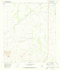
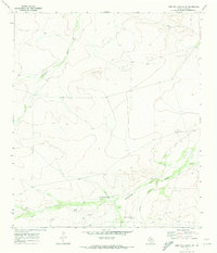
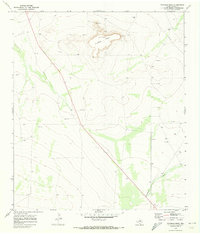
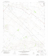
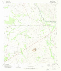
(37)- 1970 Map of Belding SW, 1973 Print
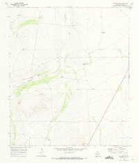 1970 Belding SW1973 Print · USGSPecos County ranching life in the early 1970s is captured here, centered on the drainage of the Coyanosa Draw. Genealogists and researchers can trace family-named sites like Kennedy Ranch and the Smith Place alongside numerous named wells and windmills.
 - 1970 Map of Tucker Hill, 1973 Print
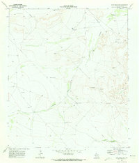
 1970 Tucker Hill1973 Print · USGSThe West Texas ranchlands near the Pecos and Reeves county line appear here as they were in the early seventies, defined by water-rights and resource extraction. Researchers can locate the Schoolhouse, several Gravel Pits, and a series of named landmarks like Metzger Windmill and Hayter Hill.
 - 1970 Map of Deep Well Ranch, 1973 Print
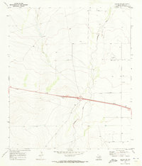
 1970 Deep Well Ranch1973 Print · USGSRanching life in West Texas during the early seventies was shaped by the desert draws and isolated outposts like Deep Well Ranch. Genealogists and historians can trace the Reeves Co Pecos Co line past the Dutch Windmill and a solitary Grave.
 - 1970 Map of Fort Stockton West, 1973 Print
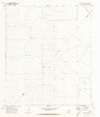
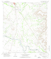
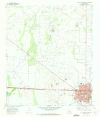 1970 Fort Stockton West1973 Print · USGSFort Stockton is captured during a period of significant growth and energy expansion in the early 1970s. Researchers can trace the town's roots through the Old Fort Cem and Comanche Springs while exploring the surrounding Fort Stockton Oil and Gas Field.
 - 1970 Map of Twelvemile Mesa, 1973 Print
 1970 Twelvemile Mesa1973 Print · USGSPecos County was a hub of energy production in the early seventies as oil and gas operations expanded across the valley. Researchers can trace the Atchison Topeka and Santa Fe rail line as it passes Fivemile Hill and the Leon Valley Oil and Gas Field.
 - 1970 Map of East Mesa, 1973 Print
 1970 East Mesa1973 Print · USGSPecos County ranching and industry are captured here in the early 1970s. Researchers can locate the Atchison Topeka and Santa Fe rail line and trace family land at McKenzie Ranch or Fourteenmile Park.
 - 1970 Map of Saddle Butte, 1973 Print
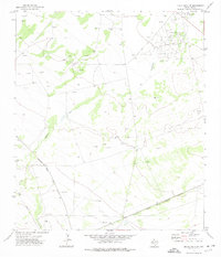
 1970 Saddle Butte1973 Print · USGSPecos County ranching and resource extraction are captured here during the early seventies. Local historians can trace the network of working landmarks like the Old Headquarters Windmill, Doodlebug Tank, and the various Oil Wells across the mesas.
 - 1970 Map of Panther Bluff, 1973 Print
 1970 Panther Bluff1973 Print · USGSThe Trans-Pecos region of West Texas in the early seventies reveals a landscape shaped by ranching and the search for water. Researchers can trace remote infrastructure from Harral Ranch to named water sources like Posey Windmill and McKenzie Well.
 - 1970 Map of Deep Well Ranch SE, 1973 Print
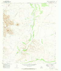
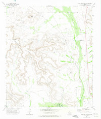
 1970 Deep Well Ranch SE1973 Print · USGSPecos County ranch lands are captured here in the early seventies, showing a landscape defined by water scarcity and resource extraction. Researchers can locate specific family-named landmarks like Cartlege Windmill and trace the paths of Hackberry Draw and Paisano Creek.
 - 1970 Map of East Mesa SW, 1973 Print
 1970 East Mesa SW1973 Print · USGSPecos County ranchlands and water networks are documented here in the early seventies, just after the 1969 aerial surveys. Researchers can trace vital desert landmarks from Bull Trap Windmill and Linger to the winding course of Sixshooter Draw.
 - 1970 Map of Belding NW, 1973 Print
 1970 Belding NW1973 Print · USGSPecos County ranchland and transit corridors are captured here in the early seventies, just as modern highways reshaped the West Texas landscape. Researchers can trace land markers like Coyanosa Draw, a remote Landing Strip, and the site at Bruce 3.
 - 1970 Map of Barstow 3 SE, 1973 Print
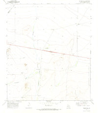
 1970 Barstow 3 SE1973 Print · USGSIn the arid West Texas desert during the early seventies, the borderlands of the Trans-Pecos reveal a landscape of isolated ranching and oil extraction. Trace the locations of family-named landmarks like McCarmack Windmill and the Blue Ridge Farm alongside industrial Oil Wells.2 unique versions available
 - 1970 Map of Deep Well Ranch NW, 1973 Print
 1970 Deep Well Ranch NW1973 Print · USGSThe West Texas ranchlands at the Reeves and Pecos county line are captured here during the early seventies. Genealogists and historians can trace the remote Graef Ranch and Hayter Ranch or locate water sources like Chapo Windmill.
 - 1970 Map of Fivemile Mesa, 1973 Print
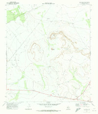
 1970 Fivemile Mesa1973 Print · USGSPecos County's arid landscape is captured in the early seventies, showcasing a period of active energy exploration across the high desert. Researchers can trace the footprint of the petroleum industry through Oil Wells and Gas Wells surrounding the prominent Fivemile Mesa.
 - 1970 Map of Fort Stockton East, 1973 Print
 1970 Fort Stockton East1973 Print · USGSFort Stockton and its high-desert surroundings come into focus during the early seventies, showing a town balancing its railroad heritage with new industrial growth. Genealogists and local historians can trace East Hill Cem, the Atchison Topeka and Santa Fe rail line, and landmarks like James Rooney Memorial Park.
 - 1970 Map of Belding NE, 1985 Print
 1970 Belding NE1985 Print · USGSPecos County industrial development is at its peak in 1970 as energy and research facilities expand across the Texas landscape. Researchers can trace the massive Test Facility and Fort Stockton Oil and Gas Field, alongside the Cem and Landing Strip.
 - 1970 Map of Belding, 1987 Print
 1970 Belding1987 Print · USGSPecos County ranching and energy operations are on display in the 1970s near Belding. Trace the path of the Atchison Topeka And Santa Fe railroad alongside a LANDING STRIP, local Gas Wells, and the Acebuche Draw.
 - 1972 Map of Buena Vista NE, 1974 Print
 1972 Buena Vista NE1974 Print · USGSThe Pecos River valley in the early seventies shows a landscape defined by petroleum extraction and desert irrigation. Researchers can trace the development of the Abell Oil And Gas Field, the settlement of Buena, and the complex Imperial Canal No 5.
 - 1972 Map of McCamey South, 1974 Print
 1972 McCamey South1974 Print · USGSThe West Texas oil and cattle country near the Pecos River is captured here in the early 1970s. Researchers can locate family landmarks like the Patton Ranch, trace the historic Old Spanish Ditch, or study the industrial footprint of the Tippett Oil Field.
 - 1972 Map of Buena Vista SW, 1974 Print
 1972 Buena Vista SW1974 Print · USGSPecos County was a hub of energy exploration in the early seventies, dominated by the Fromme Oil Field. Researchers can trace the industrial footprint of the era through the Atchison Topeka and Santa Fe railroad and the rail stop at Tunis.
 - 1972 Map of Table Top Mountain, 1974 Print
 1972 Table Top Mountain1974 Print · USGSCrockett and Upton counties are mapped in the early 1970s, showcasing the high-desert energy economy and ranching life. Genealogists and historians can trace the Kelton Ranch and Tippett sites alongside the extensive workings of the Crockett Oil Field.
 - 1972 Map of Girvin, 1975 Print
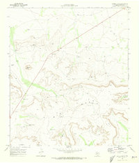
 1972 Girvin1975 Print · USGSWest Texas in the early 1970s reveals a rugged landscape defined by the Pecos River and the expanding reach of the petroleum industry. Researchers can trace the rail-and-oil economy through the Atchison Topeka and Santa Fe line, the small settlement of Girvin, and the Wentz Oil and Gas Field.
 - 1972 Map of Owego, 1975 Print
 1972 Owego1975 Print · USGSWest Texas energy production and rail transit meet in the early seventies along the Atchison Topeka and Santa Fe line. Researchers can locate remote settlements like Owego and Baldridge or trace the extent of the Sun Valley Oil Field.
 - 1972 Map of Buena Vista, 1975 Print
 1972 Buena Vista1975 Print · USGSThe West Texas oil fields were in full production during the early seventies, defining the landscape of Pecos County. Researchers can trace the sprawling energy infrastructure of the Lehn Apco Oil Field and locate the small communities of Abell City and Buena Vista.
 - 1972 Map of Girvin SE, 1975 Print
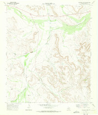
 1972 Girvin SE1975 Print · USGSThe Pecos River valley in the early seventies shows a landscape deeply shaped by the oil industry and ranching. Genealogists and historians can trace family land at Johnson Ranch, find old transit points like Adobe Crossing, and follow the Atchison Topeka and Santa Fe railroad.
Showing maps 1-25 of 37
Top cities of Pecos County
- Fort Stockton historical maps
- Iraan historical maps
- Imperial historical maps
- Sheffield historical maps
- Coyanosa historical maps
Frequently asked questions
- What are the different types of historical maps available for Pecos County?
- What is the oldest map of Pecos County?
- Where can I purchase historical maps of Pecos County for my home or office?
- Where can I download high-res historical maps of Pecos County?
- Are there historical topographic maps available for Pecos County?
- Is there historical aerial imagery available for Pecos County?
- Where are historical maps of Pecos County sourced from?