Old Maps of Spokane County, Washington for Metal Detecting
Plan your next treasure hunt with 336 historic maps of Spokane County. Find old homesites, ghost towns, trails, and gathering spots that may be lost to time — perfect for identifying promising metal detecting locations.
- Locate forgotten sites: Uncover places like long-lost settlements, abandoned rail lines, or gathering spots.
- Plan better hunts: Use map overlays combined with LiDAR or satellite views to narrow in on historically rich areas.
- Made for detectorists: Thousands of hobbyists use these maps to discover relics, coins, and hidden history.
Use these historic maps to boost your research and find new opportunities beneath the surface of Spokane County.
Spokane County, WA maps
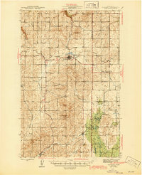
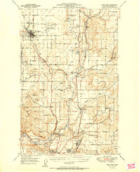
(336)- 1901 Map of Spokane
 1901 Spokane1901 Print · USGSThe Inland Empire was entering a period of massive rail-driven growth at the turn of the century, with Spokane as its industrial heart. Genealogists and historians can trace the early foundations of Ft. Wright, the railroad works at Hillyard, and rural outposts like Chattaroy and Spokane Bridge.6 unique versions available
 - 1903 Map of Oakesdale
 1903 Oakesdale1903 Print · USGSThe Palouse and South Spokane regions are shown here at the height of the early railroad era. Researchers can trace family history through numerous small grain-stop settlements like Waverly, Latah, and Plaza, or locate family-named landmarks such as Steptoe Butte and Stratton Butte.
 - 1905 Map of Oakesdale
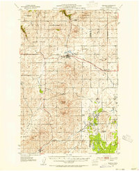
 1905 Oakesdale1905 Print · USGSEastern Washington at the dawn of the twentieth century was a landscape of burgeoning rail hubs and fertile Palouse hills. Genealogists and historians can trace the early layouts of Oakesdale, Tekoa, and Rosalia as they grew alongside the Northern Pacific RR.3 unique versions available
 - 1927 Map of Chewelah, 1957 Print
 1927 Chewelah1957 Print · USGSStevens County was a hub of mining and rail during the late twenties, centered on the Colville River valley. Genealogists can trace family footprints through dozens of rural landmarks like Halfway House, Camas Sch, and the United Copper Mine.
 - 1930 Map of Chewelah
 1930 Chewelah1930 Print · USGSStevens County's mining and timber landscape comes alive in the late 1920s, showing the vital rail-to-river corridor. Trace family roots and vanished industrial sites from Springdale to Chewelah, including the United Copper Mine and Bear Creek Sch.2 unique versions available
 - 1936 Map of Newport
 1936 Newport1936 Print · USGSThe Pend Oreille River valley in the 1930s reveals a landscape of railroad towns and timber outposts along the Idaho border. Genealogists can locate family-named school districts like Locke Sch and Otter Creek Sch, alongside settlements at Dalkena, Cusick, and Scotia.2 unique versions available
 - 1942 Map of Newport
 1942 Newport1942 Print · USGSPend Oreille River country is captured here during the early 1940s, showing the vital rail and river links between Newport and the mountain frontier. Researchers can trace family homesteads near old schools like Fertile Valley Sch or locate the Indian Mission and Dalkena mill site.3 unique versions available
 - 1943 Map of Mt Spokane
 1943 Mt Spokane1943 Print · USGSThe Washington and Idaho borderlands are shown here during the early years of the state park's development. Genealogists and local historians can trace rural school districts like Blanchard Valley Sch and old supply points like the Peone Store.2 unique versions available
 - 1943 Map of Medical Lake
 1943 Medical Lake1943 Print · USGSThe prairie and lake country west of Spokane in the early 1940s reveals a landscape of rural schools, rail junctions, and major public institutions. Researchers can locate family landmarks like Gramps Landing, Spring Hill Grange, and the State Custodial School.
 - 1944 Map of Clayton
 1944 Clayton1944 Print · USGSThe rural landscape north of Spokane is captured here just before the mid-forties, showing the vital river junctions and rail-connected settlements. Genealogists and researchers can trace local school districts and landmarks like Clayton, Haines Ranch, and the Spokane Indian Reservation.2 unique versions available
 - 1944 Map of Wellpinit
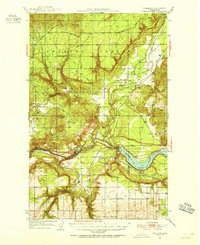
 1944 Wellpinit1944 Print · USGSThe Spokane Indian Reservation and the winding Spokane River define this 1940s landscape during an era of logging and early hydroelectric power. Genealogists and historians can trace the foundations of local life at Wellpinit, the Deer Park Logging Camp, and the State Fish Hatchery.2 unique versions available
 - 1945 Map of Reardan
 1945 Reardan1945 Print · USGSThe Lincoln County plateau in the mid-forties was a vital crossroads of the Great Northern and Northern Pacific railroads. Genealogists can locate family landmarks like District School No 1, Pleasant View Cem, and the high point of Hanning Butte.2 unique versions available
 - 1949 Map of Deer Park, 1960 Print
 1949 Deer Park1960 Print · USGSSpokane County's northern prairies and river valleys are captured here in the late 1940s as rural agriculture met growing industrial hubs. Researchers can trace family roots at Wild Rose Ch, identify old grange halls, or locate the Aluminum Reduction Plant and Whitworth College.
 - 1949 Map of Greenacres, 1961 Print
 1949 Greenacres1961 Print · USGSThe Spokane Valley-Rathdrum Prairie border is captured here at a peak of post-war industrial activity. Local historians can trace the massive Naval Supply Depot, the Aluminum Rolling Mill, and various country landmarks like the Saltese Cemetery and Tri-Community Grange.3 unique versions available
 - 1950 Map of Spokane NE, 1952 Print
 1950 Spokane NE1952 Print · USGSSpokane and its eastern valleys are captured here at a peak of rail and aviation development in the early fifties. Genealogists and local historians can trace family plots and school districts from Hillyard Cemeteries to the Hutton Settlement and Felts Field.2 unique versions available
 - 1950 Map of Spokane SE, 1952 Print
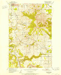 1950 Spokane SE1952 Print · USGSSpokane and the surrounding prairies and mountains are captured here in the early postwar years as rural crossroads were still the heart of the community. Genealogists and historians can locate Moran Cem, the Grange Hall, and several local schools like Sunnyside Sch and Adams Sch.2 unique versions available
 - 1950 Map of Mt Spokane, 1952 Print
 1950 Mt Spokane1952 Print · USGSThe Washington-Idaho borderlands in the early fifties reveal a landscape of high summits and quiet lake basins. Genealogists and local historians can trace rural school districts like Kit Carson School and small community hubs such as Inland Grange and Peone.3 unique versions available
 - 1950 Map of Spokane SW, 1952 Print
 1950 Spokane SW1952 Print · USGSThe outskirts of mid-century Spokane reveal a busy intersection of major railroads and rural community life on the edge of Moran Prairie. Genealogists can locate family landmarks like Windsor School, Glenora Church, and several grange halls serving the farms along LATAH CREEK.
 - 1950 Map of Spokane NW, 1952 Print
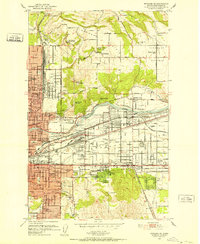
 1950 Spokane NW1952 Print · USGSSpokane enters the early fifties as a major military and rail hub, with neighborhoods expanding across the Spokane River. Genealogists and historians can locate legacy institutions like Gonzaga University, George Wright Air Force Base, and Holy Cross Cemetery.2 unique versions available
 - 1950 Map of Spokane, 1955 Print
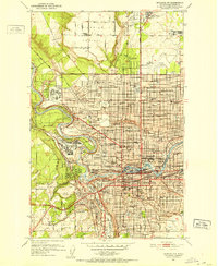
 1950 Spokane1955 Print · USGSSpokane was a bustling rail and aviation hub during the early fifties, caught in a moment of rapid post-war expansion. Genealogists and local historians can trace family roots through numerous parish schools, cemeteries like Holy Cross Cem, and outlying settlements such as Marshall and Pleasant Prairie.2 unique versions available
 - 1950 Map of Clayton, 1970 Print
 1950 Clayton1970 Print · USGSThe Stevens and Spokane county line in the mid-twentieth century shows a landscape of river-fed prairies and mountain peaks. Genealogists can locate family landmarks like Haines Ranch, Williams Valley Cem, and the Fort Spokane Historic Site.
 - 1951 Map of Deer Park
 1951 Deer Park1951 Print · USGSSpokane County's northern agricultural and industrial landscapes are captured here during the post-war era. Genealogists and researchers can trace the rural church and school networks at Wild Rose Ch, Mead, and the Peone-Foothills Grange.
 - 1951 Map of Greenacres
 1951 Greenacres1951 Print · USGSThe Spokane Valley at the mid-century shows a busy corridor of rail lines and new post-war industry. Researchers can trace family roots at Saltese Cem, explore the early footprint of the Naval Supply Depot, or locate vanished stations along the Spokane International railroad.2 unique versions available
 - 1953 Map of Reardan, 1954 Print
 1953 Reardan1954 Print · USGSThe Lincoln County wheat country near the Spokane border is captured here during the early fifties as the region's rural social life thrived. Researchers can trace the rail-and-road network connecting Reardan and Edwall, finding local landmarks like the Pleasant View Cem and West Deep Creek Grange.2 unique versions available
 - 1953 Map of Wellpinit, 1955 Print
 1953 Wellpinit1955 Print · USGSThe Spokane Indian Reservation and the rugged Stevens County hills come to life in the early fifties. Genealogists and historians can locate St Joseph Ch, the Wellpinit settlement, and local landmarks like Little Chamokane Falls.3 unique versions available
Showing maps 1-25 of 336
Top cities of Spokane County
- Spokane historical maps
- Spokane Valley historical maps
- Cheney historical maps
- Liberty Lake historical maps
- Airway Heights historical maps
- Colbert historical maps
See more
Frequently asked questions
- What are the different types of historical maps available for Spokane County?
- What is the oldest map of Spokane County?
- Where can I purchase historical maps of Spokane County for my home or office?
- Where can I download high-res historical maps of Spokane County?
- Are there historical topographic maps available for Spokane County?
- Is there historical aerial imagery available for Spokane County?
- Where are historical maps of Spokane County sourced from?