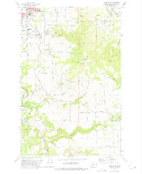
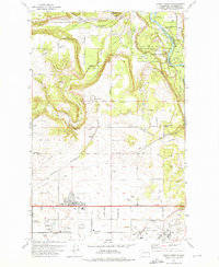
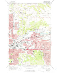
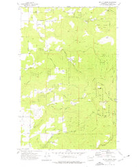
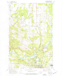
1970s Maps of Spokane County, Washington
Explore 37 historic maps of Spokane County from the 1970s. These maps offer a rare glimpse into what life looked like during the 1970s — showing old roads, neighborhoods, homes, and landmarks that have changed or disappeared over time.
Whether you're researching your family's past, planning a metal detecting trip, or studying how Spokane County's landscape evolved across the 1970s, these high-resolution maps are a powerful tool for exploring the history of this region.
- Focus on a specific era: All maps on this page are from the 1970s, giving you a focused view of this time period.
- See what’s changed: Compare century-old streets, trails, and buildings to today's modern landscape using overlays and satellite layers.
- Research with precision: Use these maps for genealogy, historical research, land use analysis, or educational projects.
- View, download, or print: Maps are fully viewable online in high resolution, and can be downloaded or printed for your own records.
Start exploring Spokane County's history through authentic maps from the 1970s. This is your window into the past.
Spokane County, WA maps
(37)- 1973 Map of Medical Lake, 1975 Print
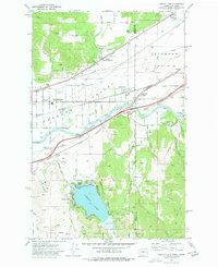
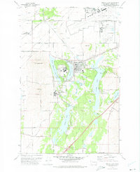 1973 Medical Lake1975 Print · USGSSpokane County's institutional and military landscape comes into focus in the 1970s, from the lakeside town to the air base. Genealogists and historians can trace the footprint of Lakeland Village, find the old Grange Hall, and locate Medical Lake Cem.3 unique versions available
 - 1973 Map of Spokane SE, 1975 Print
 1973 Spokane SE1975 Print · USGSSoutheast Spokane was a blend of suburban growth and working ranchland in the early seventies. Genealogists and historians can trace family-named sites like Moran Cem, Adams Sch, and the rural routes of the Palouse Highway.2 unique versions available
 - 1973 Map of Airway Heights, 1975 Print
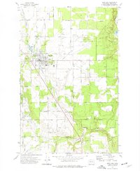
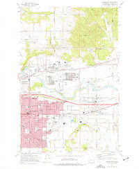
 1973 Airway Heights1975 Print · USGSThe outskirts of Spokane during the early seventies reveal a landscape shaped by aviation and military expansion. Genealogists and local historians can trace rural schoolhouses like Warsaw School and Deno School alongside the growth of Airway Heights.2 unique versions available
 - 1973 Map of Spokane NE, 1975 Print
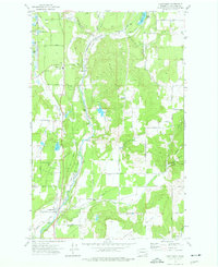
 1973 Spokane NE1975 Print · USGSSpokane and its eastern suburbs are shown here in the mid-1970s as industrial rail yards met growing residential neighborhoods. Trace local history through family-named cemeteries like Orchard Prairie Cem and the aviation legacy of Felts Field.3 unique versions available
 - 1973 Map of Deep Creek, 1975 Print
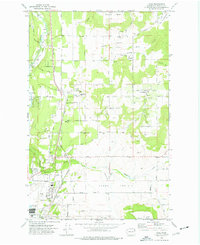
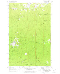
 1973 Deep Creek1975 Print · USGSSpokane County's western plateau is captured here in the mid-1970s as agricultural life met Cold War military expansion. Local historians can trace the Fairchild Air Force Base perimeter alongside Spokane Battlefield State Park and rural sites like the Deep Creek Hutterite Sch.3 unique versions available
 - 1973 Map of Spokane SW, 1975 Print
 1973 Spokane SW1975 Print · USGSThe southern outskirts of Spokane and the village of Marshall are seen here in the 1970s as suburban development meets the rugged Hangman Creek valley. Researchers can trace the Mullan Military Road Historical Monument and identify early neighborhood schools like Sacajawea Jr High Sch.3 unique versions available
 - 1973 Map of Four Lakes, 1975 Print
 1973 Four Lakes1975 Print · USGSFour Lakes and the aviation corridor west of Spokane appear here in the early 1970s, showcasing a mix of military infrastructure and rural lakefront life. Researchers can locate family landmarks like Antonian Sch, Green Mound Cem, and the old rail lines of the Burlington Northern.2 unique versions available
 - 1973 Map of Clayton, 1976 Print
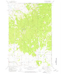
 1973 Clayton1976 Print · USGSThe Stevens and Spokane county line in the early 1970s is a landscape of valley farms and timbered peaks. Genealogists and local historians can trace the rural layout of Williams Valley through family-named landmarks like Williams Valley Hillside Cem and the Burroughs Sch.
 - 1973 Map of Deer Park, 1977 Print
 1973 Deer Park1977 Print · USGSSpokane County in the early seventies shows a landscape shaped by rail lines and community hubs. Trace family roots and local history through Kelly Cem, the Tri-County Fairgrounds, and the old rail corridor of the Burlington Northern.
 - 1973 Map of Long Lake, 1977 Print
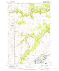
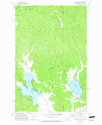
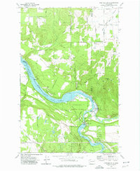
 1973 Long Lake1977 Print · USGSThe Spokane River corridor in the early 1970s reveals a landscape shaped by hydroelectric power and rural industry at the meeting of three counties. Researchers can trace the shoreline of Long Lake and locate local landmarks such as Long Lake Dam, the settlement of Crescent, and Chamokane Falls.
 - 1973 Map of Mica Peak, 1977 Print
 1973 Mica Peak1977 Print · USGSThe Washington and Idaho border country comes into focus in the early 1970s, defined by the strategic heights of Mica Peak. Trace the mountain rail lines of Manito, local family Mica Creek Cem, and the Mica Peak Air Force Station.3 unique versions available
 - 1973 Map of Greenacres, 1977 Print
 1973 Greenacres1977 Print · USGSSpokane Valley’s suburban expansion is in full swing during the early seventies, centered on the growing communities of Veradale and Opportunity. Genealogists can trace family landmarks at St Josephs Cem and the The Pines Cem, or locate long-standing institutions like Central Valley High Sch.2 unique versions available
 - 1973 Map of Four Mound Prairie, 1977 Print
 1973 Four Mound Prairie1977 Print · USGSThe Spokane River plateau in the early 1970s is shown here at the transition from farm country to the river's edge. Researchers can trace rural landmarks and family road names like Central Sch, Four Mound Fire Station, and Knight Lake.
 - 1973 Map of Newman Lake, 1977 Print
 1973 Newman Lake1977 Print · USGSThe Washington-Idaho borderlands in the early 1970s reveal a landscape of deep timber and popular lakeside retreats. Genealogists and local historians can trace the development of Hauser and the many private coves of Newman Lake, from Sutton Bay to Cherokee Bay.3 unique versions available
 - 1973 Map of Mead, 1977 Print
 1973 Mead1977 Print · USGSMead and the surrounding Spokane County prairies are shown here during a period of transition in the early 1970s. Trace the rural landscape through family-named roads and landmarks like Mater Cleri Seminary, the Indian Treaty Tree, and the Mead Airport.3 unique versions available
 - 1973 Map of Chattaroy, 1977 Print
 1973 Chattaroy1977 Print · USGSSpokane County's river valley and surrounding bluffs are captured here in the early seventies, centered on the Little Spokane River corridor. Researchers can locate the historic Milan Cem, trace the Burlington Northern rail line, and find old homesteads along Orchard Bluff.2 unique versions available
 - 1973 Map of Nine Mile Falls, 1977 Print
 1973 Nine Mile Falls1977 Print · USGSThe Spokane River valley in the early 1970s serves as a crossroads of frontier history and modern recreation. Local researchers can trace the early fur trade and military footprint at the Spokane House Historic Site and Fort Spokane Historic Site near Nine Mile Falls.2 unique versions available
 - 1973 Map of Mt Spokane, 1977 Print
 1973 Mt Spokane1977 Print · USGSThe mountains of the Washington and Idaho border are captured here in the early 1970s during a peak of recreational development. Trace the early Ski Lifts on Mt Spokane, locate the Vista House, and find old sites like Cooks Cabin and Camp Fosseen.2 unique versions available
 - 1973 Map of Liberty Lake, 1977 Print
 1973 Liberty Lake1977 Print · USGSSpokane Valley and the Idaho borderlands are captured here in the early seventies during a period of suburban and industrial growth. Researchers can trace the rail-and-river economy through landmarks like Moab, the Hauser siding, and the Saltese Flats.2 unique versions available
 - 1973 Map of Freeman, 1977 Print
 1973 Freeman1977 Print · USGSSettled along the rail lines southeast of Spokane in the early 1970s, these communities reveal a landscape of clay pits and valley farms. Genealogists can trace family names at Mica Cem and Evergreen Cem or locate the local High Sch.
 - 1973 Map of Reardan East, 1977 Print
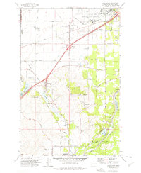
 1973 Reardan East1977 Print · USGSThe eastern reaches of Reardan in the early 1970s reveal a landscape defined by the Burlington Northern railroad and high plateau agriculture. Trace local history through landmarks like the Spring Creek Cem, Grange Hall, and Grain Elevators.
 - 1973 Map of Tumtum, 1977 Print
 1973 Tumtum1977 Print · USGSStevens County in the early seventies shows the rural community of Tumtum and the Spokane Indian Reservation boundary. Genealogists and hikers can locate the Tumtum Cem, the waters of Red Lake, and trails leading to Scoop Mountain.
 - 1973 Map of Mt. Kit Carson, 1977 Print
 1973 Mt. Kit Carson1977 Print · USGSSpokane County’s highlands are captured in the early 1970s, showcasing the extensive recreational and industrial reach of the Mt Spokane State Park region. Researchers can locate remote sites like the Daybreak Mine, Grange Hall, and the Mt St Charles Ranch among the ridges.3 unique versions available
 - 1973 Map of Waukon, 1977 Print
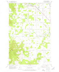
 1973 Waukon1977 Print · USGSThe rural borderlands of Lincoln and Spokane counties come into focus during the early 1970s, showing a landscape shaped by dryland farming and rail transport. Researchers can locate the Waukon Grain Elevator, trace the Old Railroad Grade, and find local landmarks like the Grange Hall.
 - 1973 Map of Dartford, 1977 Print
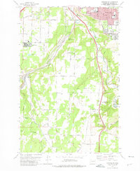
 1973 Dartford1977 Print · USGSSpokane's northern outskirts in the early 1970s show a mix of expansive prairies and burgeoning suburban life along the river. Genealogists and local historians can locate Wild Rose Cemetery, the Grange Hall, and the original campus of Whitworth College.2 unique versions available
Showing maps 1-25 of 37
Top cities of Spokane County
- Spokane historical maps
- Spokane Valley historical maps
- Cheney historical maps
- Liberty Lake historical maps
- Airway Heights historical maps
- Colbert historical maps
See more
Frequently asked questions
- What are the different types of historical maps available for Spokane County?
- What is the oldest map of Spokane County?
- Where can I purchase historical maps of Spokane County for my home or office?
- Where can I download high-res historical maps of Spokane County?
- Are there historical topographic maps available for Spokane County?
- Is there historical aerial imagery available for Spokane County?
- Where are historical maps of Spokane County sourced from?