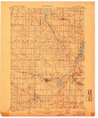
1900-1909 Maps of Wisconsin
Explore 146 historic maps of Wisconsin from 1900-1909. These maps offer a rare glimpse into what life looked like during the 1900s — showing old roads, neighborhoods, homes, and landmarks that have changed or disappeared over time.
Whether you're researching your family's past, planning a metal detecting trip, or studying how Wisconsin's landscape evolved across the 1900s, these high-resolution maps are a powerful tool for exploring the history of this region.
- Focus on a specific era: All maps on this page are from the 1900s, giving you a focused view of this time period.
- See what’s changed: Compare century-old streets, trails, and buildings to today's modern landscape using overlays and satellite layers.
- Research with precision: Use these maps for genealogy, historical research, land use analysis, or educational projects.
- View, download, or print: Maps are fully viewable online in high resolution, and can be downloaded or printed for your own records.
Start exploring Wisconsin's history through authentic maps from the 1900s. This is your window into the past.
Wisconsin maps
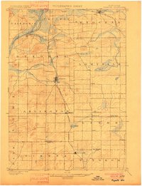
- 1900 Map of St Croix Dalles
 1900 St Croix Dalles1900 Print · USGSCovers Wisconsin, including Osceola, Town of Osceola, and other nearby areas
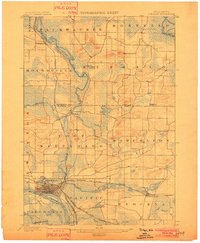
 - 1900 Map of Lancaster
 1900 Lancaster1900 Print · USGSCovers Wisconsin, including Dubuque, Platteville, and other nearby areas
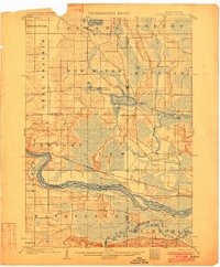
 - 1901 Map of Denzer
 1901 Denzer1901 Print · USGSCovers Wisconsin, including Baraboo, Prairie du Sac, and other nearby areas7 unique versions available
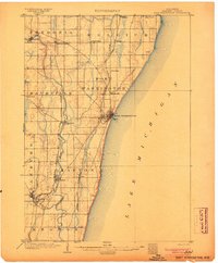
 - 1901 Map of Milwaukee
 1901 Milwaukee1901 Print · USGSCovers Wisconsin, including Milwaukee, West Allis, and other nearby areas
 - 1901 Map of Poynette
 1901 Poynette1901 Print · USGSCovers Wisconsin, including DeForest, Windsor, and other nearby areas3 unique versions available
 - 1901 Map of Waukesha
 1901 Waukesha1901 Print · USGSCovers Wisconsin, including Milwaukee, Waukesha, and other nearby areas
 - 1901 Map of Bayview
 1901 Bayview1901 Print · USGSCovers Wisconsin, including Milwaukee, Racine, and other nearby areas4 unique versions available
 - 1901 Map of Muskego
 1901 Muskego1901 Print · USGSCovers Wisconsin, including Milwaukee, Waukesha, and other nearby areas4 unique versions available
 - 1901 Map of The Dells
 1901 The Dells1901 Print · USGSCovers Wisconsin, including Reedsburg, Lake Delton, and other nearby areas6 unique versions available
 - 1901 Map of St Croix Dalles
 1901 St Croix Dalles1901 Print · USGSCovers Wisconsin, including Osceola, Town of Osceola, and other nearby areas6 unique versions available
 - 1902 Map of Portage
 1902 Portage1902 Print · USGSCovers Wisconsin, including Portage, Pardeeville, and other nearby areas3 unique versions available
 - 1902 Map of Briggsville
 1902 Briggsville1902 Print · USGSCovers Wisconsin, including Portage, Lake Delton, and other nearby areas4 unique versions available
 - 1902 Map of Mineral Point
 1902 Mineral Point1902 Print · USGSCovers Wisconsin, including Platteville, Dodgeville, and other nearby areas4 unique versions available
 - 1902 Map of Wausau
 1902 Wausau1902 Print · USGSCovers Wisconsin, including Wausau, Weston, and other nearby areas2 unique versions available
 - 1902 Map of Elkader
 1902 Elkader1902 Print · USGSCovers Wisconsin, including Manchester, Dyersville, and other nearby areas4 unique versions available
 - 1902 Map of Marathon, 1938 Print
 1902 Marathon1938 Print · USGSCovers Wisconsin, including Wausau, Merrill, and other nearby areas
 - 1903 Map of Whitewater
 1903 Whitewater1903 Print · USGSCovers Wisconsin, including Whitewater, Ottawa, and other nearby areas5 unique versions available
 - 1903 Map of Waukon
 1903 Waukon1903 Print · USGSCovers Wisconsin, including Prairie du Chien, Waukon, and other nearby areas5 unique versions available
 - 1904 Map of West Bend
 1904 West Bend1904 Print · USGSCovers Wisconsin, including West Bend, Mequon, and other nearby areas3 unique versions available
 - 1904 Map of Port Washington
 1904 Port Washington1904 Print · USGSCovers Wisconsin, including Mequon, Grafton, and other nearby areas2 unique versions available
 - 1904 Map of Hartford
 1904 Hartford1904 Print · USGSCovers Wisconsin, including Hartford, Richfield, and other nearby areas3 unique versions available
 - 1904 Map of Lancaster, 1953 Print
 1904 Lancaster1953 Print · USGSCovers Wisconsin, including Dubuque, Platteville, and other nearby areas
 - 1904 Map of Madison, 1954 Print
 1904 Madison1954 Print · USGSCovers Wisconsin, including Madison, Sun Prairie, and other nearby areas
 - 1904 Map of Lake Geneva, 1955 Print
 1904 Lake Geneva1955 Print · USGSCovers Wisconsin, including Burlington, Elkhorn, and other nearby areas
 - 1905 Map of Racine
 1905 Racine1905 Print · USGSCovers Wisconsin, including Kenosha, Racine, and other nearby areas3 unique versions available
Showing maps 1-25
Top cities of Wisconsin
- Milwaukee historical maps
- Madison historical maps
- Green Bay historical maps
- Kenosha historical maps
- Racine historical maps
- Appleton historical maps
See more
Top counties of Wisconsin
- Milwaukee County historical maps
- Dane County historical maps
- Waukesha County historical maps
- Brown County historical maps
- Racine County historical maps
- Outagamie County historical maps
See more
Frequently asked questions
- What are the different types of historical maps available for Wisconsin?
- What is the oldest map of Wisconsin?
- Where can I purchase historical maps of Wisconsin for my home or office?
- Where can I download high-res historical maps of Wisconsin?
- Are there historical topographic maps available for Wisconsin?
- Is there historical aerial imagery available for Wisconsin?
- Where are historical maps of Wisconsin sourced from?