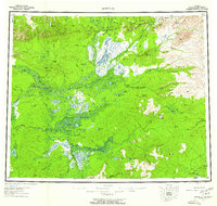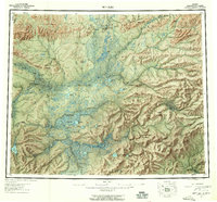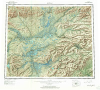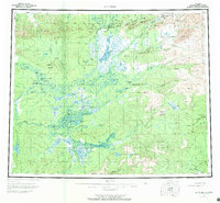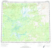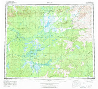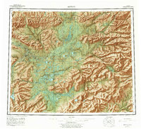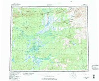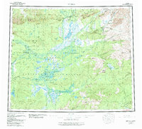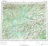
1956 Map of Bettles
USGS Topo · Published 1974About this map
Bettles and Evansville serve as central points of contact in this remote interior landscape where the John River meets the Koyukuk River. The terrain is defined by the vast Kanuti Flats and the Alatna Hills, bisected by the Arctic Circle. This mid-century survey documents a wilderness reliant on seasonal access, evidenced by the extensive network of Winter Roads and Winter Trails that connect distant outposts like Allakaket and Alatna. Resource extraction and infrastructure are visible at the Cold Bench Mine and the Radio Towers near Bettles Field. Distinctive features like Pingos and Stout Island emphasize the subarctic geography, while family-named landmarks such as Henshaw Cabin and Ray Cabin mark the few established dwellings in the territory.
Find a feature on this map
86 named features on this map. Tap any name to fly to it.
Don’t see what you’re looking for? This feature index may not catch every label — zoom into the map to look around manually.
Map Details
Editions of this 1956 Bettles Map
10 editions found