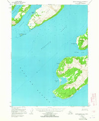
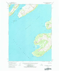
1953 Map of Blying Sound D-3
USGS Topo · Published 1965About this map
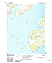
Latouche Island and the southern reaches of Montague Island dominate this coastal survey of the Kenai Peninsula region. At the time of this 1950s data collection, the settlement of Latouche is situated on the island's northwestern shore, nestled beneath the 2,222-foot summit of Latouche Peak. To the south, the terrain of Montague Island rises sharply to Jeanie Peak and Stair Mountain, terminating at the prominent Cape Cleare. The map details a maritime landscape defined by deep water passages such as Montague Strait and Latouche Passage, which separate these landmasses from the open Gulf of Alaska. Local human activity is evidenced by scattered landmarks like Alice, Cloud Cabin, and several unidentified cabins along the rugged coastline near Point Woodcock. This document captures the remote topography of Prince William Sound's outer islands before later ecological and seismic changes altered the Alaskan coast.
Find a feature on this map
23 named features on this map. Tap any name to fly to it.
Don’t see what you’re looking for? This feature index may not catch every label — zoom into the map to look around manually.
Map Details
Editions of this 1953 Blying Sound D-3 Map
6 editions found
Other maps of this area

1946 · Blying Sound
USGS Topo · 1:250,000

1950 · Blying Sound D-4
USGS Topo · 1:63,360

1951 · Blying Sound
USGS Topo · 1:250,000

1951 · Seward
USGS Topo · 1:250,000

1951 · Seward A-2
USGS Topo · 1:63,360

1951 · Seward A-3
USGS Topo · 1:63,360

1951 · Blying Sound D-1 and D-2
USGS Topo · 1:63,360

1951 · Seward A-4
USGS Topo · 1:63,360

1952 · Seward A-3
USGS Topo · 1:63,360

1952 · Seward A-4
USGS Topo · 1:63,360