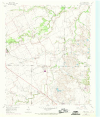
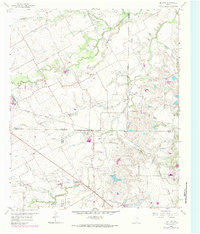
1959 Map of Britton
USGS Topo · Published 1969About this map
Britton sits at the nexus of several county boundaries, serving as a primary focal point where Tarrant, Johnson, and Ellis counties meet. The landscape in the late 1950s is defined by a dense network of drainages including Walnut Creek, Mountain Creek, and Bowman Branch, which carve through the terrain and dictate the placement of early rural infrastructure. This area was notably shaped by the Southern Pacific railroad line, which runs through the northern portion of the quadrangle, influencing the growth of nearby settlements.
Find a feature on this map
25 named features on this map. Tap any name to fly to it.
Don’t see what you’re looking for? This feature index may not catch every label — zoom into the map to look around manually.
Map Details
Editions of this 1959 Britton Map
6 editions found

Other maps of this area

1891 · Dallas
USGS Topo · 1:125,000

1891 · Cleburne
USGS Topo · 1:125,000

1893 · Dallas
USGS Topo · 1:125,000

1894 · Cleburne
USGS Topo · 1:125,000

1894 · Fort Worth
USGS Topo · 1:125,000

1954 · Dallas
USGS Topo · 1:250,000

1958 · Dallas
USGS Topo · 1:250,000

1959 · Kennedale
USGS Topo · 1:24,000

1959 · Arlington
USGS Topo · 1:24,000

1959 · Cedar Hill
USGS Topo · 1:24,000