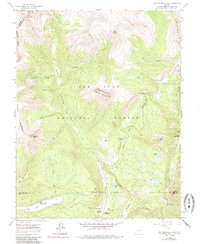
1960 Map of Engineer Mountain
USGS Topo · Published 1985About this map
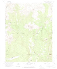
Engineer Mountain and the high alpine ridges of the San Juan National Forest define this 1960 survey, which captures the area before modern recreational development intensified. The map documents a landscape of high-altitude passes and remote outposts, including Coal Bank Pass and the Columbine Ranger Sta. In the valleys, scattered landmarks like Harris Ranch and the Mill Creek Lodge suggest early ranching and seasonal hospitality. A complex network of drainage systems, such as Lime Creek and the East Fork Hermosa Creek, feeds into small high-country basins containing Potato Lake and Boyce Lake. Industrial and transport traces are visible through a Gravel Pit, an Aqueduct, and the rugged Highline Trail, showing how the era's infrastructure contended with the steep topography of the San Juan Mountains.
Find a feature on this map
36 named features on this map. Tap any name to fly to it.
Don’t see what you’re looking for? This feature index may not catch every label — zoom into the map to look around manually.
Map Details
Editions of this 1960 Engineer Mountain Map
7 editions found
Other maps of this area

1897 · Telluride
USGS Topo · 1:62,500

1897 · Silverton
USGS Topo · 1:62,500

1898 · Engineer Mountain
USGS Topo · 1:62,500

1900 · Engineer Mountain
USGS Topo · 1:62,500

1900 · Needle Mountains
USGS Topo · 1:62,500

1901 · Silverton
USGS Topo · 1:62,500

1902 · Needle Mountains
USGS Topo · 1:62,500

1902 · Silverton
USGS Topo · 1:62,500

1904 · Telluride
USGS Topo · 1:62,500

1908 · Engineer Mountain
USGS Topo · 1:62,500