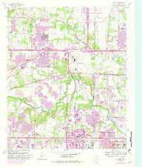
1959 Map of Euless
USGS Topo · Published 1981About this map
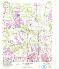
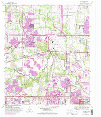
Euless and the surrounding mid-cities area are captured here during a transformative era of suburban expansion and infrastructure development. The massive footprint of the Dallas Fort Worth Regional Airport dominates the northeastern corner, illustrating the large-scale shift from rural prairie to a global transportation hub. This change is underscored by the dense network of corporate boundaries for Bedford, Arlington, Irving, and Grand Prairie, which hem in established rural landmarks like Bear Creek Cem and St John Ch. Along the meandering West Fork Trinity River, extensive Gravel Pits signify the industrial extraction required to build the growing metroplex. Transportation corridors like the Oklahoma Kansas and Texas railroad and the Dallas-Fort Worth Turnpike slice across the landscape, connecting the once-distinct settlements of Colleyville and Estelle.
Find a feature on this map
49 named features on this map. Tap any name to fly to it.
Don’t see what you’re looking for? This feature index may not catch every label — zoom into the map to look around manually.
Map Details
Editions of this 1959 Euless Map
7 editions found

Other maps of this area

1891 · Dallas
USGS Topo · 1:125,000

1893 · Dallas
USGS Topo · 1:125,000

1894 · Fort Worth
USGS Topo · 1:125,000

1925 · Dallas 2-b
USGS Topo · 1:48,000

1931 · Carrollton
USGS Topo · 1:62,500

1931 · Grapevine
USGS Topo · 1:62,500

1954 · Dallas
USGS Topo · 1:250,000

1958 · Dallas
USGS Topo · 1:250,000

1959 · Kennedale
USGS Topo · 1:24,000

1959 · Arlington
USGS Topo · 1:24,000