
1949 Map of Flora
USGS Topo · Published 1949About this map
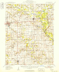
The Little Wabash River meanders across this late 1940s landscape, defining a rural corridor of Clay and Wayne counties where small-scale farming and emerging industry coexist. The Baltimore and Ohio RR serves as the primary east-west artery, connecting the town of Flora and Clay City to broader regional markets. The map reveals an exceptionally dense network of local institutions that anchored these mid-century rural communities, featuring numerous country schools like West Seminary Sch and Long Prairie Sch, alongside churches such as Bethlehem Ch and Lathrop Chapel.
Find a feature on this map
95 named features on this map. Tap any name to fly to it.
Don’t see what you’re looking for? This feature index may not catch every label — zoom into the map to look around manually.
Map Details
Editions of this 1949 Flora Map
2 editions found
Other maps of this area

1941 · Newton
USGS Topo · 1:62,500

1943 · Newton
USGS Topo · 1:62,500

1943 · Albion
USGS Topo · 1:62,500

1946 · Albion
USGS Topo · 1:62,500

1947 · Wayne City
USGS Topo · 1:62,500

1948 · Fairfield
USGS Topo · 1:62,500

1948 · Flora
USGS Topo · 1:62,500

1949 · Olney
USGS Topo · 1:62,500

1952 · Xenia
USGS Topo · 1:62,500

1953 · Sailor Springs
USGS Topo · 1:62,500