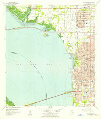
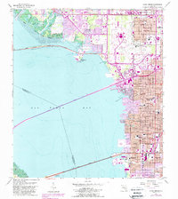
1956 Map of Gandy Bridge
USGS Topo · Published 1957About this map
The Interbay Peninsula and the eastern shores of Old Tampa Bay define this mid-century coastal landscape. Two major engineering feats, the Gandy Bridge and the Courtney Campbell Parkway, stretch across the water to connect the Tampa region with its western neighbors. Along the peninsula, a burgeoning network of suburban streets and educational institutions like Plant High Sch, Jesuit High Sch, and Madison Jr High Sch signal the era's rapid residential growth.
Find a feature on this map
46 named features on this map. Tap any name to fly to it.
Don’t see what you’re looking for? This feature index may not catch every label — zoom into the map to look around manually.
Map Details
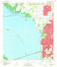
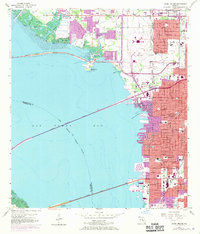
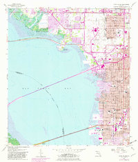
Editions of this 1956 Gandy Bridge Map
6 editions found

Other maps of this area

1921 · Tampa
USGS Topo · 1:62,500

1921 · St Petersburg
USGS Topo · 1:62,500

1943 · St Petersburg
USGS Topo · 1:31,680

1943 · Gandy Bridge
USGS Topo · 1:31,680

1943 · Safety Harbor
USGS Topo · 1:31,680

1943 · Port Tampa
USGS Topo · 1:31,680
1943 · Oldsmar
USGS Topo · 1:24,000

1944 · Sulphur Springs
USGS Topo · 1:31,680

1944 · Tampa
USGS Topo · 1:31,680

1944 · Oldsmar
USGS Topo · 1:31,680