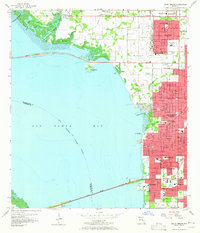
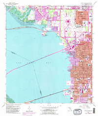
1956 Map of Gandy Bridge
USGS Topo · Published 1965About this map
Old Tampa Bay dominates this mid-century survey, bordered by the rapid urban and industrial expansion of Tampa and the Interbay Peninsula. The landscape is defined by its strategic transportation links, including the Gandy Bridge and the Courtney Campbell Parkway, which connect the mainland to Pinellas County across the water. On the eastern shore, the infrastructure of the Tampa International Airport and the neighboring Drew Park settlement reveal the area's mid-century growth. Inland, a dense network of neighborhood institutions like Jesuit High Sch, Plant High Sch, and the American Legion Cem provide specific points of interest for genealogists. The southern reach of the peninsula features the settlement of Rattlesnake, situated near the rail lines of the Atlantic Coast Line and Seaboard Air Line, highlighting the importance of the era's rail-to-sea commerce.
Find a feature on this map
49 named features on this map. Tap any name to fly to it.
Don’t see what you’re looking for? This feature index may not catch every label — zoom into the map to look around manually.
Map Details
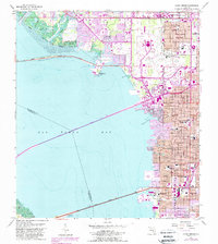
Editions of this 1956 Gandy Bridge Map
6 editions found
Other maps of this area

1921 · Tampa
USGS Topo · 1:62,500

1921 · St Petersburg
USGS Topo · 1:62,500

1943 · St Petersburg
USGS Topo · 1:31,680

1943 · Gandy Bridge
USGS Topo · 1:31,680

1943 · Safety Harbor
USGS Topo · 1:31,680

1943 · Port Tampa
USGS Topo · 1:31,680

1943 · Oldsmar
USGS Topo · 1:24,000

1944 · Sulphur Springs
USGS Topo · 1:31,680

1944 · Tampa
USGS Topo · 1:31,680

1944 · Oldsmar
USGS Topo · 1:31,680