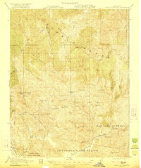
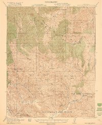
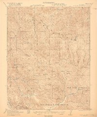
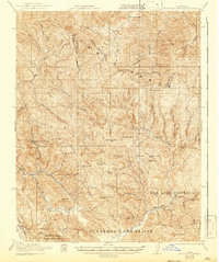
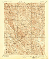
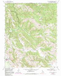
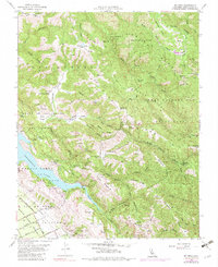
1921 Map of Gilroy Hot Springs
USGS Topo · Published 1921This historical map portrays the area of Gilroy Hot Springs in 1921, primarily covering Santa Clara County as well as portions of Stanislaus County. Featuring a scale of 1:62500, this map provides a highly detailed snapshot of the terrain, roads, buildings, counties, and historical landmarks in the Gilroy Hot Springs region at the time. Published in 1921, it is one of 5 known editions of this map due to revisions or reprints.
Map Details
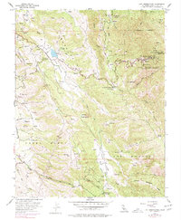
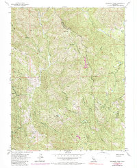
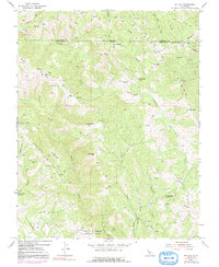
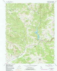
Editions of this 1921 Gilroy Hot Springs Map
5 editions found
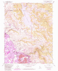
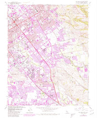
Historical Maps of Santa Clara County Through Time
31 maps found
1897 Mt. Hamilton
Santa Clara County, CA

1916 New Almaden
Santa Clara County, CA
1921 Gilroy Hot Springs
Santa Clara County, CA

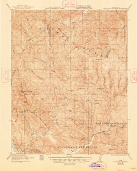
1939 Gilroy Hot Springs
Santa Clara County, CA

1940 Gilroy Hot Springs
Santa Clara County, CA

1942 Mt. Hamilton
Santa Clara County, CA

1943 Mt. Hamilton
Santa Clara County, CA

1947 Mt. Hamilton
Santa Clara County, CA
1953 Calaveras Reservoir
Santa Clara County, CA

1953 San Jose East
Santa Clara County, CA

1953 San Jose West
Santa Clara County, CA

1953 Santa Teresa Hills
Santa Clara County, CA
1955 Chittenden
Santa Clara County, CA

1955 Eylar Mountain
Santa Clara County, CA
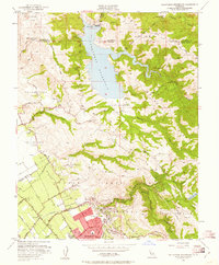
1955 Gilroy Hot Springs
Santa Clara County, CA

1955 Isabel Valley
Santa Clara County, CA
1955 Lick Observatory
Santa Clara County, CA
1955 Mississippi Creek
Santa Clara County, CA
1955 Mt. Day
Santa Clara County, CA

1955 Mt. Madonna
Santa Clara County, CA
1955 Mt. Sizer
Santa Clara County, CA

1955 Mt. Stakes
Santa Clara County, CA
1955 Pacheco Peak
Santa Clara County, CA
1961 Calaveras Reservoir
Santa Clara County, CA
1961 San Jose East
Santa Clara County, CA

1961 San Jose West
Santa Clara County, CA

1963 Mt. Hamilton
Santa Clara County, CA

1967 Mt. Hamilton
Santa Clara County, CA

1996 Mississippi Creek
Santa Clara County, CA

1996 Mount Day
Santa Clara County, CA

1996 Mount Madonna
Santa Clara County, CA