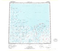
1955 Map of Harrison Bay
USGS Topo · Published 1977About this map
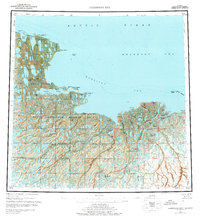
Harrison Bay and the surrounding North Slope landscape appear here as a complex network of tundra waterways and coastal features during the mid-1950s. The coastline is defined by prominent landmarks like Cape Halkett and the Eskimo Islands, while the inland area is dominated by the massive Teshekpuk Lake and the branching deltas of the Colville River.
Find a feature on this map
39 named features on this map. Tap any name to fly to it.
Don’t see what you’re looking for? This feature index may not catch every label — zoom into the map to look around manually.
Map Details
Editions of this 1955 Harrison Bay Map
8 editions found
Other maps of this area

1951 · Harrison Bay
USGS Topo · 1:250,000

1951 · Beechey Point
USGS Topo · 1:250,000

1951 · Sagavanirktok D-5
USGS Topo · 1:250,000

1951 · Teshekpuk
USGS Topo · 1:250,000

1951 · Ikpikpuk River
USGS Topo · 1:250,000

1952 · Umiat
USGS Topo · 1:250,000

1955 · Harrison Bay
USGS Topo · 1:250,000

1955 · Beechey Point
USGS Topo · 1:250,000

1955 · Teshekpuk
USGS Topo · 1:250,000

1955 · Harrison Bay A-4
USGS Topo · 1:63,360