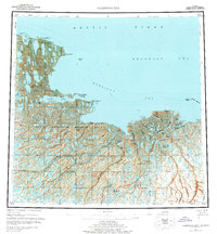
1955 Map of Harrison Bay
USGS Topo · Published 1977About this map
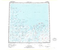
The Colville River delta dominates this 1955 survey of the Alaskan north coast, where the river's massive braided discharge enters Harrison Bay and the Beaufort Sea. The landscape is a complex mosaic of thaw lakes and winding channels within the Naval Petroleum Reserve No 4, reflecting the unique hydrology of the Arctic coastal plain. While mostly uninhabited, the map identifies Nuiqsut near the river's mouth and the Esook Trading Post (Aban'd) at Cape Halkett, marking the transition from traditional subsistence routes to early petroleum exploration. Navigational landmarks like the Nuiqsut Landing Area and the Kupigruak Channel provide a window into how people moved through this remote delta system before modern infrastructure arrived. Large inland water bodies like Teshekpuk Lake and the Kogru River highlight the drainage patterns that define this permafrost-underlain terrain.
Find a feature on this map
44 named features on this map. Tap any name to fly to it.
Don’t see what you’re looking for? This feature index may not catch every label — zoom into the map to look around manually.
Map Details
Editions of this 1955 Harrison Bay Map
8 editions found
Other maps of this area

1951 · Harrison Bay
USGS Topo · 1:250,000

1951 · Beechey Point
USGS Topo · 1:250,000

1951 · Sagavanirktok D-5
USGS Topo · 1:250,000

1951 · Teshekpuk
USGS Topo · 1:250,000

1951 · Ikpikpuk River
USGS Topo · 1:250,000

1952 · Umiat
USGS Topo · 1:250,000

1955 · Harrison Bay
USGS Topo · 1:250,000

1955 · Beechey Point
USGS Topo · 1:250,000

1955 · Teshekpuk
USGS Topo · 1:250,000

1955 · Harrison Bay A-4
USGS Topo · 1:63,360