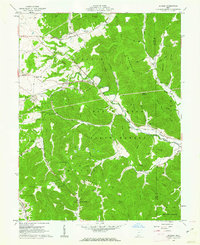
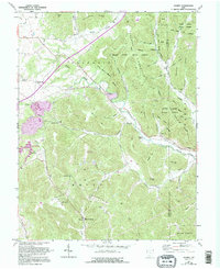
1961 Map of Jaybird
USGS Topo · Published 1962About this map
Brush Creek State Forest dominates the southern half of this landscape, where the ridges of Peach Mountain and Tener Mountain define the high ground of the Adams and Scioto county line. The Norfolk and Western railroad snakes through the valleys of Scioto Brush Creek and Brush Creek, connecting the small settlements of Jaybird, Beaver Pond, and Bacon Flat.
Find a feature on this map
62 named features on this map. Tap any name to fly to it.
Don’t see what you’re looking for? This feature index may not catch every label — zoom into the map to look around manually.
Map Details
Editions of this 1961 Jaybird Map
5 editions found
Other maps of this area

1915 · Bainbridge
USGS Topo · 1:48,000

1915 · Otway
USGS Topo · 1:62,500

1915 · Piketon
USGS Topo · 1:62,500

1916 · Peebles
USGS Topo · 1:62,500

1917 · Bainbridge
USGS Topo · 1:62,500

1917 · Piketon
USGS Topo · 1:62,500

1917 · Otway
USGS Topo · 1:62,500

1918 · Peebles
USGS Topo · 1:62,500

1944 · Piketon
USGS Topo · 1:62,500

1947 · Columbus
USGS Topo · 1:250,000