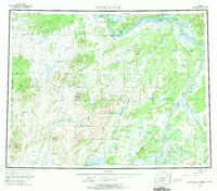
1952 Map of Kantishna River
USGS Topo · Published 1970About this map
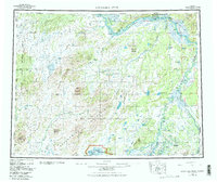
The Kantishna River and the Tanana River dominate this interior Alaskan landscape, serving as the primary corridors for travel and early settlement in the mid-20th century. Near the confluence of these great waterways, Manley Hot Springs and Hot Springs Landing stand as established hubs, while the map records the locations of several earlier sites like Cosna and Toklat. The terrain transitions from the low-lying swamps and numerous lakes such as Wien Lake and Bear Lake to the significant elevations of the Chitanana Mountains and the Bitzshtini Mountains. A notable sled road traces a path through the southern reaches near the Bearpaw River, a reminder of the seasonal transport networks essential to the subarctic before modern infrastructure. From the Dugan Hills in the northeast to the North Fork Kuskokwim River in the southwest, the survey details a wilderness defined by its shifting braided rivers and remote mining or trapping outposts.
Find a feature on this map
61 named features on this map. Tap any name to fly to it.
Don’t see what you’re looking for? This feature index may not catch every label — zoom into the map to look around manually.
Map Details
Editions of this 1952 Kantishna River Map
7 editions found

Other maps of this area

1945 · Livengood
USGS Topo · 1:250,000

1948 · Kantishna River
USGS Topo · 1:250,000

1950 · Medfra
USGS Topo · 1:250,000

1950 · Fairbanks
USGS Topo · 1:250,000

1951 · Healy
USGS Topo · 1:250,000

1951 · Kantishna River
USGS Topo · 1:250,000

1951 · Ruby
USGS Topo · 1:250,000

1951 · Fairbanks
USGS Topo · 1:250,000

1951 · Melozitna
USGS Topo · 1:250,000

1951 · Tanana
USGS Topo · 1:250,000