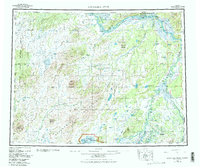
1952 Map of Kantishna River
USGS Topo · Published 1983About this map
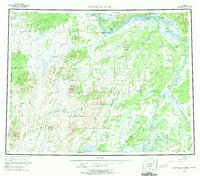
Tanana River and Kantishna River dominate this interior Alaskan landscape, a region defined by its vast water networks and remote mountain ranges as it appeared in the mid-20th century. The settlement of Manley Hot Springs serves as a primary hub in the north, connected to the river system via Hot Springs Landing. The map illustrates the transition from the braided river flats to the high elevations of the Bitzshtini Mountains and Chitanatala Mountains, revealing how early aviation and river transport were critical to the area. Landmarks such as Mooseheart Mountain and Haystack Mountain provide significant navigation points for the surrounding wilderness. Interior travel is further evidenced by the long Sled Road winding through the southern terrain toward the Denali National Preserve. Scattered Cabins and isolated sites like Nineteenmile highlight the sparse, survival-based settlement patterns of this era before more modern infrastructure arrived.
Find a feature on this map
58 named features on this map. Tap any name to fly to it.
Don’t see what you’re looking for? This feature index may not catch every label — zoom into the map to look around manually.
Map Details
Editions of this 1952 Kantishna River Map
7 editions found

Other maps of this area

1945 · Livengood
USGS Topo · 1:250,000

1948 · Kantishna River
USGS Topo · 1:250,000

1950 · Medfra
USGS Topo · 1:250,000

1950 · Fairbanks
USGS Topo · 1:250,000

1951 · Healy
USGS Topo · 1:250,000

1951 · Kantishna River
USGS Topo · 1:250,000

1951 · Ruby
USGS Topo · 1:250,000

1951 · Fairbanks
USGS Topo · 1:250,000

1951 · Melozitna
USGS Topo · 1:250,000

1951 · Tanana
USGS Topo · 1:250,000