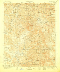
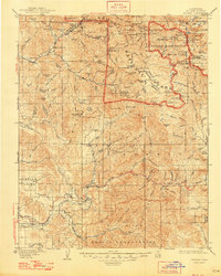
1909 Map of Kaweah
USGS Topo · Published 1914About this map
Sequoia National Park dominates the northern reaches of this Sierra Nevada landscape, preserved here just over a decade after its establishment. The terrain is defined by the complex drainage systems of the Kaweah River and Tule River, where steep ridges like Paradise Ridge and Blue Ridge separate high alpine peaks from the developing valleys below. Evidence of early mountain industry is visible at Atwells Mill and Dillon Mill, while the specialized nature of the high country is marked by scattered Rangers Cabins and the remote outpost at Mineral King.
Find a feature on this map
147 named features on this map. Tap any name to fly to it.
Don’t see what you’re looking for? This feature index may not catch every label — zoom into the map to look around manually.
Map Details
Editions of this 1909 Kaweah Map
7 editions found

Other maps of this area

1903 · Tehipite
USGS Topo · 1:125,000

1904 · Kaweah
USGS Topo · 1:125,000

1905 · Tehipite
USGS Topo · 1:125,000

1905 · Olancha
USGS Topo · 1:125,000

1905 · Fairview
USGS Topo · 1:24,000

1906 · Kernville
USGS Topo · 1:125,000

1907 · Olancha
USGS Topo · 1:125,000

1907 · Mt. Whitney
USGS Topo · 1:125,000

1908 · Kernville
USGS Topo · 1:125,000

1909 · Kaweah
USGS Topo · 1:125,000