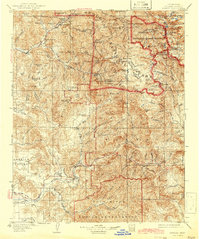
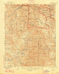
1909 Map of Kaweah
USGS Topo · Published 1942About this map
The Tule River Indian Reservation and the southern reaches of Sequoia National Park define this landscape at the western edge of the Sierra Nevada. The convergence of the North Fork and South Fork at Three Rivers illustrates the historical importance of the Kaweah watershed for early Tulare County settlements. To the south, the Tule River system anchors communities like Springville and Success, which served as vital gateways for the region's logging and ranching activities.
Find a feature on this map
146 named features on this map. Tap any name to fly to it.
Don’t see what you’re looking for? This feature index may not catch every label — zoom into the map to look around manually.
Map Details
Editions of this 1909 Kaweah Map
7 editions found

Other maps of this area

1903 · Tehipite
USGS Topo · 1:125,000

1904 · Kaweah
USGS Topo · 1:125,000

1905 · Tehipite
USGS Topo · 1:125,000

1905 · Olancha
USGS Topo · 1:125,000

1905 · Fairview
USGS Topo · 1:24,000

1906 · Kernville
USGS Topo · 1:125,000

1907 · Olancha
USGS Topo · 1:125,000

1907 · Mt. Whitney
USGS Topo · 1:125,000

1908 · Kernville
USGS Topo · 1:125,000

1909 · Kaweah
USGS Topo · 1:125,000