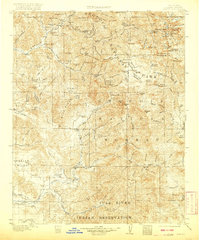
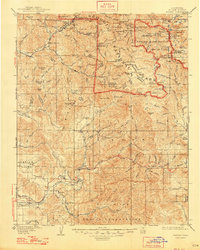
1909 Map of Kaweah
USGS Topo · Published 1921About this map
Sequoia National Park dominates the high-altitude landscape of this 1909 survey, revealing the rugged topography of the High Sierra before modern infrastructure reached deep into the backcountry. The map traces the four main branches of the Middle Fork Kaweah River and its sister forks as they descend from granite peaks like Sawtooth Peak and Florence Peak. To the east, the historic mining and resort settlement of Mineral King sits tucked between the Needham Mt and high glacial basins, while the lower elevations to the west show the early agricultural development around Springville and Success.
Find a feature on this map
107 named features on this map. Tap any name to fly to it.
Don’t see what you’re looking for? This feature index may not catch every label — zoom into the map to look around manually.
Map Details
Editions of this 1909 Kaweah Map
7 editions found

Other maps of this area

1903 · Tehipite
USGS Topo · 1:125,000

1904 · Kaweah
USGS Topo · 1:125,000

1905 · Tehipite
USGS Topo · 1:125,000

1905 · Olancha
USGS Topo · 1:125,000

1905 · Fairview
USGS Topo · 1:24,000

1906 · Kernville
USGS Topo · 1:125,000

1907 · Olancha
USGS Topo · 1:125,000

1907 · Mt. Whitney
USGS Topo · 1:125,000

1908 · Kernville
USGS Topo · 1:125,000

1909 · Kaweah
USGS Topo · 1:125,000