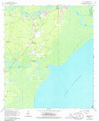
1963 Map of Killian
USGS Topo · Published 1980About this map
The Tickfaw River and Amite River converge toward the northern reaches of Lake Maurepas in this detailed 1963 survey of southern Livingston Parish. The settlement of Killian serves as a local focal point, characterized by several family-named landmarks such as McKinney Cem and Schroeder Cem, alongside community anchors like Bethlehem Ch and Huff Chapel. To the west, the landscape transitions into the low-lying terrain of Bull Run Swamp and Church Branch, while Bear Island sits amidst the wetlands to the south.
Find a feature on this map
20 named features on this map. Tap any name to fly to it.
Don’t see what you’re looking for? This feature index may not catch every label — zoom into the map to look around manually.
Map Details
Editions of this 1963 Killian Map
4 editions found
Other maps of this area

1892 · Mount Airy
USGS Topo · 1:62,500

1892 · Bonnet Carre
USGS Topo · 1:62,500

1934 · Springfield
USGS Topo · 1:62,500

1935 · Ponchatoula
USGS Topo · 1:62,500

1936 · Ruddock
USGS Topo · 1:31,680

1936 · Bonnet Carre
USGS Topo · 1:62,500

1939 · Ponchatoula
USGS Topo · 1:62,500

1939 · Springfield
USGS Topo · 1:62,500

1946 · North of Garyville
USGS Topo · 1:31,680

1946 · Petite Amite River
USGS Topo · 1:31,680