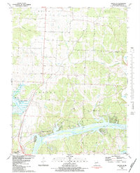
1983 Map of Lincoln SE
USGS Topo · Published 1983About this map
Warsaw anchors the southwestern edge of this survey where the Osage River transitions between two major water management systems. The landscape is defined by the complex interface of the Harry S Truman Reservoir and Lake of the Ozarks, showcasing the managed waterways of the early 1980s. Local transit and community life are marked by an Old Grade road and several rural congregations such as Mt Pleasant Ch and the Victory in God Chapel. Significant genealogy and burial sites are scattered across the terrain, including Bird Cem, Drake Cem, and Feaster Cem. The map includes a look at the Sterett Creek Public Use Area, emphasizing the importance of recreation and public access along these Missouri shorelines during this era.
Find a feature on this map
37 named features on this map. Tap any name to fly to it.
Don’t see what you’re looking for? This feature index may not catch every label — zoom into the map to look around manually.
Map Details
Editions of this 1983 Lincoln SE Map
This is the sole edition of this map. No revisions or reprints were ever made.
Other maps of this area

1887 · Warsaw
USGS Topo · 1:125,000

1894 · Warsaw
USGS Topo · 1:125,000

1935 · Edwards
USGS Topo · 1:24,000

1935 · Dell
USGS Topo · 1:24,000

1936 · Shawnee Bend
USGS Topo · 1:24,000

1936 · Lakeview Heights
USGS Topo · 1:24,000

1936 · Schuyler
USGS Topo · 1:24,000

1945 · Fristoe
USGS Topo · 1:62,500

1947 · Jefferson City
USGS Topo · 1:250,000

1954 · Jefferson City
USGS Topo · 1:250,000