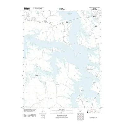
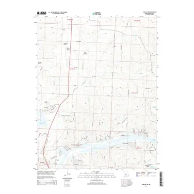
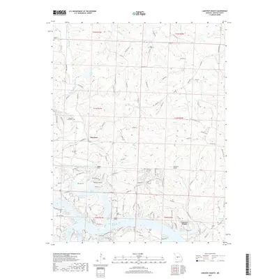
1936 Map of Lakeview Heights
USGS Topo · Published 1955About this map
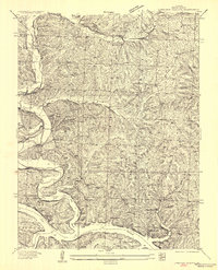
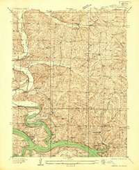
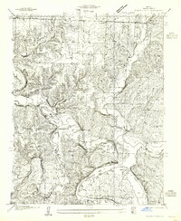
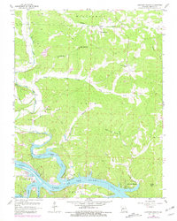
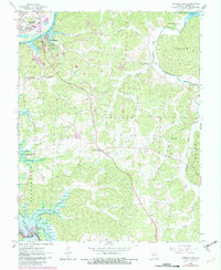
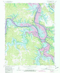
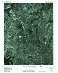
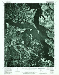
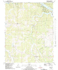
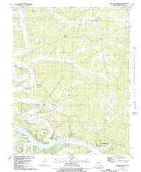
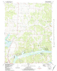
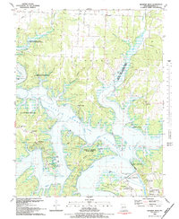
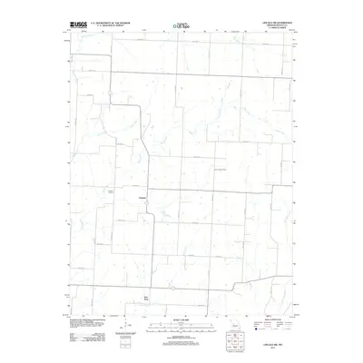
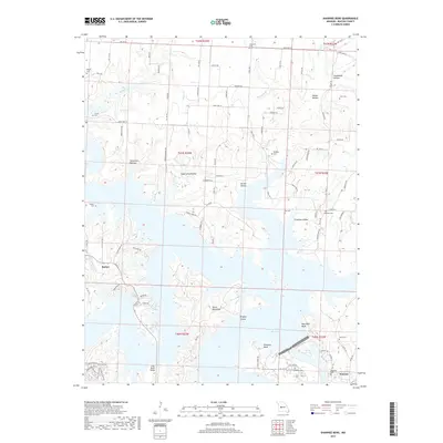
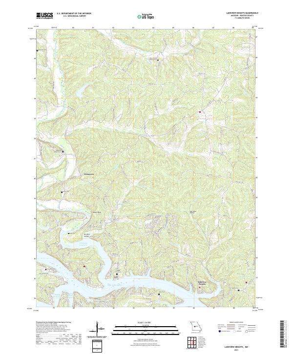
The Lake of the Ozarks dominates the southern landscape of this mid-1930s survey, showing the intricate shoreline and flooded valleys shortly after the Bagnell Dam completion. The terrain is characterized by a dense network of schools that served the rural communities of Benton County, including Litten School, Ross School, and Walnut Valley School. Religious life is anchored by Mount Hulda Ch and Kessler Church, which stand atop the high ridges overlooking the winding tributaries. The map captures the early development of Lakeview Estates near the water's edge, contrasting with the traditional farmsteads and timbered draws of Ross Creek and Cole Camp Creek. This survey reveals the transition of the region from a purely agricultural and timbering economy to one shaped by the massive new reservoir, particularly evident in named inlets like Anglers Dream Arm.
Find a feature on this map
27 named features on this map. Tap any name to fly to it.
Don’t see what you’re looking for? This feature index may not catch every label — zoom into the map to look around manually.
Map Details
Editions of this 1936 Lakeview Heights Map
2 editions found
Historical Maps of Lakeview Heights Through Time
53 maps found

1935 Dell
Benton County, MO

1935 Edwards
Benton County, MO
1936 Lakeview Heights
Benton County, MO
1936 Schuyler
Benton County, MO

1936 Shawnee Bend
Benton County, MO
1945 Fristoe
Benton County, MO
1955 Shawnee Bend
Benton County, MO
1957 Edwards
Benton County, MO
1957 Schuyler
Benton County, MO
1959 Edwards
Benton County, MO
1959 Lakeview Heights
Benton County, MO
1959 Lincoln SE
Benton County, MO
1959 Shawnee Bend
Benton County, MO
1961 Lincoln NW
Benton County, MO
1964 Warsaw East
Benton County, MO
1965 Warsaw West
Benton County, MO
1980 Lincoln SE
Benton County, MO
1980 Shawnee Bend
Benton County, MO
1980 Warsaw East
Benton County, MO
1980 Warsaw West
Benton County, MO
1983 Edwards
Benton County, MO

1983 Harry S Truman Reservoir
Benton County, MO
1983 Lakeview Heights
Benton County, MO
1983 Lincoln SE
Benton County, MO
1983 Shawnee Bend
Benton County, MO
2011 Edwards
Benton County, MO
2011 Lakeview Heights
Benton County, MO
2011 Lincoln NW
Benton County, MO
2011 Lincoln SE
Benton County, MO
2011 Shawnee Bend
Benton County, MO
2011 Warsaw East
Benton County, MO
2011 Warsaw West
Benton County, MO
2014 Edwards
Benton County, MO
2014 Lakeview Heights
Benton County, MO
2014 Lincoln NW
Benton County, MO
2014 Lincoln SE
Benton County, MO
2014 Shawnee Bend
Benton County, MO
2015 Warsaw East
Benton County, MO
2015 Warsaw West
Benton County, MO
2017 Edwards
Benton County, MO
2017 Lakeview Heights
Benton County, MO
2017 Lincoln NW
Benton County, MO
2017 Lincoln SE
Benton County, MO
2017 Shawnee Bend
Benton County, MO
2017 Warsaw East
Benton County, MO
2017 Warsaw West
Benton County, MO
2021 Edwards
Benton County, MO
2021 Lakeview Heights
Benton County, MO
2021 Lincoln NW
Benton County, MO
2021 Lincoln SE
Benton County, MO
2021 Shawnee Bend
Benton County, MO
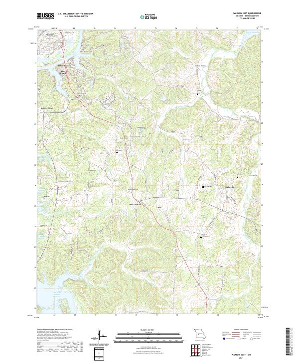
2021 Warsaw East
Benton County, MO
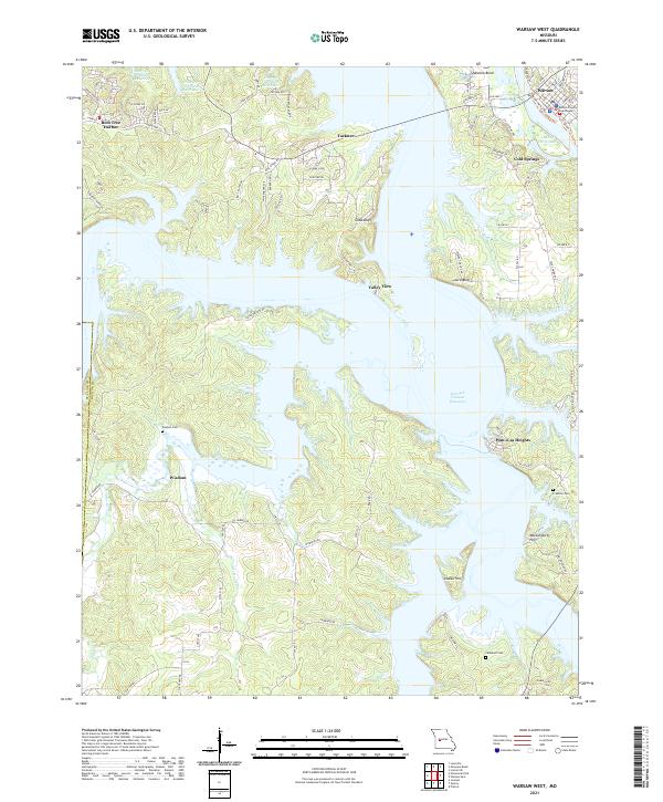
2021 Warsaw West
Benton County, MO