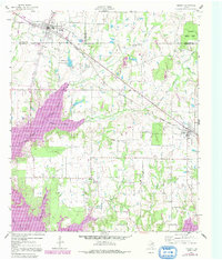
1960 Map of Mabank
USGS Topo · Published 1991About this map
Mabank sits at the intersection of the Southern Pacific railroad and regional roadways, serving as a hub near the three-way border of Kaufman, Van Zandt, and Henderson counties. The landscape shows a distinct shift in land use following the development of the Cedar Creek Reservoir, which dominates the western and southern reaches of the sheet. The expansion of the reservoir shoreline is visible in the emergence of waterfront communities like Enchanted Oaks, contrasting with the more established inland agricultural patterns around Pauline and Eustace.
Find a feature on this map
29 named features on this map. Tap any name to fly to it.
Don’t see what you’re looking for? This feature index may not catch every label — zoom into the map to look around manually.
Map Details
Editions of this 1960 Mabank Map
5 editions found

Other maps of this area

1920 · Kemp
USGS Topo · 1:62,500

1948 · Martins Mill
USGS Topo · 1:62,500

1949 · Martins Mill
USGS Topo · 1:62,500

1949 · Athens
USGS Topo · 1:62,500

1950 · Athens
USGS Topo · 1:62,500

1954 · Dallas
USGS Topo · 1:250,000

1956 · Tyler
USGS Topo · 1:250,000

1957 · Kemp
USGS Topo · 1:62,500

1958 · Dallas
USGS Topo · 1:250,000

1960 · Tool
USGS Topo · 1:24,000