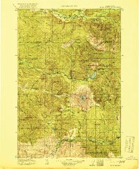
1919 Map of Mt St Helens
USGS Topo · Published 1919About this map
Mt St Helens stands as the central landmark of this 1919 survey, decades before its modern eruptive history altered the surrounding landscape. The area is dominated by the Columbia National Forest, where the headwaters of the Toutle River, Lewis River, and Green River carve through high volcanic peaks. Early industrial activity is evidenced by the Polar Star Mine and Sweden Mine tucked into the ridges near Goat Mountain, while small settlements like Kosmos and Nesika represent the sparse human footprint in the northern river valleys.
Find a feature on this map
65 named features on this map. Tap any name to fly to it.
Don’t see what you’re looking for? This feature index may not catch every label — zoom into the map to look around manually.
Map Details
Editions of this 1919 Mt St Helens Map
4 editions found
Other maps of this area

1916 · Chehalis
USGS Topo · 1:125,000

1919 · Mount St Helens
USGS Topo · 1:125,000

1924 · Mt Rainier
USGS Topo · 1:96,000

1926 · Steamboat Mtn
USGS Topo · 1:125,000

1926 · Hood River
USGS Topo · 1:125,000

1928 · Mt Rainier
USGS Topo · 1:125,000

1929 · Hood River
USGS Topo · 1:125,000

1931 · Steamboat Mtn
USGS Topo · 1:125,000

1937 · Eatonville
USGS Topo · 1:125,000

1940 · Lookout Mtn
USGS Topo · 1:62,500