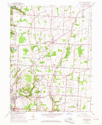
1966 Map of New Albany
USGS Topo · Published 1968About this map
New Albany stands at the center of this mid-1960s survey, a period when the agricultural character of northeastern Franklin County was increasingly intersected by infrastructure. To the northwest, the edge of Hoover Reservoir and the established Blendon Woods Metropolitan Park anchor the landscape, while the southern portion of the map shows the expansion of Gahanna near Rocky Fork. The era is defined by a dense network of country roads such as Morse Road and Central College Road, and the presence of utility corridors like the major Pipeline and several compressor stations.
Find a feature on this map
44 named features on this map. Tap any name to fly to it.
Don’t see what you’re looking for? This feature index may not catch every label — zoom into the map to look around manually.
Map Details
Editions of this 1966 New Albany Map
3 editions found
Other maps of this area

1902 · Westerville
USGS Topo · 1:62,500

1904 · Westerville
USGS Topo · 1:62,500

1907 · Thurston
USGS Topo · 1:62,500

1908 · Granville
USGS Topo · 1:62,500

1909 · Thurston
USGS Topo · 1:62,500

1910 · Granville
USGS Topo · 1:62,500

1925 · East Columbus
USGS Topo · 1:62,500

1943 · East Columbus
USGS Topo · 1:62,500

1947 · Columbus
USGS Topo · 1:250,000

1950 · Marion
USGS Topo · 1:250,000