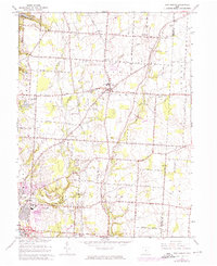
1966 Map of New Albany
USGS Topo · Published 1974About this map
New Albany and the eastern fringes of Gahanna define this central Ohio landscape during a period of transition in the mid-1960s. The map illustrates a rural-to-suburban shift, with established agriculture in Plain and Jefferson townships meeting the expansion of housing and modern utilities. To the northwest, the Hoover Reservoir provides a major geographic boundary, while the Blendon Woods Metropolitan Park preserves a significant green space along the western edge.
Find a feature on this map
36 named features on this map. Tap any name to fly to it.
Don’t see what you’re looking for? This feature index may not catch every label — zoom into the map to look around manually.
Map Details
Editions of this 1966 New Albany Map
3 editions found
Other maps of this area

1902 · Westerville
USGS Topo · 1:62,500

1904 · Westerville
USGS Topo · 1:62,500

1907 · Thurston
USGS Topo · 1:62,500

1908 · Granville
USGS Topo · 1:62,500

1909 · Thurston
USGS Topo · 1:62,500

1910 · Granville
USGS Topo · 1:62,500

1925 · East Columbus
USGS Topo · 1:62,500

1943 · East Columbus
USGS Topo · 1:62,500

1947 · Columbus
USGS Topo · 1:250,000

1950 · Marion
USGS Topo · 1:250,000