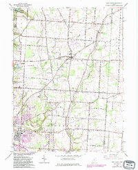
1966 Map of New Albany
USGS Topo · Published 1983About this map
New Albany stands at the center of this mid-century landscape, positioned before the extensive suburban sprawl of later decades reached this part of Franklin and Licking Counties. The village is surrounded by a network of rural routes such as Central College Road and Thompson Road, which connect localized community hubs like Havens Corners and the growing edges of Gahanna. This 1966 revision reveals an era of transition, where established family landmarks like Burnside Cem and Maplewood Cem sit alongside modern utility expansions including numerous pipelines and several substations.
Find a feature on this map
45 named features on this map. Tap any name to fly to it.
Don’t see what you’re looking for? This feature index may not catch every label — zoom into the map to look around manually.
Map Details
Editions of this 1966 New Albany Map
3 editions found
Other maps of this area

1902 · Westerville
USGS Topo · 1:62,500

1904 · Westerville
USGS Topo · 1:62,500

1907 · Thurston
USGS Topo · 1:62,500

1908 · Granville
USGS Topo · 1:62,500

1909 · Thurston
USGS Topo · 1:62,500

1910 · Granville
USGS Topo · 1:62,500

1925 · East Columbus
USGS Topo · 1:62,500

1943 · East Columbus
USGS Topo · 1:62,500

1947 · Columbus
USGS Topo · 1:250,000

1950 · Marion
USGS Topo · 1:250,000