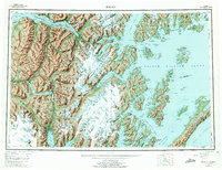
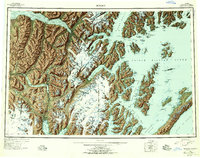
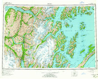
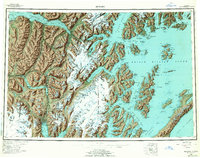
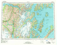
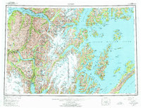
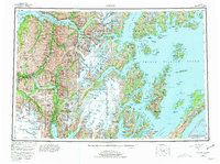
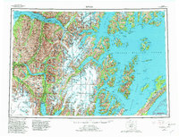
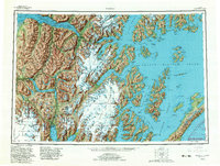
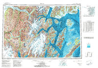
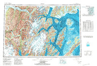
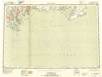
1953 Map of Seward
USGS Topo · Published 1975About this map
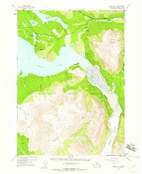
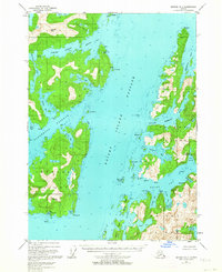
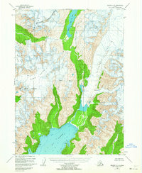
Seward sits at the head of Resurrection Bay, serving as a vital terminus where the Alaska Railroad and Seward Highway meet the maritime routes of the Kenai Peninsula. This mid-century survey illustrates the era's infrastructure before major modern shifts, showing the coastal settlements of Whittier, Chenega, and Latouche established among the deep fjords of Prince William Sound. The map reveals a landscape dominated by massive glacial systems, including the Harding Icefield and Sargent Icefield, which feed numerous named glaciers like the Nellie Juan Glacier and Chenega Glacier. Inland, the proximity of the Portage site to Turnagain Arm highlights the historic transit corridor between the sound and the Cook Inlet waters. Smaller communities like Sunrise, Hope, and Lawing are also documented, reflecting the scattered settlement patterns of the Chugach National Forest during the 1950s.
Find a feature on this map
147 named features on this map. Tap any name to fly to it.
Don’t see what you’re looking for? This feature index may not catch every label — zoom into the map to look around manually.
Map Details
Editions of this 1953 Seward Map
12 editions found

1956 edition
28 x 22.7 inches
1956 edition
28.5 x 22.5 inches
1963 edition
28.2 x 22.7 inches
1963 edition
28.2 x 22.2 inches
1969 edition
29 x 22.7 inches
1975 edition
29 x 22.3 inches
1975 edition
28.8 x 22.1 inches
1981 edition
30.4 x 22.7 inches
1982 edition
30.4 x 23.2 inches
1982 edition
30.4 x 23 inches
1985 edition
33.6 x 23.2 inches
1987 edition
33.9 x 23.3 inches
Other maps of this area

1944 · Kenai
USGS Topo · 1:250,000
1946 · Blying Sound
USGS Topo · 1:250,000

1948 · Cordova
USGS Topo · 1:250,000

1948 · Middleton Island
USGS Topo · 1:250,000

1949 · Tyonek
USGS Topo · 1:250,000

1950 · Kenai
USGS Topo · 1:250,000

1950 · Middleton Island
USGS Topo · 1:250,000
1950 · Kenai B-1
USGS Topo · 1:63,360
1950 · Seward B-3
USGS Topo · 1:63,360
1950 · Seward A-6
USGS Topo · 1:63,360