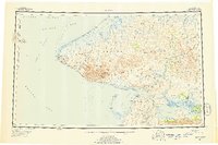
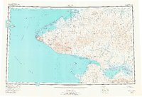
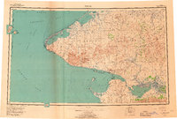
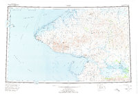
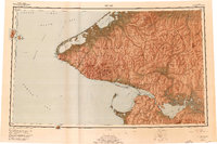
1950 Map of Teller
USGS Topo · Published 1956About this map
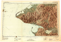
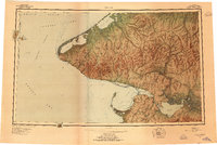
Cape Prince of Wales anchors this mid-century view of the westernmost edge of the Seward Peninsula, where the North American continent meets the Bering Strait. This survey highlights the strategic and logistical layout of the region during the early Cold War era, including the international boundary defined by the U.S.-Russia Convention of 1867 passing between Big Diomede Island and Little Diomede Island. Inland, the landscape is defined by the York Mountains and Kiguaiak Mountains, while the coast is dotted with vital outposts like Tin City and Wales. Remote travel is documented through a network of Winter Trails and Tractor Trails connecting the interior Agiapuk River basin to maritime hubs such as Teller and Grantley Harbor. Features like the Nuluk Shelter Cabin and various landing areas illustrate the rugged requirements for survival and movement in this arctic maritime environment.
Find a feature on this map
47 named features on this map. Tap any name to fly to it.
Don’t see what you’re looking for? This feature index may not catch every label — zoom into the map to look around manually.
Map Details
Editions of this 1950 Teller Map
8 editions found
Historical Maps of Brevig Mission Through Time
4 maps found