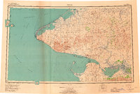
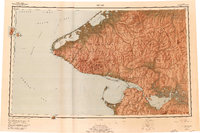
1950 Map of Teller
USGS Topo · Published 1968About this map
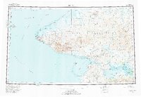
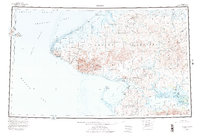
The westernmost edge of the Seward Peninsula meets the Bering Strait in this mid-century topographic survey, where the international boundary between the USSR and United States runs between Big Diomede Island and Little Diomede Island. The landscape is dominated by the steep rises of Cape Mountain and the York Mountains, separated from the coastal lagoons by a network of seasonal tractor trails and a winter trail system. Settlements are concentrated along the coastline, including the communities of Wales, Teller, and Brevig Mission. To the east, the geography shifts toward the inland waters of Grantley Harbor and the Imuruk Basin, fed by the Kuzitrin River. This map reveals the maritime reliance of the region, from the Cape Prince of Wales to the isolated King Island in the Bering Sea, during an era when ground transport relied heavily on specialized arctic routes.
Find a feature on this map
83 named features on this map. Tap any name to fly to it.
Don’t see what you’re looking for? This feature index may not catch every label — zoom into the map to look around manually.
Map Details
Editions of this 1950 Teller Map
8 editions found
Other maps of this area

1950 · Bendeleben A-6
USGS Topo · 1:63,360

1950 · Bendeleben B-6
USGS Topo · 1:63,360

1950 · Bendeleben C-6
USGS Topo · 1:63,360

1950 · Nome D-2
USGS Topo · 1:63,360

1950 · Nome D-4
USGS Topo · 1:63,360

1950 · Bendeleben D-6
USGS Topo · 1:63,360

1950 · Nome
USGS Topo · 1:250,000

1950 · Teller
USGS Topo · 1:250,000

1950 · Bendeleben
USGS Topo · 1:250,000

1950 · Teller A-2
USGS Topo · 1:63,360