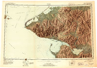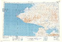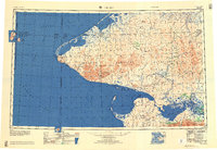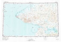
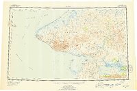
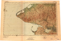
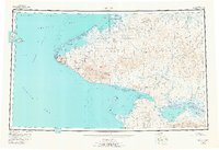
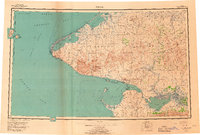
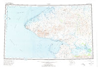
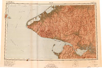
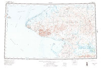
1950 Map of Teller
USGS Topo · Published 1978About this map
The Seward Peninsula meets the international boundary between the USSR and United States in this mid-century survey of Alaska's westernmost edge. Centered on the critical maritime geography of Port Clarence and Grantley Harbor, the map documents the indigenous and settler footprints of the era, including Wales, Brevig Mission, and Marys Igloo. To the west, the maritime frontier is defined by Big Diomede Island and Little Diomede Island sitting within the Bering Strait, while the mainland interior reveals a network of winter trails and tractor routes crossing the Continental Divide.
Find a feature on this map
74 named features on this map. Tap any name to fly to it.
Don’t see what you’re looking for? This feature index may not catch every label — zoom into the map to look around manually.
Map Details
Editions of this 1950 Teller Map
8 editions found
Historical Maps of Brevig Mission Through Time
4 maps found