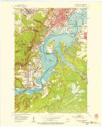
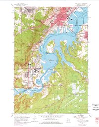
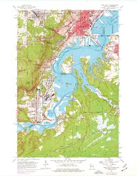
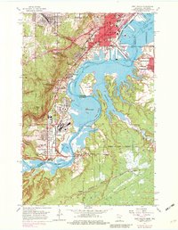
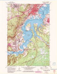
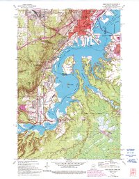
1954 Map of West Duluth
USGS Topo · Published 1955This historical map portrays the area of West Duluth in 1954, primarily covering Douglas County as well as portions of Douglas County and Minnesota. Featuring a scale of 1:24000, this map provides a highly detailed snapshot of the terrain, roads, buildings, counties, and historical landmarks in the West Duluth region at the time. Published in 1955, it is one of 9 known editions of this map due to revisions or reprints.
Find a feature on this map
64 named features on this map. Tap any name to fly to it.
Don’t see what you’re looking for? This feature index may not catch every label — zoom into the map to look around manually.
Map Details
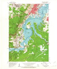
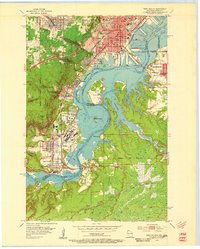
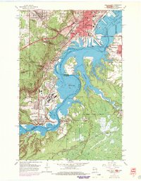
Editions of this 1954 West Duluth Map
9 editions found
Historical Maps of Midway Township Through Time
32 maps found

1945 Highland
Douglas County, WI

1949 Highland
Douglas County, WI

1949 Patzau
Douglas County, WI

1954 Amnicon Lake
Douglas County, WI

1954 Borea
Douglas County, WI

1954 Cloverland
Douglas County, WI

1954 Foxboro
Douglas County, WI

1954 Lyman Lake
Douglas County, WI

1954 Parkland
Douglas County, WI

1954 Patzau
Douglas County, WI

1954 Poplar NE
Douglas County, WI

1954 South Range
Douglas County, WI

1954 Sunnyside
Douglas County, WI

1955 Patzau
Douglas County, WI

1961 Cloverland
Douglas County, WI

1961 Ellison Lake
Douglas County, WI

1961 Lyman Lake
Douglas County, WI

1971 Chittamo
Douglas County, WI

1971 Chittamo NE
Douglas County, WI

1981 Bennett
Douglas County, WI

1982 Buckety Creek
Douglas County, WI

1982 Minong Flowage
Douglas County, WI

1983 Black Lake
Douglas County, WI

1983 Dairyland
Douglas County, WI

1983 Empire Swamp
Douglas County, WI

1983 Moose Junction
Douglas County, WI

1983 Scovils Lake
Douglas County, WI

1984 Ellison Lake
Douglas County, WI

1984 Island Lake
Douglas County, WI

1984 Lake Minnesuing
Douglas County, WI

1984 Metzger Lake
Douglas County, WI

1984 Oulu
Douglas County, WI