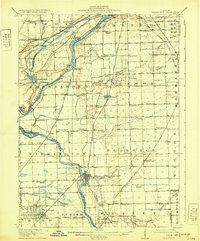
1918 Map of Wilmington
USGS Topo · Published 1931About this map
The confluence of the Des Plaines River and the Kankakee River anchors this landscape in the years following the turn of the century. This river system, along with the Illinois and Michigan Canal, served as the vital corridor for transport and industry in the late nineteenth and early twentieth centuries. The sheet reveals a dense network of early schools, including the Red Brick School, Schweizer School, and the Troutman Grove School, suggesting a well-established rural social structure before the consolidation of the modern era. Small rail-dependent settlements like Elwood, Symerton, and Ritchey dot the prairie, while Braidwood reflects the coal-mining heritage of the region. The map also traces the Chicago and Alton and other major railroads that moved both commuters and coal through the region, connecting these small farm towns to the growing urban centers nearby.
Find a feature on this map
97 named features on this map. Tap any name to fly to it.
Don’t see what you’re looking for? This feature index may not catch every label — zoom into the map to look around manually.
Map Details
Editions of this 1918 Wilmington Map
5 editions found
Other maps of this area

1890 · Des Plaines
USGS Topo · 1:62,500

1892 · Morris
USGS Topo · 1:62,500

1892 · Joliet
USGS Topo · 1:62,500

1892 · Wilmington
USGS Topo · 1:62,500

1894 · Des Plaines
USGS Topo · 1:62,500

1900 · Des Plaines
USGS Topo · 1:62,500

1901 · Des Plaines
USGS Topo · 1:62,500

1918 · Wilmington
USGS Topo · 1:62,500

1918 · Morris
USGS Topo · 1:62,500

1922 · Kankakee
USGS Topo · 1:62,500