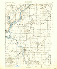
1918 Map of Wilmington
USGS Topo · Published 1937About this map
The Des Plaines River and Kankakee River converge in this region of northern Illinois, shaping a landscape defined by waterway transport and early rail networks. The presence of the Illinois and Michigan Canal running through Channahon highlights the era's reliance on artificial waterways, while the dense network of railroads—including the Chicago and Alton Railroad and the Atchison Topeka and Santa Fe Railroad—illustrates the industrial transition.
Find a feature on this map
97 named features on this map. Tap any name to fly to it.
Don’t see what you’re looking for? This feature index may not catch every label — zoom into the map to look around manually.
Map Details
Editions of this 1918 Wilmington Map
5 editions found
Other maps of this area

1890 · Des Plaines
USGS Topo · 1:62,500

1892 · Morris
USGS Topo · 1:62,500

1892 · Joliet
USGS Topo · 1:62,500

1892 · Wilmington
USGS Topo · 1:62,500

1894 · Des Plaines
USGS Topo · 1:62,500

1900 · Des Plaines
USGS Topo · 1:62,500

1901 · Des Plaines
USGS Topo · 1:62,500

1918 · Wilmington
USGS Topo · 1:62,500

1918 · Morris
USGS Topo · 1:62,500

1922 · Kankakee
USGS Topo · 1:62,500