1920s Maps of the United States
Explore 3,190 historic maps of the United States from the 1920s. These maps offer a rare glimpse into what life looked like during the 1920s — showing old roads, neighborhoods, homes, and landmarks that have changed or disappeared over time.
Whether you're researching your family's past, planning a metal detecting trip, or studying how the United States's landscape evolved across the 1920s, these high-resolution maps are a powerful tool for exploring the history of this region.
- Focus on a specific era: All maps on this page are from the 1920s, giving you a focused view of this time period.
- See what’s changed: Compare century-old streets, trails, and buildings to today's modern landscape using overlays and satellite layers.
- Research with precision: Use these maps for genealogy, historical research, land use analysis, or educational projects.
- View, download, or print: Maps are fully viewable online in high resolution, and can be downloaded or printed for your own records.
Start exploring the United States's history through authentic maps from the 1920s. This is your window into the past.
United States maps
- 1920 Map of Siltcoos Lake
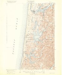 1920 Siltcoos Lake1920 Print · USGSThe Oregon coast at the end of the Great War reveals a landscape of river inlets and timber-driven rail lines. You can trace the Southern Pacific tracks past rural schoolhouses like Idlewild School and old stops at Cushman P.O. or Acme.3 unique versions available
 - 1920 Map of Flathead Lake
 1920 Flathead Lake1920 Print · USGSWestern Montana at the dawn of the twenties reveals a landscape being transformed by irrigation and rail. Genealogists can trace family roots in early settlements like Polson, Ronan, and Dayton, or locate landmarks such as Wild Horse I. and the Pablo Reservoir.
 - 1920 Map of Longfellow
 1920 Longfellow1920 Print · USGSRailroad outposts and high desert terrain define this West Texas survey from the early twentieth century. Genealogists and historians can trace the Southern Pacific line through stops like Purrington, Tesnus, and Rosenfeld, along with landmarks like the Pittsburg Boring.
 - 1920 Map of Elk Garden
 1920 Elk Garden1920 Print · USGSThe West Virginia highlands and the Potomac River border are captured here just after the Great War, during the peak of the rail-and-coal era. Genealogists can locate numerous rural landmarks including Elk Garden, Rehoboth Church, and the Nethken School.
 - 1920 Map of Eutawville
 1920 Eutawville1920 Print · USGSCoastal South Carolina comes to life in the years following the Great War, showing a landscape defined by the Santee River and Four Hole Swamp. Genealogists can trace family roots through numerous local landmarks like Black Creek Church, Unity School, and the settlement at Holly Hill.
 - 1920 Map of Hardeeville
 1920 Hardeeville1920 Print · USGSThe Savannah River floodplain in the years following the Great War reveals a world of river landings and emerging rail towns. Genealogists and historians can trace the transition from water to rail through features like Becks Ferry, Hardeeville, and the Indian Mound.
 - 1920 Map of Lincoln Mountain
 1920 Lincoln Mountain1920 Print · USGSThe Green Mountain summits and surrounding hill towns of central Vermont are captured here just after the Great War. Genealogists and local historians can trace old homesteads, early district schools like Gore School, and mountain landmarks such as Battell Lodge.
 - 1920 Map of Okatie
 1920 Okatie1920 Print · USGSThe South Carolina Lowcountry is captured here in the years following the Great War, showing a landscape defined by tidal rivers and strategic rail lines. Trace family roots and historical sites through Honey Hill Civil War Entrenchment, Grahamville, and Cherry Point Landing.
 - 1920 Map of Chicora
 1920 Chicora1920 Print · USGSBerkeley County was a landscape of river landings and bay-country settlements just after the turn of the century. Genealogists can locate family-named landmarks like Prioleau and numerous community anchors like St Luke Church, Eadytown, and the Francis Marion Tomb.
 - 1920 Map of Holland
 1920 Holland1920 Print · USGSCoastal plain life at the end of the Great War centers on the river-and-rail hubs of Franklin and Holland. Genealogists can trace family footprints across dozens of country schools like Holmes School and river crossings such as Joyners Bridge and Manning Ferry.2 unique versions available
 - 1920 Map of Bowman
 1920 Bowman1920 Print · USGSIn the early twentieth century, this part of the South Carolina Lowcountry was a landscape of remote settlements and small-scale industry. Genealogists can trace family footprints through numerous community landmarks like Boghette Cem, Livingston Mill, and the Shady Grove Camp Ground.
 - 1920 Map of Ivor
 1920 Ivor1920 Print · USGSCoastal plain life in Southampton and Isle of Wight counties is captured here just after the Great War, when rail and river travel still shaped the landscape. Genealogists can locate family landmarks like Tucker Swamp Church, Crumplers School, and Millfield Millpond.2 unique versions available
 - 1920 Map of Seabrook
 1920 Seabrook1920 Print · USGSCoastal Harris County near the end of the Great War was a network of bayous and new rail lines. Genealogists and local historians can locate early landmarks like the Old Middle Bayou School, the Clear Lake Inn, and the transit hub at Webster.
 - 1920 Map of Ellenton
 1920 Ellenton1920 Print · USGSThe Savannah River valley in the years following the Great War reveals a landscape of river landings and small rail towns. Genealogists can trace family footprints through rural sites like Ellenton, St Marys Church, and the Burton and Myers Store.
 - 1920 Map of Seven Devils Mining District
 1920 Seven Devils Mining District1920 Print · USGSThe Seven Devils Mining District was a bustling area of extraction and high-country ranching in the 1920s. Genealogists and historians can trace old homesteads and mining hubs like Cuprum, Landore, and Towsley Cabin, or locate the Landore School and Iron Springs Ranger Sta.
 - 1920 Map of Waco
 1920 Waco1920 Print · USGSWaco and its surrounding rail corridors are captured in high detail shortly after the first World War. Researchers can trace the legacy of Rifle Range Camp MacArthur and vanished river crossings like Greenwoods Ferry and Old Towash.
 - 1920 Map of Philadelphia
 1920 Philadelphia1920 Print · USGSPhiladelphia and its New Jersey neighbors are captured here just after the Great War, showing a landscape defined by massive riverfront industry and a dense rail network. Genealogists can trace family footprints through numerous small communities and stations like Blenheim Station, Woodbury Heights, and the grounds of the Alms House.
 - 1920 Map of Wicomico
 1920 Wicomico1920 Print · USGSThe Potomac and Wicomico riverfronts appear here as they were just after the Great War, when steamboat wharves and ferries still anchored local commerce. Trace the old rail lines to Bel Alton Cox Sta or locate long-standing landmarks like Charlotte Hall and Ludlow Ferry.
 - 1920 Map of Choteau
 1920 Choteau1920 Print · USGSNorth-central Montana in the early twentieth century shows a landscape being reshaped by irrigation canals and competing rail lines. Family historians can trace early settlements like Agawam, Bole, and Gilman, or locate regional landmarks like Priest Butte and Pishkun Reservoir.
 - 1920 Map of Animas Peak
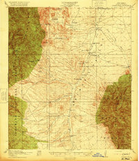 1920 Animas Peak1920 Print · USGSSouthern New Mexico ranching culture is preserved in this post-war survey of the Hidalgo County borderlands. Researchers can trace the heritage of local homesteads like the Gray Ranch, Old Isaacs Place, and the remote Maddox School.2 unique versions available
 - 1920 Map of Homeville
 1920 Homeville1920 Print · USGSCoastal plain life in Sussex and Southampton counties thrived along the rails and rivers in the early twentieth century. Researchers can trace the legacy of small communities and crossroads schools like Sebrell, Hickory Hill School, and the Union Hill Church near the Nottoway River.3 unique versions available
 - 1920 Map of Pembroke
 1920 Pembroke1920 Print · USGSGeorgia's coastal plain emerges in the years after the Great War, showing a network of rail lines and river landings. Genealogists can trace old family roots through Stevens Grove School, Beulah Church, and the settlement at Pembroke.3 unique versions available
 - 1920 Map of Statesboro
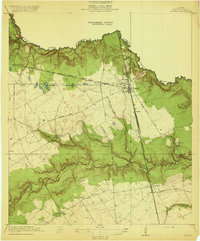
 1920 Statesboro1920 Print · USGSSoutheast Georgia was a bustling junction of regional railways just after the First World War. Researchers can trace family roots and land ownership across a network of rural schools like Smith Allen Deaf School, small settlements like Adabelle, and the prominent Central of Georgia Railway.4 unique versions available
 - 1920 Map of Hilltonia
 1920 Hilltonia1920 Print · USGSScreven County and the Savannah River valley are captured here at the end of the Great War, showing a landscape defined by ferries and rail. Genealogists can trace family footprints at Lovetts Cemetery, Bascom School, and the riverfront at Burtons Ferry.4 unique versions available
 - 1920 Map of Spring
 1920 Spring1920 Print · USGSNorthern Harris County is shown at a pivotal rail-junction moment as the Galveston Line and International and Great Northern meet at Spring. Genealogists can locate early community landmarks like the Kothman School, Bammel settlement, and Roth School along the winding Cypress Creek.2 unique versions available
Showing maps 1-25
Top regions of the United States
- California historical maps
- Texas historical maps
- Florida historical maps
- New York historical maps
- Pennsylvania historical maps
- Illinois historical maps
See more
Top cities of the United States
- New York historical maps
- Los Angeles historical maps
- Chicago historical maps
- Houston historical maps
- Phoenix historical maps
- Philadelphia historical maps
See more
Frequently asked questions
- What are the different types of historical maps available for United States?
- What is the oldest map of United States?
- Where can I purchase historical maps of United States for my home or office?
- Where can I download high-res historical maps of United States?
- Are there historical topographic maps available for United States?
- Is there historical aerial imagery available for United States?
- Where are historical maps of United States sourced from?