2000s (21st Century) Maps of the United States
Explore 273,354 historic maps of the United States from the 2000s (21st Century). These maps offer a rare glimpse into what life looked like during the 2000s — showing old roads, neighborhoods, homes, and landmarks that have changed or disappeared over time.
Whether you're researching your family's past, planning a metal detecting trip, or studying how the United States's landscape evolved across the 2000s, these high-resolution maps are a powerful tool for exploring the history of this region.
- Focus on a specific era: All maps on this page are from the 2000s, giving you a focused view of this time period.
- See what’s changed: Compare century-old streets, trails, and buildings to today's modern landscape using overlays and satellite layers.
- Research with precision: Use these maps for genealogy, historical research, land use analysis, or educational projects.
- View, download, or print: Maps are fully viewable online in high resolution, and can be downloaded or printed for your own records.
Start exploring the United States's history through authentic maps from the 2000s. This is your window into the past.
United States maps
- 2000 Map of Pagoda
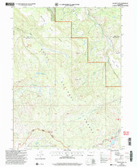
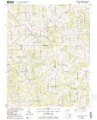
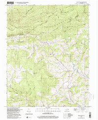
 2000 Pagoda2000 Print · USGSThe Williams Fork valley and its surrounding high-country forests are captured here at the turn of the millennium. Local researchers can trace old mining and water history through features like the Cedar Creek Mine, the Pagoda settlement, and Sullivan Reservoir.
 - 2000 Map of Pagoda Peak
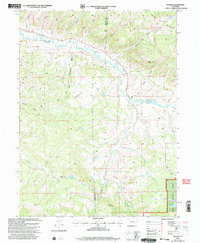
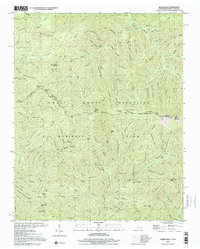
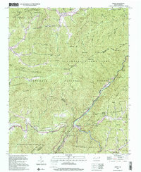
 2000 Pagoda Peak2000 Print · USGSHigh Colorado wilderness at the turn of the millennium centers on the prominent Pagoda Peak and the surrounding national forests. Local historians and hikers can trace the path of the Flat Tops Scenic Byway near Vaughan Lake and the remote reaches of Stinsby Reservoir.
 - 2000 Map of Rouses Point
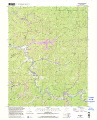
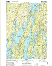
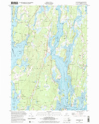
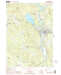
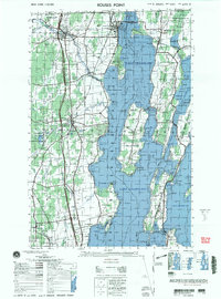 2000 Rouses Point2000 Print · USGSUpper Lake Champlain and the Canadian borderland appear here at the end of the century, showing the intricate shoreline and island communities. Genealogists and local historians can trace family sites at Sacred Heart Cemetery or visit the historic Fort Montgomery (ruins) and St Annes Shrine.
 - 2000 Map of South Creek, 2001 Print
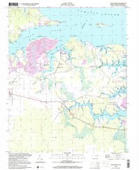 2000 South Creek2001 Print · USGSThe Pamlico River shoreline near the mouth of the South Creek reflects a long history of maritime living at the turn of the millennium. Genealogists can trace family landmarks and river landings like Alliance Ldg, Reads Chapel, and Sandy Landing.
 - 2000 Map of Camden, 2001 Print
 2000 Camden2001 Print · USGSThe Maine coast near Camden and Rockport is shown here at the start of the new millennium, balancing deep-water harbors with high granite peaks. Researchers can locate family plots at Oak Hill Cem or trace the early paths of the Spring Brook Trail and Mount Battie observatory.
 - 2000 Map of Lecontes Mills, 2001 Print
 2000 Lecontes Mills2001 Print · USGSClearfield County at the turn of the century shows a unique mix of heavy industry and rural Pennsylvania life along the West Branch Susquehanna River. Genealogists and historians can trace family roots through sites like Lecontes Mills, Shiloh Cem, and the old Township Sch.
 - 2000 Map of Jennies Butte, 2001 Print
 2000 Jennies Butte2001 Print · USGSHigh in the Cascade Range during the late twentieth century, this area shows the intersection of tribal lands and protected wilderness. Trace remote forest boundaries and natural landmarks like Jennies Butte, the historic Campbell Line, and Soda Spring.
 - 2000 Map of Thunderhead Mtn, 2001 Print
 2000 Thunderhead Mtn2001 Print · USGSThe Tennessee-North Carolina border at the start of the 2000s remains a wild corridor of high-elevation gaps and remote ridges. Hikers and historians can trace the Appalachian Trail over Thunderhead Mtn and locate landmarks like Indian Flats Falls and Big Chestnut Bald.
 - 2000 Map of Silers Bald, 2001 Print
 2000 Silers Bald2001 Print · USGSThe high divide of the Great Smoky Mountains is captured here at the turn of the millennium, showing the state line between Sevier County and Swain County. Hikers and historians can trace the Appalachian National Scenic Trail past Silers Bald, Double Spring Gap, and Mt Buckley.
 - 2000 Map of Racine, 2001 Print
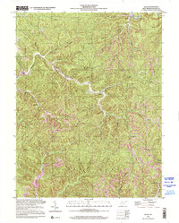
 2000 Racine2001 Print · USGSThe Coal River Valley at the opening of the millennium reveals a landscape shaped by narrow hollows, coal mining, and long-standing riverside communities. Researchers can trace family roots at Snodgrass Cemetery or explore the geography around Peytona, Nellis, and Drawdy Falls Roadside Park.
 - 2000 Map of Mouth Of Wilson, 2001 Print
 2000 Mouth Of Wilson2001 Print · USGSThe borderlands of Virginia and North Carolina are captured here at the turn of the millennium, centered on the winding New River. Researchers can trace rural lineages through numerous landmarks like Mouth of Wilson, Youngs Chapel, and Piney Creek High Sch.
 - 2000 Map of Sylva South, 2001 Print
 2000 Sylva South2001 Print · USGSJackson County at the turn of the millennium shows a fascinating mix of academic expansion and deep-rooted mountain heritage along the Tuckasegee River. Genealogists and local historians can trace the footprint of Western Carolina University alongside family landmarks like Parris Cem and the village of Webster.
 - 2000 Map of Hewitt, 2001 Print
 2000 Hewitt2001 Print · USGSThe high ridges of Graham and Swain counties are captured here at the turn of the millennium, showing a landscape of deep gaps and forest settlements. Genealogists and hikers can trace the Appalachian National Scenic Trail or locate remote sites like Rowlin Sch and Jenkins Cem.
 - 2000 Map of Trout Dale, 2001 Print
 2000 Trout Dale2001 Print · USGSGrayson County's high ridges and mountain settlements are captured here as they appeared at the turn of the millennium. Researchers can locate numerous family burial sites like Blevins Cem and Fairwood Cem or trace the path of the Appalachian National Scenic Trail.
 - 2000 Map of Bunches Bald, 2001 Print
 2000 Bunches Bald2001 Print · USGSThe high ridges of the Great Smoky Mountains meet the Cherokee Indian Reservation at the turn of the millennium. Local historians can trace the paths of the Blue Ridge Parkway past the Big Cove Mission and the Masonic Monument.
 - 2000 Map of Barthell SW, 2001 Print
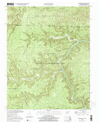 2000 Barthell SW2001 Print · USGSThe South Fork Cumberland River divides the Tennessee and Kentucky borderlands at the turn of the millennium. Researchers can find old family sites like Slaven Cem and historical rural outposts including No Business Sch and Anderson.
 - 2000 Map of Westport, 2001 Print
 2000 Westport2001 Print · USGSCoastal Lincoln County at the turn of the millennium reveals a landscape of deep tidal rivers and historic island settlements. Genealogists and local historians can trace family landmarks and rural sites like Doggett Castle, Grover Cem, and the old Westport Ch.
 - 2000 Map of Phippsburg, 2001 Print
 2000 Phippsburg2001 Print · USGSThe Kennebec River meets the Atlantic here as the twenty-first century begins, showcasing a coastline shaped by maritime history and military defense. Genealogists and historians can locate the Old Mica Mine, the Sebasco Sch, and landmark sites like the Fort Popham Lighthouse.
 - 2000 Map of Quick, 2001 Print
 2000 Quick2001 Print · USGSKanawha County’s creek-carved valleys are captured here at the turn of the millennium, showing a landscape shaped by rural industry and small-town roots. Local historians can trace the positions of the Book Mine, the Hansford Sch, and settlements like Quick and Blount.
 - 2000 Map of Winthrop, 2001 Print
 2000 Winthrop2001 Print · USGSMaine's lake country at the turn of the millennium shows a landscape defined by deep-water ponds and small lakeside villages. Genealogists can locate family burial sites like Whistler Cem and Benson Cem, or trace landmarks at Tallwood and Winthrop Center.
 - 2000 Map of Fontana Dam, 2001 Print
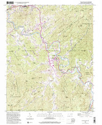
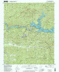 2000 Fontana Dam2001 Print · USGSThe Great Smoky Mountains and the massive Tennessee Valley Authority hydro-projects define this Graham County landscape at the start of the millennium. Researchers can trace the Appalachian Trail, locate family sites at Payne Cem, or find the Fontana Copper Mine.
 - 2000 Map of Lincolnville, 2001 Print
 2000 Lincolnville2001 Print · USGSMid-coast Maine at the turn of the millennium retains its traditional network of crossroads settlements and coastal landmarks. Genealogists can locate family burial grounds like Union Cem and trace the area's rural development through points like Slab City and Grange Corner.
 - 2000 Map of Franklin, 2001 Print
 2000 Franklin2001 Print · USGSFranklin and its neighbors thrive at the turn of the millennium where the Pemigewasset and Winnipesaukee rivers meet. Genealogists and historians can trace local landmarks like the Daniel Webster Birthplace, the old Halcyon Sta, and Webster Place.
 - 2000 Map of Goose Prairie, 2001 Print
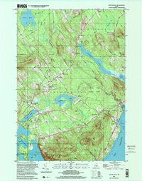
 2000 Goose Prairie2001 Print · USGSThe mountain settlement of Goose Prairie and its surrounding wilderness are captured here at the turn of the millennium. Researchers and hikers can locate specific sites like Camp Fife, Pleasant Valley Campground, and the summits of Fifes Peaks.
 - 2000 Map of Bridgton, 2001 Print
 2000 Bridgton2001 Print · USGSThe Bridgton and Harrison area at the start of the new millennium is defined by its iconic lakes and deep-rooted summer camp culture. Researchers can locate numerous family burial sites like Finnish Cem and Trafton Cem or trace the early development of Sandy Creek and North Bridgton.
Showing maps 1-25
Top regions of the United States
- California historical maps
- Texas historical maps
- Florida historical maps
- New York historical maps
- Pennsylvania historical maps
- Illinois historical maps
See more
Top cities of the United States
- New York historical maps
- Los Angeles historical maps
- Chicago historical maps
- Houston historical maps
- Phoenix historical maps
- Philadelphia historical maps
See more
Frequently asked questions
- What are the different types of historical maps available for United States?
- What is the oldest map of United States?
- Where can I purchase historical maps of United States for my home or office?
- Where can I download high-res historical maps of United States?
- Are there historical topographic maps available for United States?
- Is there historical aerial imagery available for United States?
- Where are historical maps of United States sourced from?