1890s Maps of the United States
Explore 5,072 historic maps of the United States from the 1890s. These maps offer a rare glimpse into what life looked like during the 1890s — showing old roads, neighborhoods, homes, and landmarks that have changed or disappeared over time.
Whether you're researching your family's past, planning a metal detecting trip, or studying how the United States's landscape evolved across the 1890s, these high-resolution maps are a powerful tool for exploring the history of this region.
- Focus on a specific era: All maps on this page are from the 1890s, giving you a focused view of this time period.
- See what’s changed: Compare century-old streets, trails, and buildings to today's modern landscape using overlays and satellite layers.
- Research with precision: Use these maps for genealogy, historical research, land use analysis, or educational projects.
- View, download, or print: Maps are fully viewable online in high resolution, and can be downloaded or printed for your own records.
Start exploring the United States's history through authentic maps from the 1890s. This is your window into the past.
United States maps
- 1890 Map of Louisiana
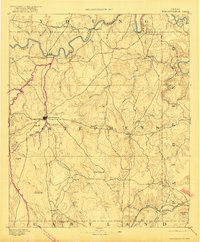
 1890 Louisiana1890 Print · USGSUpper Missouri and Illinois river country in the 1890s is captured here at the height of the steam-rail era. Genealogists can trace family roots through old rural outposts like New Harmony, Prairieville, and the transit hub at Bowling Green.5 unique versions available
 - 1890 Map of Great Egg Harbor
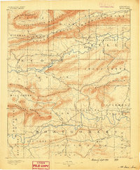
 1890 Great Egg Harbor1890 Print · USGSCoastal New Jersey thrived on a network of river landings and new rail lines during the 1880s. Genealogists and local historians can trace family ties through landmarks like Doughty's Mill, Bargaintown, and early outposts like Life Saving Station (29).
 - 1890 Map of Goochland
 1890 Goochland1890 Print · USGSGoochland and the surrounding Virginia Piedmont are captured here in the late nineteenth century as the river-and-rail economy thrived. Researchers can trace the paths of the Chesapeake and Ohio Railroad and find landmarks like Hopeful Church or the Coal Pits.
 - 1890 Map of Durant
 1890 Durant1890 Print · USGSEastern Iowa's rail-dependent farming communities are documented in the late nineteenth century as the grid of townships began to mature. Genealogists and historians can trace the early footprints of Durant, Walcott, and the remote Round Grove P.O. along established rail lines.
 - 1890 Map of Hawley
 1890 Hawley1890 Print · USGSFranklin County and the Vermont borderlands are shown here in the 1880s as the railroad era transformed the Deerfield Valley. Trace the path of the Fitchburg Railroad through the Hoosac Tunnel or find old roads in Hawley and Ashfield.
 - 1890 Map of Fort Benton
 1890 Fort Benton1890 Print · USGSUpper Missouri river country was transforming in the late nineteenth century as rail lines and ranching settlements expanded across the plains. Genealogists and historians can trace early land routes between Fort Benton, Stanford, and the mining district around Clendenin.
 - 1890 Map of Wellington
 1890 Wellington1890 Print · USGSSumner and Cowley counties are captured here in the late nineteenth century as a dense network of railroads and river towns transformed the Kansas prairie. Genealogists and historians can trace the early layouts of Wellington, Oxford, and Geuda Springs before the turn of the century.6 unique versions available
 - 1890 Map of Whitesburg
 1890 Whitesburg1890 Print · USGSThe Cumberland Plateau in the 1880s is a world of deep hollows and isolated mountain settlements. Genealogists can trace family roots in early communities like Whitesburgh and Pikeville or locate crossings at Pound Gap and Shelby Gap.
 - 1890 Map of Easton
 1890 Easton1890 Print · USGSThe Delaware River valley thrived as a transport hub during the 1890s, where three major canals and multiple railroads met at the Pennsylvania-New Jersey border. Genealogists and industrial historians can trace the paths of the Morris Canal, the works at Durham Furnace, and the strategic Musconetcong Tunnel.
 - 1890 Map of High Bridge
 1890 High Bridge1890 Print · USGSHunterdon and Morris counties at the close of the nineteenth century are defined by their complex rail networks and dramatic ridges. Genealogists and historians can trace the early layouts of High Bridge, Clinton, and the settlements surrounding the distinct curve of Cushetunk Mountain.2 unique versions available
 - 1890 Map of Des Plaines
 1890 Des Plaines1890 Print · USGSThe Des Plaines valley and southern Cook County are shown here in the late nineteenth century as a hub of canal and rail transit. Genealogists can trace family roots in early settlements like Lemont, Orland, and Mokena or locate vanished stops like Johnston Station.
 - 1890 Map of Magazine Mountain
 1890 Magazine Mountain1890 Print · USGSThe Arkansas River Valley is captured here in the late nineteenth century as rail transport begins to eclipse river travel. Genealogists can trace early homesteads and community hubs like Paris, Booneville, and the remote Burnett Springs.6 unique versions available
 - 1890 Map of Stephenville
 1890 Stephenville1890 Print · USGSErath County at the close of the frontier era centers on the rising trade hub of Stephenville and its surrounding hill country. Researchers can trace the original Texas Central Railroad corridor through Dublin and find vanished locales like Duffau Wells.5 unique versions available
 - 1890 Map of Belchertown
 1890 Belchertown1890 Print · USGSThe Swift River valley is seen here in the late nineteenth century, long before the creation of the Quabbin Reservoir. Genealogists and local historians can trace the vanished streets of Enfield, Greenwich, and North Dana, or follow the old Boston & Albany R. R. line.
 - 1890 Map of Hammonton
 1890 Hammonton1890 Print · USGSThe South Jersey Pine Barrens emerge in the late nineteenth century as a complex network of rail lines and agrarian outposts. Genealogists and local historians can trace the foundations of Hammonton, Williamstown, and vanished stops like Banzard Station and New Germany.
 - 1890 Map of Breckenridge
 1890 Breckenridge1890 Print · USGSStephens County was a landscape of budding settlements and cattle country in the late nineteenth century. Genealogists can trace early homesteads near Breckenridge or follow the Texas and Pacific R.R. past peaks like Steal Easy Mt. and Gunsight Mt..6 unique versions available
 - 1890 Map of Salem
 1890 Salem1890 Print · USGSSouth Jersey at the height of the Victorian era is captured here, showing the dense network of rail lines and creek-side landings. Genealogists and historians can trace family-named sites like Avis Mills, Hancock's Bridge, and Sharptown.2 unique versions available
 - 1890 Map of Batesville
 1890 Batesville1890 Print · USGSIndependence and Sharp counties relied on a intricate network of river ferries and rural outposts in the 1890s. Researchers can trace ancestral locations like Old Clem Place, historic church sites like Bethesda Ch, and river crossings at Walls Fy.
 - 1890 Map of Bessemer
 1890 Bessemer1890 Print · USGSCentral Alabama emerges as an industrial powerhouse in the late nineteenth century as railroads weave through the ridges of Jefferson and Shelby counties. Genealogists and historians can trace the early footprints of Bessemer, the iron operations at Sloss, and remote landmarks like Woods Ferry.
 - 1890 Map of Tuckahoe
 1890 Tuckahoe1890 Print · USGSCoastal New Jersey in the 1890s shows a landscape of riverfront villages and early industrial sites connected by new rails. Genealogists can trace family roots through riverside settlements like Mauricetown or locate historic industry at Old Etna Furnace and Monroe Forge.
 - 1890 Map of Roanoke
 1890 Roanoke1890 Print · USGSThe Roanoke Valley in the late nineteenth century was a growing rail and mining hub shaped by the Blue Ridge. Researchers can trace the early industrial footprint of the Rorer Mines or locate old community anchors like Dillons Mill and Hales Bridge.
 - 1890 Map of Suwanee
 1890 Suwanee1890 Print · USGSNorth Georgia in the 1890s was a landscape of river-powered commerce and gold prospecting. Genealogists and historians can trace family-named river crossings like Jones Ferry and Pirkle's Ferry or locate the historic Kin Mori Gold Mine.
 - 1890 Map of Mount Ida
 1890 Mount Ida1890 Print · USGSMontgomery and Scott counties are shown in the late nineteenth century, dominated by the ridges of the Ouachita Mountains and the winding Washita or Ouachita River. Genealogists and historians can trace early settlements like Mt. Ida, Oden, and the mining camp at Silver City.7 unique versions available
 - 1890 Map of Maurice Cove
 1890 Maurice Cove1890 Print · USGSCumberland County’s shoreline in the late nineteenth century is a complex landscape of tidal creeks and maritime infrastructure. Researchers can trace the early rail terminus at Port Norris or locate offshore hazards like Dead Man's Shoal and Egg Island Light.
 - 1890 Map of Madison
 1890 Madison1890 Print · USGSMadison and its surrounding lake country are captured in the late 1880s as the capital city began to dominate the central isthmus. Researchers can trace early rail corridors like the Madison and Northern Railroad and locate settlements such as Mendota and Token Creek.
Showing maps 1-25
Top regions of the United States
- California historical maps
- Texas historical maps
- Florida historical maps
- New York historical maps
- Pennsylvania historical maps
- Illinois historical maps
See more
Top cities of the United States
- New York historical maps
- Los Angeles historical maps
- Chicago historical maps
- Houston historical maps
- Phoenix historical maps
- Philadelphia historical maps
See more
Frequently asked questions
- What are the different types of historical maps available for United States?
- What is the oldest map of United States?
- Where can I purchase historical maps of United States for my home or office?
- Where can I download high-res historical maps of United States?
- Are there historical topographic maps available for United States?
- Is there historical aerial imagery available for United States?
- Where are historical maps of United States sourced from?