1960s Maps of the United States
Explore 44,724 historic maps of the United States from the 1960s. These maps offer a rare glimpse into what life looked like during the 1960s — showing old roads, neighborhoods, homes, and landmarks that have changed or disappeared over time.
Whether you're researching your family's past, planning a metal detecting trip, or studying how the United States's landscape evolved across the 1960s, these high-resolution maps are a powerful tool for exploring the history of this region.
- Focus on a specific era: All maps on this page are from the 1960s, giving you a focused view of this time period.
- See what’s changed: Compare century-old streets, trails, and buildings to today's modern landscape using overlays and satellite layers.
- Research with precision: Use these maps for genealogy, historical research, land use analysis, or educational projects.
- View, download, or print: Maps are fully viewable online in high resolution, and can be downloaded or printed for your own records.
Start exploring the United States's history through authentic maps from the 1960s. This is your window into the past.
United States maps
- 1960 Map of Brazil East
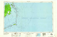
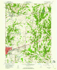 1960 Brazil East1960 Print · USGSClay County at the dawn of the 1960s shows a landscape of busy coal pits and industrial towns. Genealogists and historians can trace family locations near Knightsville, search for burials at Calcutta Cem, or follow the path of the Pennsylvania Railroad.3 unique versions available
 - 1960 Map of Pensacola
 1960 Pensacola1960 Print · USGSThe Florida Panhandle and Alabama's eastern shore are shown during a period of rapid military and coastal growth. Genealogists and historians can trace the mid-century footprints of Warrington, the Pensacola NAS (Chevalier), and the Blackwater River timber lands.
 - 1960 Map of Ogden
 1960 Ogden1960 Print · USGSIn the mid-1950s, this region of the American West balanced military expansion with frontier history along the Union Pacific RR. Genealogists and historians can trace old settlements like Fort Bridger, the residential growth of Washington Terrace, and industrial sites from the Hill AFB complex to the coal mines of Kemmerer.
 - 1960 Map of Butte
 1960 Butte1960 Print · USGSWestern Montana at the dawn of the sixties is defined by its industrial mining hubs and the railroads that connect them. Genealogists and historians can trace the routes of the Milwaukee Road through Butte or locate smaller settlements like Southern Cross and Bearmouth.
 - 1960 Map of Buffalo
 1960 Buffalo1960 Print · USGSWestern New York and the Niagara Peninsula thrive during the mid-twentieth century industrial peak. Genealogists and historians can trace family-named points and early settlements from Dunkirk Light to the Allegany Indian Reservation.
 - 1960 Map of Gainesville
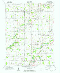
 1960 Gainesville1960 Print · USGSNortheast Arkansas in the late fifties shows the sharp contrast between the managed Cache River bottoms and the heights of Crowleys Ridge. Genealogists can locate family landmarks like Bonds Cem, Pruitt Ch, and the original settlement at Gainesville.
 - 1960 Map of Jacksonville
 1960 Jacksonville1960 Print · USGSCoastal Florida and Georgia meet in this mid-century portrait of a region shaped by naval power and the winding St Johns River. Researchers can trace the development of military sites like Cecil Field or locate historic rural landmarks such as Jerusalem Ch and Kings Ferry.
 - 1960 Map of Iron River
 1960 Iron River1960 Print · USGSThe Upper Peninsula’s western reaches are shown in the late fifties, featuring the industrial infrastructure of the Copper Country and the vast Ottawa National Forest. Researchers can trace the rail lines of the Milwaukee Road through settlements like Bruce Crossing and the White Pine Mine.
 - 1960 Map of Elk City
 1960 Elk City1960 Print · USGSThe Central Idaho wilderness and Bitterroot Range are captured here during the peak of mid-century industrial mining. Researchers can trace remote backcountry settlements like Burgdorf and Warren, alongside major mineral sites including the Blackbird Mine and Ima Mine.2 unique versions available
 - 1960 Map of Fresno
 1960 Fresno1960 Print · USGSThe San Joaquin Valley's mid-century agricultural boom meets the high peaks of the Sierra Nevada in this detailed survey. Genealogists and historians can trace the rail-driven growth of Fresno, Tulare, and Visalia or locate family roots in smaller towns like Raisin City and Calwa City.2 unique versions available
 - 1960 Map of El Dorado
 1960 El Dorado1960 Print · USGSSouth Central Arkansas in the late fifties was a hub of energy production and defense industry. Researchers can trace the extensive Oil and Gas Fields around El Dorado or locate family landmarks like Old Park Cem and New Hope Church.
 - 1960 Map of Gilman
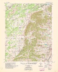
 1960 Gilman1960 Print · USGSThe Indiana countryside near Daleville and Gilman is shown here in the early 1960s, a landscape defined by its river bends and intersecting rail lines. Researchers can trace family sites at Vermillion Meetinghouse, identify old burials at Jones Cem, or locate former rail stops at Reed Station and Moonville.5 unique versions available
 - 1960 Map of Estacada
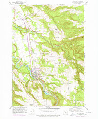 1960 Estacada1960 Print · USGSClackamas County communities and river-based industry thrive in the early 1960s along the Clackamas River. Genealogists and researchers can trace the Abandoned Railroad through Eagle Creek or locate the River Mill Powerhouse and Forrester Cem.
 - 1960 Map of Williams
 1960 Williams1960 Print · USGSNorthern Arizona in the mid-twentieth century was defined by its massive canyons and the vital rail line connecting its remote ranches. Genealogists and historians can trace the development of Peach Springs, the high-altitude Bill Williams Mountain, and isolated outposts like Diamond Bar Ranch.
 - 1960 Map of Gadsden
 1960 Gadsden1960 Print · USGSNorthern Alabama in the mid-1950s is defined by the mighty Tennessee River and its massive reservoirs. Trace the development of Huntsville and Redstone Arsenal or explore the vast William B Bankhead National Forest.2 unique versions available
 - 1960 Map of Presque Isle
 1960 Presque Isle1960 Print · USGSNorthern Maine during the mid-century was a land of timber, rails, and strategic airfields. Genealogists and historians can trace the growth of Presque Isle and Ashland or explore the remote northern reaches of Baxter State Park and Presque Isle AFB.3 unique versions available
 - 1960 Map of Jenkins
 1960 Jenkins1960 Print · USGSEastern Kentucky and the West Virginia borderlands are captured at a mid-century peak of the coal and rail era. Trace the industrial corridors of the Chesapeake and Ohio RR through mountain hubs like Hazard and Jenkins.
 - 1960 Map of Hancock
 1960 Hancock1960 Print · USGSThe Keweenaw Peninsula and Isle Royale are captured in detail during the late 1950s. Researchers can trace copper-mining era settlements like Calumet and Laurium, or locate remote maritime landmarks such as the Isle Royale Lighthouse.
 - 1960 Map of Trona
 1960 Trona1960 Print · USGSThe Mojave Desert at mid-century reveals a landscape of massive military installations and industrial mineral works. Researchers can trace the heritage of mining and ranching at Ashford Mill, Randsburg, and Paxton Ranch while following the Old Spanish Trail.2 unique versions available
 - 1960 Map of Manteo
 1960 Manteo1960 Print · USGSThe Outer Banks and Dare County in the early sixties reveal a landscape defined by maritime tradition and shifting sands. Genealogists can trace family lines through villages like Rodanthe and Buxton or locate landmarks like Fort Raleigh and the Cape Hatteras Lighthouse.
 - 1960 Map of Kalispell
 1960 Kalispell1960 Print · USGSNorthwest Montana in the late fifties is defined by the mountain corridors of the Great Northern Railway and the vast reaches of Glacier National Park. Researchers can trace the legacy of timber and mining towns like Libby, Rexford, and Whitefish, or locate landmarks such as the Snowshoe Mine.
 - 1960 Map of Reno
 1960 Reno1960 Print · USGSThe high desert of western Nevada comes alive in this mid-century survey of the Reno-Tahoe region. Genealogists and historians can trace rail lines like the Southern Pacific RR and locate remote outposts such as Olinghouse, Nixon, and the Olinghouse Mine.2 unique versions available
 - 1960 Map of Tremain
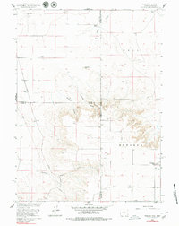 1960 Tremain1960 Print · USGSThe high plains of the Wyoming-Nebraska border come into focus in 1960, showing a landscape defined by cattle ranching and rail infrastructure. Researchers can trace historic family-named homesteads like Bull Canyon Ranch and Spahr Ranch alongside the Epworth Cem.3 unique versions available
 - 1960 Map of Denver
 1960 Denver1960 Print · USGSDenver and the Colorado Front Range are seen here at a pivotal moment of postwar expansion into the plains and foothills. Researchers can trace the mid-century rail network of the Denver & Rio Grande Western RR and locate historic institutional landmarks like Buckley Field and the Colorado School of Mines.
 - 1960 Map of Ashton
 1960 Ashton1960 Print · USGSThe Idaho-Montana-Wyoming borderlands at the dawn of the sixties show a landscape defined by the Continental Divide and early wilderness tourism. Genealogists and historians can trace rail-stop settlements like Trude Siding, old outposts like Warm River, and early lodging at Snowball Inn.
Showing maps 1-25
Top regions of the United States
- California historical maps
- Texas historical maps
- Florida historical maps
- New York historical maps
- Pennsylvania historical maps
- Illinois historical maps
See more
Top cities of the United States
- New York historical maps
- Los Angeles historical maps
- Chicago historical maps
- Houston historical maps
- Phoenix historical maps
- Philadelphia historical maps
See more
Frequently asked questions
- What are the different types of historical maps available for United States?
- What is the oldest map of United States?
- Where can I purchase historical maps of United States for my home or office?
- Where can I download high-res historical maps of United States?
- Are there historical topographic maps available for United States?
- Is there historical aerial imagery available for United States?
- Where are historical maps of United States sourced from?