1950s Maps of the United States
Explore 47,119 historic maps of the United States from the 1950s. These maps offer a rare glimpse into what life looked like during the 1950s — showing old roads, neighborhoods, homes, and landmarks that have changed or disappeared over time.
Whether you're researching your family's past, planning a metal detecting trip, or studying how the United States's landscape evolved across the 1950s, these high-resolution maps are a powerful tool for exploring the history of this region.
- Focus on a specific era: All maps on this page are from the 1950s, giving you a focused view of this time period.
- See what’s changed: Compare century-old streets, trails, and buildings to today's modern landscape using overlays and satellite layers.
- Research with precision: Use these maps for genealogy, historical research, land use analysis, or educational projects.
- View, download, or print: Maps are fully viewable online in high resolution, and can be downloaded or printed for your own records.
Start exploring the United States's history through authentic maps from the 1950s. This is your window into the past.
United States maps
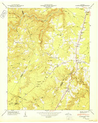
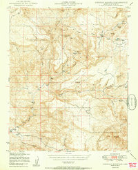
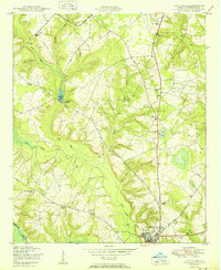
- 1950 Map of Zephyr
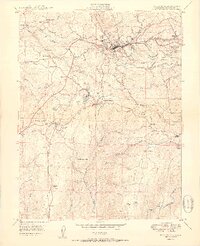
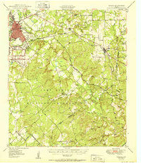 1950 Zephyr1950 Print · USGSBrownwood and the surrounding central Texas countryside are shown at a pivotal mid-century moment as the military and rail industries shaped the local economy. Researchers can locate the sprawling Camp Bowie Military Reservation, find local burial sites like Indian Creek Cemetery, and trace the path of the Santa Fe railroad.2 unique versions available
 - 1950 Map of Leonidas
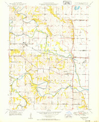
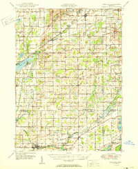 1950 Leonidas1950 Print · USGSSouthern Michigan’s borderlands at mid-century are defined by the winding St Joseph River and a patchwork of rural school districts. Genealogists can trace family roots through landmarks like Gilson Cem, Dutton Cem, and the numerous rural schools including Factoryville Sch.2 unique versions available
 - 1950 Map of Buffalo NW
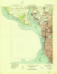 1950 Buffalo NW1950 Print · USGSThe Niagara River and Grand Island are shown in detail during the early fifties, capturing Buffalo's northern expansion. Genealogists and historians can locate dozens of local institutions like Lafayette High Sch, Mt Olivet Cem, and Bell Airport.2 unique versions available
 - 1950 Map of Monteagle
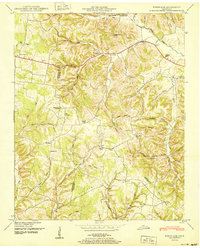
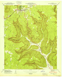 1950 Monteagle1950 Print · USGSMonteagle and the surrounding Cumberland Plateau are shown at mid-century as a network of plateau settlements and deep cove farms. Researchers can trace family history through numerous rural landmarks like Lappin Cem, St Johns Ch, and the Jumpoff Sch.3 unique versions available
 - 1950 Map of Clarkrange
 1950 Clarkrange1950 Print · USGSMid-century Fentress County is defined here by the high-plateau route of the Alvin C York Highway and the rugged breaks of the Cumberland Plateau. You can trace family homesteads near Muddy Pond, local schools like Martha Washington School, and the crossroads at Clarkrange.2 unique versions available
 - 1950 Map of Paulden
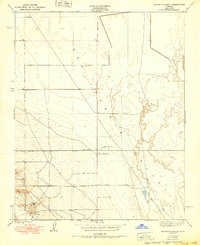
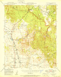 1950 Paulden1950 Print · USGSYavapai County ranching and rail infrastructure are captured here in the mid-twentieth century as the high desert settlements expanded. Researchers can trace the path of the Atchison Topeka and Santa Fe through Drake and locate family landmarks like Stewart Ranch and Hubbel Ranch.2 unique versions available
 - 1950 Map of Hitchcock
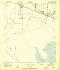 1950 Hitchcock1950 Print · USGSGalveston County settlement at mid-century is centered on the railroad corridor between the coastal prairies and the marshy bayous. Researchers can trace family-named routes like Bene Road and Jay Road or locate the Alta Loma Cemetery and Camp Wallace Military Reservation.
 - 1950 Map of Kettleman Plain
 1950 Kettleman Plain1950 Print · USGSThe oil fields of Kings County are captured here at mid-century, showcasing a landscape of industrial development and arid ridges. Researchers can trace the early petroleum infrastructure near North Dome and the remote Oil Pumping Sta.
 - 1950 Map of Dexter West
 1950 Dexter West1950 Print · USGSChaves County's agricultural and ranching heartland is captured here at mid-century, just as the regional economy was being shaped by irrigation and aviation. Genealogists and historians can trace family holdings like Lowe Ranch or locate industrial sites like Bogies Cotton Gin and the Twin Wells Stock Pens.4 unique versions available
 - 1950 Map of Bridport
 1950 Bridport1950 Print · USGSThe rural landscapes of Bridport and Shoreham come alive in the 1950s, showing a world of hilltop farms and winding valley streams. Genealogists can locate family names at Pine Hill Cem or Lakeview Cem, and trace the grounds of All Saints Chapel and School No 6.2 unique versions available
 - 1950 Map of Sheridan Mountain
 1950 Sheridan Mountain1950 Print · USGSYavapai County's high mesa ranching country is captured here during the post-war era within the Prescott National Forest. Genealogists and historians can locate established livestock operations like Spider Ranch, Dumbbell Ranch, and the Yolo Cabin.2 unique versions available
 - 1950 Map of Doyle
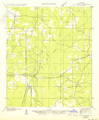
 1950 Doyle1950 Print · USGSLivingston Parish at the start of the 1940s is shown here as a landscape of rail-side towns and rural creek-bottom settlements. Genealogists can locate family burial sites like Stafford Cem and Lard Cem or trace the early path of the Illinois Central Railroad through Holden.
 - 1950 Map of Lincoln
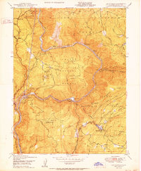
 1950 Lincoln1950 Print · USGSThe Columbia and Spokane Rivers converge here just after the filling of Lake Roosevelt, shaping the borders of two tribal nations. Genealogists and local historians can locate early schools like Rothlisburg Sch, the landmark Fort Spokane, and the community of Lincoln.2 unique versions available
 - 1950 Map of Las Plumas
 1950 Las Plumas1950 Print · USGSButte County was a hub of mining and railroad engineering in the years following World War II. Researchers can locate active lode claims like the Surcease Mine and trace the Western Pacific line as it serves Berry Creek Station and Las Plumas.2 unique versions available
 - 1950 Map of Cape Hatteras
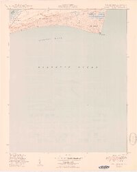 1950 Cape Hatteras1950 Print · USGSThe Outer Banks come to life in this mid-century survey of the North Carolina coast during a period of transition for its maritime communities. Trace the shoreline from Frisco to Cape Point, locating landmarks like Little Grove Ch and the Coast Guard Sta.2 unique versions available
 - 1950 Map of Vancouver
 1950 Vancouver1950 Print · USGSCoastal Oregon and the lower Columbia River valley are captured in detail just after the war. Researchers can trace historic rail routes like the Southern Pacific or locate early settlements such as Vernonia, Gaston, and the Grand Ronde Indian Reservation.
 - 1950 Map of Louisville
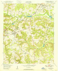
 1950 Louisville1950 Print · USGSJefferson County, Georgia, is documented here at mid-century, centered on the historic town of Louisville and the Ogeechee River. Genealogists can trace rural communities through landmarks like Pioneer Church and School and Bothwell Cemetery.
 - 1950 Map of Plain Dealing SW
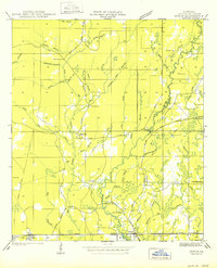
 1950 Plain Dealing SW1950 Print · USGSBossier Parish at mid-century shows a landscape shaped by rail transport and rural community hubs like Collinsburg and Rocky Mount. Genealogists and historians can locate family-named sites such as Booker Chapel, New Light Sch, and the St Louis Southwestern RR corridor.
 - 1950 Map of Burrel
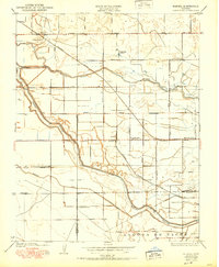 1950 Burrel1950 Print · USGSThe San Joaquin Valley landscape at mid-century reveals a complex irrigation network and rail-dependent economy. Genealogists and historians can trace old rural school districts like Elkhorn School and family-named landmarks such as Burrel Ranch.
 - 1950 Map of Reynolds Ranch
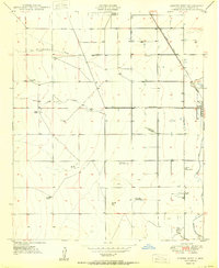
 1950 Reynolds Ranch1950 Print · USGSKern County ranching and water management are captured here during the mid-century, reflecting the landscape as it was surveyed in the 1930s. Genealogists and researchers can trace family-named sites such as Gilbert Ranch and Reynolds Ranch or follow the Goose Lake Canal.
 - 1950 Map of Placerville
 1950 Placerville1950 Print · USGSEl Dorado County in the late 1940s retains the clear footprint of its mining and railroad heritage. Researchers can trace the location of vanished settlements at Logtown (Site) and Cold Springs (Site), alongside active landmarks like the Crusader Mine and the Southern Pacific line.2 unique versions available
 - 1950 Map of Hephzibah
 1950 Hephzibah1950 Print · USGSRichmond County in the early post-war era reveals a landscape of kaolin mining and deep-rooted rural communities. Researchers can trace family history through a wealth of landmarks like Albion Kaolin Chalk Mine, Adams Grove Church, and Bugs Cemetery.
 - 1950 Map of Maywood
 1950 Maywood1950 Print · USGSNortheast Missouri farm country comes to life in the late 1940s as the railroad and river systems shape the landscape. Genealogists can locate family landmarks like Hebron Cem and Shannon Sch, or trace the tracks of the Chicago Burlington and Quincy through Maywood.
 - 1950 Map of Bodenham
 1950 Bodenham1950 Print · USGSGiles County in the years following World War II was a landscape of ridge-top farms and country schools. You can trace early property lines near New Prospect or locate family sites like Chestnut Grove Church and Copperas Sch.
 - 1950 Map of Hialeah
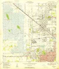 1950 Hialeah1950 Print · USGSMid-century Miami-Dade County is shown here during a period of rapid suburban and industrial expansion. Researchers can trace the early layout of Hialeah, the grounds of Hialeah Park, and numerous family burial sites like Mt Nebo Cem.
Showing maps 1-25
Top regions of the United States
- California historical maps
- Texas historical maps
- Florida historical maps
- New York historical maps
- Pennsylvania historical maps
- Illinois historical maps
See more
Top cities of the United States
- New York historical maps
- Los Angeles historical maps
- Chicago historical maps
- Houston historical maps
- Phoenix historical maps
- Philadelphia historical maps
See more
Frequently asked questions
- What are the different types of historical maps available for United States?
- What is the oldest map of United States?
- Where can I purchase historical maps of United States for my home or office?
- Where can I download high-res historical maps of United States?
- Are there historical topographic maps available for United States?
- Is there historical aerial imagery available for United States?
- Where are historical maps of United States sourced from?