1990s Maps of the United States
Explore 12,423 historic maps of the United States from the 1990s. These maps offer a rare glimpse into what life looked like during the 1990s — showing old roads, neighborhoods, homes, and landmarks that have changed or disappeared over time.
Whether you're researching your family's past, planning a metal detecting trip, or studying how the United States's landscape evolved across the 1990s, these high-resolution maps are a powerful tool for exploring the history of this region.
- Focus on a specific era: All maps on this page are from the 1990s, giving you a focused view of this time period.
- See what’s changed: Compare century-old streets, trails, and buildings to today's modern landscape using overlays and satellite layers.
- Research with precision: Use these maps for genealogy, historical research, land use analysis, or educational projects.
- View, download, or print: Maps are fully viewable online in high resolution, and can be downloaded or printed for your own records.
Start exploring the United States's history through authentic maps from the 1990s. This is your window into the past.
United States maps
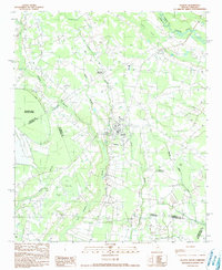
- 1990 Map of Hebron Crossroads
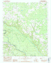
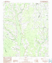 1990 Hebron Crossroads1990 Print · USGSClarendon and Williamsburg Counties in the early 1980s are defined by their deep swamp drainage and crossroads communities. Genealogists and local historians can trace family roots through Hebron Crossroads, Union Crossroads, and the grounds of Holly Tree Plantation.
 - 1990 Map of Knott Creek Ranch
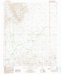
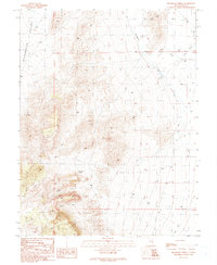
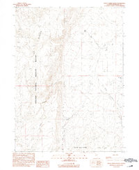 1990 Knott Creek Ranch1990 Print · USGSThe high desert of Humboldt County is captured in the early nineties, centered on the remote Knott Creek Ranch. Researchers can trace the rugged transition from the Sheldon National Wildlife Refuge to the Black Rock Range through landmarks like Idaho Canyon and Indian Spring.
 - 1990 Map of Mormon Basin
 1990 Mormon Basin1990 Print · USGSThe Baker and Malheur county line runs through this rugged mining district as it appeared in the late twentieth century. Genealogists and historians can locate former settlements at Amelia and Miller, or trace old workings at the Sunday Hill Mine.
 - 1990 Map of Ninemile Peak
 1990 Ninemile Peak1990 Print · USGSEureka and Nye counties meet at the edge of the range in the late twentieth century, showing a remote landscape of mining and high desert water. Trace old mining claims through scattered Prospects or locate water sources like Water Canyon Spring and Mountain Lion Spring.
 - 1990 Map of Tiger Well
 1990 Tiger Well1990 Print · USGSMaricopa County's desert mining landscape is captured here in the late twentieth century, showing a region defined by extraction and scarce water sources. Researchers can trace the footprint of the Ambrosia Mill and remote operations like the Black Nugget Mine or Black Diamond Mine.
 - 1990 Map of Lostine
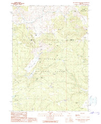
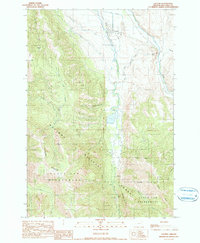 1990 Lostine1990 Print · USGSLostine and the Wallowa Valley in the late twentieth century show a landscape defined by the balance of mountain wilderness and valley irrigation. Genealogists and local historians can trace the paths of the Poley Allen Ditch, the riverside Gaging Station, and the Pole Bridge Picnic Area.
 - 1990 Map of Morehead City
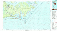 1990 Morehead City1990 Print · USGSCoastal Carteret County at the start of the nineties reveals a landscape balanced between military installations and expansive national seashores. Trace the shoreline from Cherry Point down to the Lighthouse at Cape Lookout and the historic streets of Beaufort.
 - 1990 Map of Christmas Creek
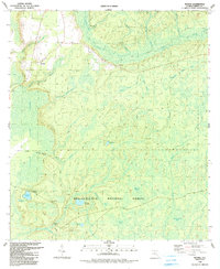
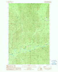 1990 Christmas Creek1990 Print · USGSJefferson County's timberlands and river valleys are captured here in the 1990s, centered on the confluence of the Snahapish River and Clearwater River. Researchers can locate the Olympic Correction Center and recreation sites like Coppermine Bottom Campground and Crooks Rapids.
 - 1990 Map of Olanta
 1990 Olanta1990 Print · USGSThe South Carolina coastal plain in the late twentieth century is captured here as a landscape of unique Carolina Bays and rural crossroads. Researchers can trace landownership patterns near Olanta or explore the preserved wetlands of Woods Bay State Park and Fuller Bay.
 - 1990 Map of Rabbit Mountain
 1990 Rabbit Mountain1990 Print · USGSDouglas County’s rugged interior is documented here in the late twentieth century as timber and mining roads crisscross the ridges. Researchers can identify former habitation points like Cow Creek (Site) and Brandt (Site) or trace the winding course of the West Fork.
 - 1990 Map of Ash Valley
 1990 Ash Valley1990 Print · USGSThe high ranchlands of Lassen County are shown here as they appeared in the 1990s. Trace old family sites and water sources like Fleming Sheep Camp, Oxendine Spring, and the small Cem on the valley floor.
 - 1990 Map of Big Mowich Mountain
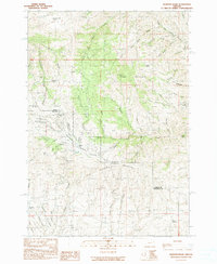
 1990 Big Mowich Mountain1990 Print · USGSHarney and Grant counties meet in this 1990 survey of the high forest country before modern digital mapping changed the look of the landscape. Researchers can trace family-named sites like Harris Ranch or Allison Ranch and locate remote landmarks such as the Allison Guard Sta and Stinking Spring.
 - 1990 Map of Hope Falls
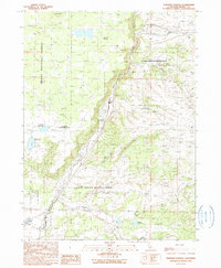
 1990 Hope Falls1990 Print · USGSThe Adirondack foothills of Saratoga and Hamilton Counties are shown here during the late twentieth century as the region balanced wilderness and remote settlement. Researchers can trace historic hamlets like Hope Falls and Tennantville or follow the shoreline of Great Sacandaga Lake past West Day.
 - 1990 Map of Canby
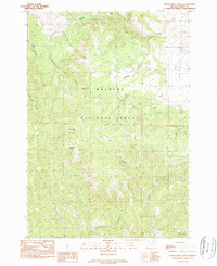
 1990 Canby1990 Print · USGSUpper Modoc County in the early 1990s was a landscape where high-desert ranching met mountain timberlands. Researchers can trace the layout of Canby, locate the Arlington Sch, and find the geothermal activity at Kelley Hot Spring.
 - 1990 Map of Ambler River D-4
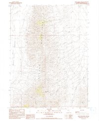
 1990 Ambler River D-41990 Print · USGSThe northern Brooks Range foothills are captured here in the late twentieth century, showing a landscape of sprawling Arctic rivers. Researchers can trace the courses of the Noatak River and Imelyak River or locate the high Akikhaak Peaks.
 - 1990 Map of Arch Tank
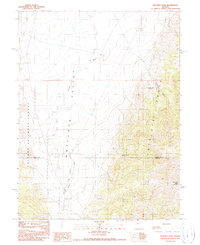
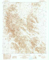 1990 Arch Tank1990 Print · USGSThe high desert of the Kofa Mountains comes into focus in 1990, showing a landscape defined by critical water catchments. Researchers can trace the path of the King Road past Arch Tank, Bandy Tank, and the narrow crossing at McPherson Pass.
 - 1990 Map of Bradshaw Spring
 1990 Bradshaw Spring1990 Print · USGSNye County's high desert landscape is captured here during the late eighties, documenting a remote region shaped by sparse water and mineral interests. Researchers can trace the locations of Bradshaw Spring, a solitary Grave, and several high-altitude Prospects.
 - 1990 Map of Woods
 1990 Woods1990 Print · USGSLiberty County's pine flatwoods and cypress bays are meticulously mapped here during the late twentieth century. Genealogists and local historians can locate the community of Woods, trace the path to Smokehouse Crossing, or find the remote Fawn Ford along the New River.
 - 1990 Map of Minnesota Mountain
 1990 Minnesota Mountain1990 Print · USGSShasta County in the 1990s is defined by the expansive waters of the National Recreation Area and its surrounding peaks. Researchers can locate the Bully Hill (Site), trace the McClure Gulch drainage, or find the Museum near Squaw Creek.
 - 1990 Map of Deer Creek Peak
 1990 Deer Creek Peak1990 Print · USGSHumboldt County’s high desert landscape was mapped in detail just before the turn of the millennium, showing a region defined by mining and ranching. Researchers can trace remote operations and water sources like Bottle Creek Ranch, Mine sites, and Poorman Spring.
 - 1990 Map of Burlington
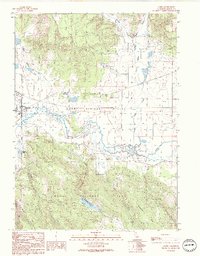
 1990 Burlington1990 Print · USGSThe tri-state confluence of Iowa, Illinois, and Missouri is mapped here at the end of the twentieth century. Genealogists and historians can trace the riverfront heritage of Burlington, Keokuk, and Fort Madison, or locate sites like the Battle of Athens State Historic Site.2 unique versions available
 - 1990 Map of Surprise Station
 1990 Surprise Station1990 Print · USGSNortheastern California's high plateau comes into focus here in the late twentieth century, showing a landscape shaped by the river and the reservation. You can locate the Chimney Rock Historical Mon, trace the North Fork Pit River, and find remote outposts like Surprise Station.
 - 1990 Map of Blakely
 1990 Blakely1990 Print · USGSThe lowlands of Williamsburg and Berkeley counties are mapped here in the early nineties as the riverine forest transitions to upland farm plots. Genealogists and researchers can trace the vicinity of Blakely, locate a rural Cem, and follow the water through Mattassee Lake.
 - 1990 Map of Donaldson Creek
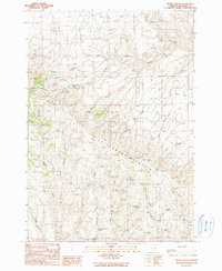
 1990 Donaldson Creek1990 Print · USGSThe high country of Grant County is captured here in the late 1980s, centered on the wooded slopes of the Malheur National Forest. Researchers can locate the Pismire Camp (Site) and trace water sources from Sagebrush Spring to the headwaters of Donaldson Creek.
 - 1990 Map of Brady Creek
 1990 Brady Creek1990 Print · USGSMalheur County’s high country is captured here in the late twentieth century, showing a landscape of remote ranching and essential water sources. You can trace early land use through named features like Juniper Mtn Ranch, Homestead Spring, and the Upper Buckbrush Reservoir.
Showing maps 1-25
Top regions of the United States
- California historical maps
- Texas historical maps
- Florida historical maps
- New York historical maps
- Pennsylvania historical maps
- Illinois historical maps
See more
Top cities of the United States
- New York historical maps
- Los Angeles historical maps
- Chicago historical maps
- Houston historical maps
- Phoenix historical maps
- Philadelphia historical maps
See more
Frequently asked questions
- What are the different types of historical maps available for United States?
- What is the oldest map of United States?
- Where can I purchase historical maps of United States for my home or office?
- Where can I download high-res historical maps of United States?
- Are there historical topographic maps available for United States?
- Is there historical aerial imagery available for United States?
- Where are historical maps of United States sourced from?